Horse Ridge
Berg · Vereinigte Staaten
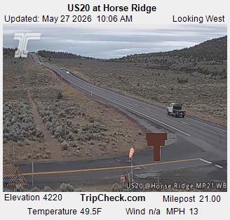
Horse Ridge is series of volcanic ridges in eastern Deschutes County, Oregon, United States. It is located south of Highway 20, west of the Millican community, and south of the Oregon Badlands Wilderness. The Horse Ridge Research Natural Area occupies predominantly north and northeast facing slopes of the ridges.
Aus Wikipedia, CC BY-SA · Artikel lesen
Am Gipfel · Vorhersage für 21:00
35 °FTeilweise bewölkt · Wind 16 mph aus SW
 In 3D ansehen
Wettervorhersage für Horse Ridge
- 21:0035 °FSW 16 mph–
- 0:0034 °FSW 17 mph–
- 3:0033 °FSW 15 mph–
- 6:0035 °FSW 13 mph–
- 9:0038 °FS 12 mph–
- 12:0043 °FSW 14 mph–
- 15:0045 °FSW 15 mph–
- 18:0040 °FW 10 mph–
| Tag | Himmel | Max. / Min. | Regen | Wind bis |
|---|---|---|---|---|
| Mi., 28. Okt. | Teilweise bewölkt | 45 °F / 33 °F | – | 17 mph |
| Do., 29. Okt. | Teilweise bewölkt | 47 °F / 31 °F | – | 9 mph |
| Fr., 30. Okt. | Teilweise bewölkt | 46 °F / 33 °F | – | 9 mph |
| Sa., 31. Okt. | Regen | 40 °F / 32 °F | 0,15 in | 4 mph |
| So., 1. Nov. | Überwiegend klar | 41 °F / 31 °F | – | 5 mph |
| Mo., 2. Nov. | Überwiegend klar | 52 °F / 31 °F | – | 6 mph |
| Di., 3. Nov. | Überwiegend klar | 57 °F / 38 °F | – | 5 mph |
Vorhersage von MET Norway (CC BY 4.0), aktualisiert um 18:17 GMT-7. Zeiten in Ortszeit.
Fakten
- Art
- Berg
- Koordinaten
- 43.910°N 121.066°W
- Quelle
- Wikidata, CC0
Horse Ridge
Series of volcanic ridges in Deschutes County, Oregon, United States
Horse Ridge is series of volcanic ridges in eastern Deschutes County, Oregon, United States. It is located south of Highway 20, west of the Millican community, and south of the Oregon Badlands Wilderness. The Horse Ridge Research Natural Area occupies predominantly north and northeast facing slopes of the ridges. It was established in 1967.
Aus Wikipedia, CC BY-SA · Artikel lesen
Gipfel nahe Horse Ridge
- Lava Butte5.023 ft · 23 km entferntAuf der Karte
- Pilot Butte4.142 ft · 24 km entferntAuf der Karte
- Newberry-Vulkan7.986 ft · 29 km entferntAuf der Karte
- Powell Buttes5.216 ft · 30 km entferntAuf der Karte
- Tumalo Mountain7.776 ft · 47 km entferntAuf der Karte
- Mount Bachelor9.068 ft · 50 km entferntAuf der Karte
- Broken Top9.177 ft · 54 km entferntAuf der Karte
- East Lava Field5.614 ft · 55 km entferntAuf der Karte
- Grizzly Mountain5.629 ft · 59 km entferntAuf der Karte
- Fort Rock4.699 ft · 60 km entferntAuf der Karte
Höchste Berge in Vereinigte Staaten
- Denali20.308 ftAuf der Karte
- Mount Saint Elias18.009 ftAuf der Karte
- Mount Foraker17.402 ftAuf der Karte
- Mount Bona16.535 ftAuf der Karte
- Mount Blackburn16.390 ftAuf der Karte
- Mount Sanford16.237 ftAuf der Karte
- Mount Vancouver15.787 ftAuf der Karte
- Mount Churchill15.636 ftAuf der Karte
- Mount Fairweather15.325 ftAuf der Karte
- Mount Hubbard14.951 ftAuf der Karte