Pavilion Mountain
2.089 m6.854 ft
Berg · Marble Range · Kanada
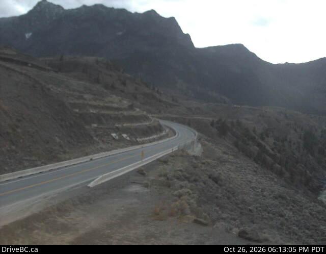
Pavilion Mountain is the highest summit of the southern Marble Range in the South Cariboo region of southwestern British Columbia. "Mount Carson", a subsidiary peak, was misapplied to the whole mountain 1957–1965, before the well-established local name was restored. Pavilion Creek is to the south.
Aus Wikipedia, CC BY-SA · Artikel lesen
Am Gipfel · Vorhersage für 6:00
-6 °CNebel · Wind 6 km/h aus SW
Wetter auf dem Gipfel: Pavilion Mountain, 2.089 m
- 6:00-6 °CSW 6 km/h–
- 9:00-6 °CSW 7 km/h–
- 12:00-3 °CSW 8 km/h–
- 15:00-1 °CS 6 km/h0,2 mm
- 18:00-5 °CN 4 km/h0,7 mm
- 21:00-6 °CNW 7 km/h–
- 0:00-6 °CW 5 km/h–
- 3:00-7 °CNW 5 km/h0,3 mm
| Tag | Himmel | Max. / Min. | Regen | Wind bis |
|---|---|---|---|---|
| Heute | Teilweise bewölkt | -1 °C / -6 °C | 0,9 mm | 8 km/h |
| Mi., 28. Okt. | Bewölkt | -6 °C / -8 °C | 1,4 mm | 8 km/h |
| Do., 29. Okt. | Teilweise bewölkt | -7 °C / -10 °C | – | 4 km/h |
| Fr., 30. Okt. | Überwiegend klar | -6 °C / -13 °C | 0,2 mm | 2 km/h |
| Sa., 31. Okt. | Teilweise bewölkt | -6 °C / -11 °C | – | 5 km/h |
| So., 1. Nov. | Teilweise bewölkt | -5 °C / -13 °C | 0,4 mm | 5 km/h |
| Mo., 2. Nov. | Teilweise bewölkt | -2 °C / -9 °C | – | 6 km/h |
Vorhersage von MET Norway (CC BY 4.0), aktualisiert um 22:20 GMT-7. Zeiten in Ortszeit.
Fakten
- Art
- Berg
- Höhe über dem Meer
- 2.089 m (6.854 ft)
- Schartenhöhe
- 1.019 m (3.343 ft)
- Gebirge
- Marble Range
- Land
- Kanada
- Koordinaten
- 50.983°N 121.683°W
- Quelle
- Wikidata, CC0
Pavilion Mountain
Mountain in British Columbia, Canada
Pavilion Mountain is the highest summit of the southern Marble Range in the South Cariboo region of southwestern British Columbia. "Mount Carson", a subsidiary peak, was misapplied to the whole mountain 1957–1965, before the well-established local name was restored. Pavilion Creek is to the south. Pavilion Lake and Marble Canyon are to the southeast.
Aus Wikipedia, CC BY-SA · Artikel lesen
Gipfel nahe Pavilion Mountain
- Chimney Rock1.725 m · 12 km entferntAuf der Karte
- Mount Bishop (Camelsfoot Range)1.721 m · 37 km entferntAuf der Karte
- Mount Brew2.891 m · 49 km entferntAuf der Karte
- Mount McLeanBerg · 40 km entferntAuf der Karte
Höchste Berge in Kanada
- Mount Logan5.959 mAuf der Karte
- Mount Saint Elias18.009 ftAuf der Karte
- Mount Lucania5.240 mAuf der Karte
- King Peak5.173 mAuf der Karte
- Mount Steele5.073 mAuf der Karte
- Mount Wood4.850 mAuf der Karte
- Mount Vancouver15.787 ftAuf der Karte
- Mount Slaggard4.742 mAuf der Karte
- Mount Macaulay4.700 mAuf der Karte
- Mount Fairweather15.325 ftAuf der Karte