Box Hill
224 m735 ft
Colina · North Downs · Reino Unido
Box Hill is a summit of the North Downs in Surrey, approximately 31 km (19 mi) south-west of London. It is named after the ancient box woodland found on the steepest west-facing chalk slopes overlooking the River Mole.
De Wikipedia, CC BY-SA · Leer el artículo
En la cumbre · pronóstico para las 9:00
12 °CNublado · viento de 13 mph del SO
 Verla en 3D
Clima en la cumbre de Box Hill, 224 m
- 9:0012 °CSO 13 mph–
- 12:0014 °CO 15 mph–
- 15:0013 °CO 12 mph–
- 18:009 °CSO 7 mph–
- 21:008 °CSO 9 mph–
- 0:007 °CSO 9 mph–
- 3:007 °CSO 7 mph–
- 6:007 °CSO 8 mph–
| Día | Cielo | Máx. / mín. | Lluvia | Viento hasta |
|---|---|---|---|---|
| Hoy | Despejado | 14 °C / 8 °C | – | 15 mph |
| mié, 28 oct | Parcialmente nublado | 14 °C / 7 °C | – | 11 mph |
| jue, 29 oct | Nublado | 13 °C / 7 °C | – | 7 mph |
| vie, 30 oct | Nublado | 12 °C / 7 °C | – | 7 mph |
| sáb, 31 oct | Mayormente despejado | 12 °C / 5 °C | – | 4 mph |
| dom, 1 nov | Nublado | 11 °C / 5 °C | – | 9 mph |
| lun, 2 nov | Despejado | 11 °C / 5 °C | – | 6 mph |
Pronóstico de MET Norway (CC BY 4.0), actualizado a las 01:17 GMT. Horas locales.
Ficha técnica
- Tipo
- Colina
- Altitud sobre el nivel del mar
- 224 m (735 ft)
- Prominencia
- 49 m (161 ft)
- Cordillera
- North Downs
- País
- Reino Unido
- Coordenadas
- 51.255°N 0.309°W
- Fuente
- Wikidata, CC0
Box Hill, Surrey
Hill and beauty spot in Surrey, England
Box Hill is a summit of the North Downs in Surrey, approximately 31 km (19 mi) south-west of London. It is named after the ancient box woodland found on the steepest west-facing chalk slopes overlooking the River Mole. The western part of the hill is owned and managed by the National Trust, whilst the village of Box Hill lies on higher ground to the east.
De Wikipedia, CC BY-SA · Leer el artículo
Picos cerca de Box Hill
- Colley Hill220 m · a 6,3 kmEn el mapa
- Leith Hill294 m · a 9,8 kmEn el mapa
- Botley Hill270 m · a 23 kmEn el mapa
- Hydon's Ball179 m · a 24 kmEn el mapa
- Betsom's Hill251 m · a 26 kmEn el mapa
- Hog's Back154 m · a 27 kmEn el mapa
- Ludgate Hill18 m · a 32 kmEn el mapa
- Gibbet Hill272 m · a 32 kmEn el mapa
- Tower Hill15 m · a 32 kmEn el mapa
- Primrose Hill65 m · a 33 kmEn el mapa
Los más altos de North Downs
- Box Hill224 mEn el mapa
- Colley Hill220 mEn el mapa
- Hog's Back154 mEn el mapa
Montañas más altas de Reino Unido
- Pico Nordenskjöld2355 mEn el mapa
- Monte Carse2330 mEn el mapa
- Pico Pan de Azúcar2325 mEn el mapa
- Monte Roots2280 mEn el mapa
- Monte Paterson2195 mEn el mapa
- Pico de la Reina María2062 mEn el mapa
- Monte Baume1910 mEn el mapa
- Monte Macklin1900 mEn el mapa
- Monte Fagerli1880 mEn el mapa
- Monte Brooker1880 mEn el mapa
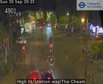
Cámaras web cerca de Box Hill



Historia alrededor de Box Hill
- Treaty of Nonsuch1585
- murder of Elianne Andam2023
- Gatwick Airport drone incident2018
- Purley station rail crash1989
- Guildford pub bombings: Bombs planted by the IRA at pubs patronised by off-duty soldiers, The Horse and Groom and The Seven Stars, kill five people1974
- Ariana Afghan Airlines Flight 7011969
- Croydon typhoid outbreak of 19371937
- 1924 Imperial Airways de Havilland DH.34 crash1924