Montañas de Estados Unidos
Verla en 3DEast Sister
Montaña · Sweetwater Mountains · Estados Unidos
East Sister is the highest independent mountain located completely within Lyon County in Nevada, United States. It is located within the Sweetwater Mountains just a short distance north of the highest point in Lyon County on the northeast ridge of Middle Sister. The peak is within the Humboldt-Toiyabe National Forest.
De Wikipedia, CC BY-SA · Leer el artículo
En la cumbre · pronóstico para las 23:00
28 °FDespejado · viento de 3 mph del S
Pronóstico del tiempo en East Sister
- 23:0028 °FS 3 mph–
- 2:0028 °FNE 1 mph–
- 5:0028 °FSE 1 mph–
- 8:0031 °FE 1 mph–
- 11:0042 °FNO 4 mph–
- 14:0045 °FN 6 mph–
- 17:0040 °FN 4 mph–
- 20:0031 °FSE 2 mph–
| Día | Cielo | Máx. / mín. | Lluvia | Viento hasta |
|---|---|---|---|---|
| mié, 28 oct | Despejado | 45 °F / 28 °F | – | 6 mph |
| jue, 29 oct | Nublado | 45 °F / 29 °F | – | 11 mph |
| vie, 30 oct | Parcialmente nublado | 38 °F / 28 °F | 0,02 pulg. | 6 mph |
| sáb, 31 oct | Aguanieve | 34 °F / 24 °F | 0,09 pulg. | 4 mph |
| dom, 1 nov | Mayormente despejado | 32 °F / 21 °F | – | 5 mph |
| lun, 2 nov | Despejado | 41 °F / 24 °F | – | 3 mph |
| mar, 3 nov | Nublado | 54 °F / 38 °F | – | 2 mph |
Pronóstico de MET Norway (CC BY 4.0), actualizado a las 12:17 GMT-7. Horas locales.
Ficha técnica
- Tipo
- Montaña
- Prominencia
- 724 ft (221 m)
- Cordillera
- Sweetwater Mountains
- País
- Estados Unidos
- Coordenadas
- 38.523°N 119.290°W
- Fuente
- Wikidata, CC0
Picos cerca de East Sister
- Middle Sister10.859 ft · a 1,8 kmEn el mapa
- Mount Patterson11.673 ft · a 9,7 kmEn el mapa
- Bald Mountain9549 ft · a 15 kmEn el mapa
- Pico Sonora11.464 ft · a 35 kmEn el mapa
- Stanislaus Peak11.234 ft · a 36 kmEn el mapa
- Eagle Peak11.854 ft · a 40 kmEn el mapa
- Highland Peak10.935 ft · a 41 kmEn el mapa
- Robinson Peak10.794 ft · a 41 kmEn el mapa
- Leavitt Peak11.573 ft · a 41 kmEn el mapa
- Mount Grant11.285 ft · a 44 kmEn el mapa
Montañas más altas de Estados Unidos
- Denali20.308 ftEn el mapa
- Monte San Elías18.009 ftEn el mapa
- Monte Foraker17.402 ftEn el mapa
- Monte Bona16.535 ftEn el mapa
- Monte Blackburn16.390 ftEn el mapa
- Monte Sanford16.237 ftEn el mapa
- Monte Vancouver15.787 ftEn el mapa
- Monte Churchill15.636 ftEn el mapa
- Monte Fairweather15.325 ftEn el mapa
- Mount Hubbard14.951 ftEn el mapa
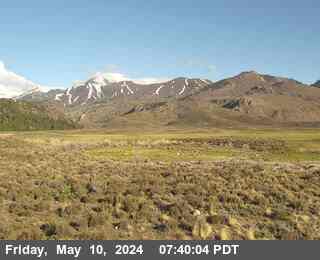
Cámaras web cerca de East Sister
Historia alrededor de East Sister
Ciudades cerca de East Sister
- Yeringtona 51 km
- South Lake Tahoea 76 km