Gilhooley Tower
7480 ft2280 m
Montaña · Montañas Olímpicas · Estados Unidos
Gilhooley Tower is a basalt spire in the Olympic Mountains and is located in Jefferson County of Washington state. It is situated in Olympic National Park on the Olympic Peninsula. Its nearest higher peak is Mount Deception at 0.13 mi (0.21 km) to the southeast.
De Wikipedia, CC BY-SA · Leer el artículo
En la cumbre · pronóstico para las 7:00
20 °FNiebla · viento de 2 mph del O
 Verla en 3D
Clima en la cumbre de Gilhooley Tower, 7480 ft
- 7:0020 °FO 2 mph–
- 10:0026 °FSO 3 mph–
- 13:0029 °FSO 5 mph–
- 16:0026 °FO 5 mph0 pulg.
- 19:0020 °FO 6 mph0,11 pulg.
- 22:0022 °FO 7 mph0,04 pulg.
- 1:0020 °FO 6 mph–
- 4:0020 °FO 6 mph–
| Día | Cielo | Máx. / mín. | Lluvia | Viento hasta |
|---|---|---|---|---|
| Hoy | Nublado | 29 °F / 19 °F | 0,15 pulg. | 7 mph |
| mié, 28 oct | Parcialmente nublado | 25 °F / 18 °F | – | 7 mph |
| jue, 29 oct | Nublado | 23 °F / 18 °F | 0,46 pulg. | 6 mph |
| vie, 30 oct | Nieve débil | 22 °F / 20 °F | 0,04 pulg. | 4 mph |
| sáb, 31 oct | Nieve | 24 °F / 13 °F | 0,04 pulg. | 4 mph |
| dom, 1 nov | Mayormente despejado | 24 °F / 13 °F | 0 pulg. | 1 mph |
| lun, 2 nov | Nublado | 38 °F / 22 °F | – | 3 mph |
Pronóstico de MET Norway (CC BY 4.0), actualizado a las 06:17 GMT-7. Horas locales.
Ficha técnica
- Tipo
- Montaña
- Altitud sobre el nivel del mar
- 7480 ft (2280 m)
- Cordillera
- Montañas Olímpicas
- País
- Estados Unidos
- Coordenadas
- 47.816°N 123.237°W
- Fuente
- Wikidata, CC0
Gilhooley Tower
Basalt spire in Jefferson County, Washington
Gilhooley Tower is a basalt spire in the Olympic Mountains and is located in Jefferson County of Washington state. It is situated in Olympic National Park on the Olympic Peninsula. Its nearest higher peak is Mount Deception at 0.13 mi (0.21 km) to the southeast. Precipitation runoff drains into tributaries of the Dungeness River and Dosewallips River.
De Wikipedia, CC BY-SA · Leer el artículo
Picos cerca de Gilhooley Tower
- Mount Deception7788 ft · a 0,4 kmEn el mapa
- Mount Clark7530 ft · a 2,2 kmEn el mapa
- Mount Mystery7639 ft · a 2,6 kmEn el mapa
- Mount Cameron7192 ft · a 6,9 kmEn el mapa
- Lost Peak6516 ft · a 7,4 kmEn el mapa
- Sentinel Peak6591 ft · a 8,9 kmEn el mapa
- Buckhorn Mountain6988 ft · a 9,1 kmEn el mapa
- Monte Constance7756 ft · a 9,5 kmEn el mapa
- Mount Fromme6706 ft · a 9,7 kmEn el mapa
- Mount Claywood6837 ft · a 10 kmEn el mapa
Los más altos de Montañas Olímpicas
- Monte Olympus7979 ftEn el mapa
- Mount Deception7788 ftEn el mapa
- Monte Constance7756 ftEn el mapa
- Gilhooley Tower7480 ftEn el mapa
- Gray Wolf Ridge7218 ftEn el mapa
- Mount Cameron7192 ftEn el mapa
- Mount Mathias7146 ftEn el mapa
- Mount Carrie6995 ftEn el mapa
- Buckhorn Mountain6988 ftEn el mapa
Montañas más altas de Estados Unidos
- Denali20.308 ftEn el mapa
- Monte San Elías18.009 ftEn el mapa
- Monte Foraker17.402 ftEn el mapa
- Monte Bona16.535 ftEn el mapa
- Monte Blackburn16.390 ftEn el mapa
- Monte Sanford16.237 ftEn el mapa
- Monte Vancouver15.787 ftEn el mapa
- Monte Churchill15.636 ftEn el mapa
- Monte Fairweather15.325 ftEn el mapa
- Mount Hubbard14.951 ftEn el mapa
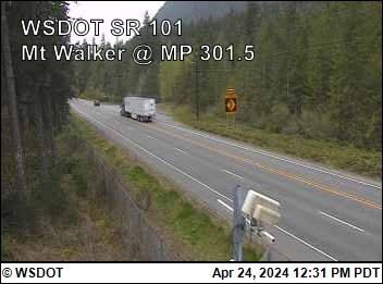
Cámaras web cerca de Gilhooley Tower
Ciudades cerca de Gilhooley Tower
- Sequima 31 km
- Port Angelesa 37 km
- Silverdalea 45 km
- Poulsboa 45 km
- Port Townsenda 48 km
- Bremertona 53 km