Montañas de Austria
Große Riedlkarspitze
2585 m8481 ft
Montaña · Cadena de Hinterautal-Vomper · Austria
Die Große Riedlkarspitze ist ein 2585 m ü. A. hoher Berg im Karwendel in Tirol in der Hinterautal-Vomper-Kette. Benachbarte Gipfel sind die Breitgrieskarspitze im Osten sowie die Larchetkarspitze im Westen.
De Wikipedia en alemán, CC BY-SA · Leer el artículo
En la cumbre · pronóstico para las 8:00
-0 °CNublado · viento de 6 km/h del N
 Verla en 3D
Clima en la cumbre de Große Riedlkarspitze, 2585 m
- 8:00-0 °CN 6 km/h–
- 11:002 °CNO 6 km/h2,6 mm
- 14:00-0 °CN 9 km/h0,7 mm
- 17:00-2 °CN 8 km/h0,3 mm
- 20:00-3 °CN 7 km/h0,1 mm
- 23:00-4 °CN 6 km/h–
- 2:00-4 °CN 4 km/h–
- 5:00-4 °CNE 4 km/h–
| Día | Cielo | Máx. / mín. | Lluvia | Viento hasta |
|---|---|---|---|---|
| Hoy | Nieve fuerte | 2 °C / -4 °C | 3,7 mm | 9 km/h |
| jue, 29 oct | Mayormente despejado | 0 °C / -7 °C | – | 8 km/h |
| vie, 30 oct | Despejado | 1 °C / -9 °C | – | 9 km/h |
| sáb, 31 oct | Despejado | 2 °C / -9 °C | – | 8 km/h |
| dom, 1 nov | Parcialmente nublado | -3 °C / -7 °C | – | 7 km/h |
| lun, 2 nov | Nieve | -7 °C / -9 °C | 13,1 mm | 8 km/h |
| mar, 3 nov | Nieve débil | -7 °C / -10 °C | 3,2 mm | 7 km/h |
Pronóstico de MET Norway (CC BY 4.0), actualizado a las 06:21 CET. Horas locales.
Ficha técnica
- Tipo
- Montaña
- Altitud sobre el nivel del mar
- 2585 m (8481 ft)
- Prominencia
- 182 m (597 ft)
- Aislamiento
- a 1 km de un terreno más alto
- Cordillera
- Cadena de Hinterautal-Vomper
- País
- Austria
- Coordenadas
- 47.412°N 11.367°E
- Fuente
- Wikidata, CC0
Picos cerca de Große Riedlkarspitze
- Birkkarspitze2749 m · a 5,3 kmEn el mapa
- Kaltwasserkarspitze2733 m · a 6,6 kmEn el mapa
- Hafelekarspitze2334 m · a 11 kmEn el mapa
- Nordkette2637 m · a 13 kmEn el mapa
- Dreitorspitze2682 m · a 18 kmEn el mapa
- Bergisel746 m · a 19 kmEn el mapa
- Krottenkopf2086 m · a 20 kmEn el mapa
- Wank1780 m · a 20 kmEn el mapa
- Herzogstand1731 m · a 23 kmEn el mapa
- Hohe Munde2662 m · a 23 kmEn el mapa
Los más altos de Cadena de Hinterautal-Vomper
- Große Seekarspitze2677 mEn el mapa
- Große Riedlkarspitze2585 mEn el mapa
- Pleisenspitze2569 mEn el mapa
- Hochnissl2547 mEn el mapa
Montañas más altas de Austria
- Grossglockner3798 mEn el mapa
- Wildspitze3768 mEn el mapa
- Weißkugel3738 mEn el mapa
- Großvenediger3657 mEn el mapa
- Hintere Schwärze3624 mEn el mapa
- Großes Wiesbachhorn3564 mEn el mapa
- Ramolkogel3549 mEn el mapa
- Schalfkogel3537 mEn el mapa
- Watzespitze3532 mEn el mapa
- Fineilspitze3514 mEn el mapa
Cámaras web cerca de Große Riedlkarspitze
 IR night vision | Tunnel Porta Claudia Nord Rchtg. Seefeld B177 km 21.0a 7,7 km de la cumbre
B177, B177: km 21,00: Tunnel Porta Claudia Nord: Richtg. Seefeld, Blickrichtung Seefelda 7,8 km de la cumbre
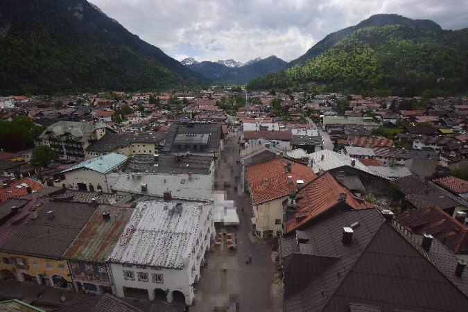 Alpenwelt Karwendel - Mittenwald Kirchea 8,7 km de la cumbre
B177, Tunnel Porta Claudia Süd Rchtg. Seefeld, Blickrichtung Seefelda 9 km de la cumbre
Historia alrededor de Große Riedlkarspitze
- The 1964 Winter Olympics are held in Innsbruck, Austria1964
- G7 leaders gather for a summit in Germany to discuss the situation in Ukraine2022
- Battles of Bergisel1809
- Fourth Battle of Bergisel1809
- Third Battle of Bergisel1809
- Second Battle of Bergisel1809
- First Battle of Bergisel1809
- Battle of Innsbruck1809
Ciudades cerca de Große Riedlkarspitze
- Innsbrucka 17 km
- Garmisch-Partenkirchena 22 km
- Telfsa 25 km
- Penzberga 38 km
- Bad Tölza 41 km
- Geretsrieda 50 km