Großer Geiger
3360 m11.024 ft
Montaña · Grupo Venediger · Austria
The Großer Geiger, formerly also called the Obersulzbacher Venediger and Heiliggeistkogel, is a mountain, 3,360 m (AA), in the Venediger Group in the main chain of the Central Tauern.
De Wikipedia, CC BY-SA · Leer el artículo
En la cumbre · pronóstico para las 1:00
-8 °CMayormente despejado · viento de 5 km/h del O
 Verla en 3D
Clima en la cumbre de Großer Geiger, 3360 m
- 1:00-8 °CO 5 km/h–
- 4:00-9 °CO 5 km/h–
- 7:00-10 °CSO 7 km/h–
- 10:00-6 °CNO 8 km/h0,3 mm
- 13:00-5 °CNO 7 km/h1,4 mm
- 16:00-5 °CNO 6 km/h4,1 mm
- 19:00-6 °CN 8 km/h1 mm
- 22:00-7 °CN 6 km/h–
| Día | Cielo | Máx. / mín. | Lluvia | Viento hasta |
|---|---|---|---|---|
| Hoy | Nieve | -5 °C / -10 °C | 6,8 mm | 8 km/h |
| jue, 29 oct | Mayormente despejado | -7 °C / -15 °C | – | 8 km/h |
| vie, 30 oct | Despejado | -6 °C / -15 °C | – | 6 km/h |
| sáb, 31 oct | Despejado | -7 °C / -15 °C | – | 4 km/h |
| dom, 1 nov | Nublado | -10 °C / -14 °C | – | 9 km/h |
| lun, 2 nov | Nieve fuerte | -12 °C / -14 °C | 15,4 mm | 9 km/h |
| mar, 3 nov | Nieve | -12 °C / -14 °C | 5,9 mm | 9 km/h |
Pronóstico de MET Norway (CC BY 4.0), actualizado a las 00:18 CET. Horas locales.
Ficha técnica
- Tipo
- Montaña
- Altitud sobre el nivel del mar
- 3360 m (11.024 ft)
- Aislamiento
- a 2,7 km de un terreno más alto
- Cordillera
- Grupo Venediger
- País
- Austria
- Primer ascenso
- 20 de agosto de 1871
- Coordenadas
- 47.093°N 12.309°E
- Fuente
- Wikidata, CC0
Großer Geiger
Mountain in the Austrian Central Alps
The Großer Geiger, formerly also called the Obersulzbacher Venediger and Heiliggeistkogel, is a mountain, 3,360 m (AA), in the Venediger Group in the main chain of the Central Tauern. This chain lies in the High Tauern, part of the Austrian Central Alps on the border between the Austrian states of Tyrol in the south and Salzburg in the north.
De Wikipedia, CC BY-SA · Leer el artículo
Picos cerca de Großer Geiger
- Großvenediger3657 m · a 3,4 kmEn el mapa
- Rainerhorn3559 m · a 4,3 kmEn el mapa
- Dreiherrnspitze3499 m · a 5,8 kmEn el mapa
- Rötspitze3496 m · a 11 kmEn el mapa
- Lenkstein3236 m · a 20 kmEn el mapa
- Großer Muntanitz3232 m · a 21 kmEn el mapa
- Hochgall3436 m · a 24 kmEn el mapa
- Schneebiger Nock3358 m · a 27 kmEn el mapa
- Glocknerwand3721 m · a 29 kmEn el mapa
- Grossglockner3798 m · a 29 kmEn el mapa
Los más altos de Grupo Venediger
- Großvenediger3657 mEn el mapa
- Dreiherrnspitze3499 mEn el mapa
- Rötspitze3496 mEn el mapa
- Hoher Eichham3371 mEn el mapa
- Großer Geiger3360 mEn el mapa
- Keeskogel3291 mEn el mapa
- Schlieferspitze3290 mEn el mapa
Montañas más altas de Austria
- Grossglockner3798 mEn el mapa
- Wildspitze3768 mEn el mapa
- Weißkugel3738 mEn el mapa
- Großvenediger3657 mEn el mapa
- Hintere Schwärze3624 mEn el mapa
- Großes Wiesbachhorn3564 mEn el mapa
- Ramolkogel3549 mEn el mapa
- Schalfkogel3537 mEn el mapa
- Watzespitze3532 mEn el mapa
- Fineilspitze3514 mEn el mapa
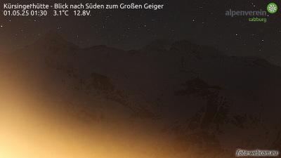
Cámaras web cerca de Großer Geiger


Ciudades cerca de Großer Geiger
- Saalfelden am Steinernen Meera 55 km
- Bressanonea 65 km
- Innsbrucka 72 km