Montañas de Liechtenstein
Kirchlespitz
1929 m6329 ft
Montaña · Macizo de Rhäticon · Liechtenstein
Kirchlespitz is a mountain in Liechtenstein in the Rätikon range of the Eastern Alps between Malbun and Steg, with a height of 1,929 metres (6,329 ft).
De Wikipedia, CC BY-SA · Leer el artículo
En la cumbre · pronóstico para las 3:00
-0 °CParcialmente nublado · viento de 2 km/h del SE
 Verla en 3D
Clima en la cumbre de Kirchlespitz, 1929 m
- 3:00-0 °CSE 2 km/h–
- 6:001 °CSE 4 km/h–
- 9:004 °CSE 2 km/h0,7 mm
- 12:004 °CN 7 km/h0,9 mm
- 15:002 °CN 6 km/h–
- 18:001 °CN 4 km/h–
- 21:001 °CN 3 km/h–
- 0:001 °CNE 2 km/h–
| Día | Cielo | Máx. / mín. | Lluvia | Viento hasta |
|---|---|---|---|---|
| Hoy | Lluvia | 4 °C / -0 °C | 1,6 mm | 8 km/h |
| jue, 29 oct | Mayormente despejado | 5 °C / -3 °C | – | 7 km/h |
| vie, 30 oct | Despejado | 5 °C / -5 °C | – | 7 km/h |
| sáb, 31 oct | Despejado | 4 °C / -5 °C | – | 6 km/h |
| dom, 1 nov | Parcialmente nublado | 1 °C / -6 °C | – | 5 km/h |
| lun, 2 nov | Nublado | -2 °C / -7 °C | 3,9 mm | 5 km/h |
| mar, 3 nov | Nieve débil | -1 °C / -4 °C | 2 mm | 6 km/h |
Pronóstico de MET Norway (CC BY 4.0), actualizado a las 02:17 CET. Horas locales.
Ficha técnica
- Tipo
- Montaña
- Altitud sobre el nivel del mar
- 1929 m (6329 ft)
- Cordillera
- Macizo de Rhäticon
- País
- Liechtenstein
- Coordenadas
- 47.103°N 9.589°E
- Fuente
- Wikidata, CC0
Picos cerca de Kirchlespitz
- Naafkopf2571 m · a 4,9 kmEn el mapa
- Grauspitz2599 m · a 5,7 kmEn el mapa
- Falknis2562 m · a 6,2 kmEn el mapa
- Drei Schwestern2053 m · a 8,1 kmEn el mapa
- Schesaplana2965 m · a 11 kmEn el mapa
- Pizol2844 m · a 22 kmEn el mapa
- Säntis2501 m · a 25 kmEn el mapa
- Glatthorn2133 m · a 28 kmEn el mapa
- Ringelspitz3247 m · a 29 kmEn el mapa
- Rote Wand2703 m · a 31 kmEn el mapa
Los más altos de Macizo de Rhäticon
- Schesaplana2965 mEn el mapa
- Drei Türme2830 mEn el mapa
- Madrisa2826 mEn el mapa
- Sulzfluh2818 mEn el mapa
- Seekopf2698 mEn el mapa
- Grauspitz2599 mEn el mapa
- Schollberg2570 mEn el mapa
- Kirchlispitzen2551 mEn el mapa
- Kirchlespitz1929 mEn el mapa
Montañas más altas de Liechtenstein
- Grauspitz2599 mEn el mapa
- Ochsenkopf2286 mEn el mapa
- Galinakopf2198 mEn el mapa
- Kuhgrat2123 mEn el mapa
- Schönberg2104 mEn el mapa
- Kirchlespitz1929 mEn el mapa
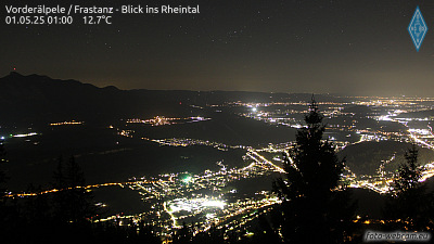
Cámaras web cerca de Kirchlespitz



Historia alrededor de Kirchlespitz
- Battle of Frastanz1499
- Battle of Ragaz1446
- Battle of Feldkirch1799
- 2016 Nenzing shooting2016
- The home and office of Klaus Zumwinkel, CEO of Deutsche Post, is searched by police investigating tax evasion2008
- Vaduz Convention1960
- The 1939 Liechtenstein putsch takes place; members of the (VDBL) unsuccessfully attempt to provoke a clash with the Liechtenstein government with the aim…1939
- Rotter kidnapping1933