Mount Index
5991 ft1826 m
Montaña · Cordillera de las Cascadas · Estados Unidos
Mount Index is a peak in the central part of the Cascade Range in King County, Washington, United States. It lies just south of the Skykomish River and U.S. Route 2, at the western edge of the Cascades. Mount Index features a low elevation relative to peaks higher in the Cascades, and a topographic prominence.
De Wikipedia, CC BY-SA · Leer el artículo
En la cumbre · pronóstico para las 16:00
33 °FNieve débil · viento de 3 mph del O
 Verla en 3D
Clima en la cumbre de Mount Index, 5991 ft
- 16:0033 °FO 3 mph0,01 pulg.
- 19:0028 °FSE 2 mph–
- 22:0027 °FSE 2 mph0,02 pulg.
- 1:0029 °FSE 2 mph0,02 pulg.
- 4:0029 °FS 2 mph0,14 pulg.
- 7:0029 °FSO 2 mph0,04 pulg.
- 10:0030 °FO 3 mph0,08 pulg.
- 13:0030 °FO 5 mph0,1 pulg.
| Día | Cielo | Máx. / mín. | Lluvia | Viento hasta |
|---|---|---|---|---|
| mar, 27 oct | Nieve | 31 °F / 24 °F | 0,97 pulg. | 11 mph |
| mié, 28 oct | Nieve | 28 °F / 22 °F | 1,09 pulg. | 8 mph |
| jue, 29 oct | Nieve | 26 °F / 17 °F | 0,24 pulg. | 6 mph |
| vie, 30 oct | Nieve | 26 °F / 12 °F | 0,28 pulg. | 5 mph |
| sáb, 31 oct | Mayormente despejado | 28 °F / 13 °F | – | 6 mph |
| dom, 1 nov | Mayormente despejado | 27 °F / 12 °F | – | 5 mph |
| lun, 2 nov | Parcialmente nublado | 36 °F / 15 °F | – | 7 mph |
Pronóstico de MET Norway (CC BY 4.0), actualizado a las 12:16 GMT-7. Horas locales.
Ficha técnica
- Tipo
- Montaña
- Altitud sobre el nivel del mar
- 5991 ft (1826 m)
- Prominencia
- 2991 ft (912 m)
- Cordillera
- Cordillera de las Cascadas
- País
- Estados Unidos
- Coordenadas
- 47.774°N 121.580°W
- Fuente
- Wikidata, CC0
Mount Index
Mountain in Washington (state), United States
Mount Index is a peak in the central part of the Cascade Range in King County, Washington, United States. It lies just south of the Skykomish River and U.S. Route 2, at the western edge of the Cascades. Mount Index features a low elevation relative to peaks higher in the Cascades, and a topographic prominence. It comprises three pointed spires which rise steeply from a very low base.
De Wikipedia, CC BY-SA · Leer el artículo
Picos cerca de Mount Index
- Baring Mountain6125 ft · a 11 kmEn el mapa
- Beckler Peak5041 ft · a 22 kmEn el mapa
- Mount Fernow6191 ft · a 26 kmEn el mapa
- Columbia Peak7172 ft · a 26 kmEn el mapa
- Vesper Peak6221 ft · a 27 kmEn el mapa
- Wilmans Peaks6883 ft · a 27 kmEn el mapa
- Sperry Peak6119 ft · a 27 kmEn el mapa
- Monte Cristo Peak7136 ft · a 28 kmEn el mapa
- Cadet Peak7185 ft · a 29 kmEn el mapa
- Big Four Mountain6181 ft · a 30 kmEn el mapa
Los más altos de Cordillera de las Cascadas
- Monte Rainier14.400 ftEn el mapa
- Monte Adams12.280 ftEn el mapa
- Monte McLoughlin9495 ftEn el mapa
- Monte Thielsen9183 ftEn el mapa
- Broken Top9177 ftEn el mapa
- Black Peak8976 ftEn el mapa
- Dome Peak8921 ftEn el mapa
- Silver Star Mountain8875 ftEn el mapa
- Mount Index5991 ftEn el mapa
Montañas más altas de Estados Unidos
- Denali20.308 ftEn el mapa
- Monte San Elías18.009 ftEn el mapa
- Monte Foraker17.402 ftEn el mapa
- Monte Bona16.535 ftEn el mapa
- Monte Blackburn16.390 ftEn el mapa
- Monte Sanford16.237 ftEn el mapa
- Monte Vancouver15.787 ftEn el mapa
- Monte Churchill15.636 ftEn el mapa
- Monte Fairweather15.325 ftEn el mapa
- Mount Hubbard14.951 ftEn el mapa
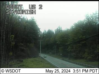
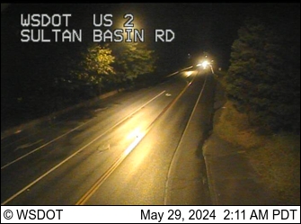
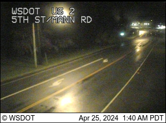
Cámaras web cerca de Mount Index

Ciudades cerca de Mount Index
- Sultana 20 km
- Monroea 31 km
- Union Hill-Novelty Hilla 35 km
- Cottage Lakea 37 km
- City of Sammamisha 39 km
- Sammamisha 40 km