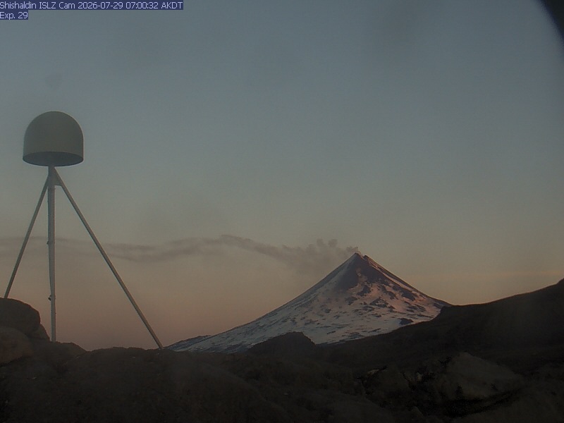
Mount Roundtop
6138 ft1871 m
Volcán · Cordillera Aleutiana · Estados Unidos
Roundtop Mountain is a stratovolcano located on the Aleutian island of Unimak in the U.S. state of Alaska. Its last eruption was sometime between 9,100 and 10,000 years ago. This geographic feature was first called "Dome" in 1897 by Lieutenant Commander J. F. Moser, of the U.S. Navy.
De Wikipedia, CC BY-SA · Leer el artículo
En la cumbre · pronóstico para las 23:00
26 °FNiebla · viento de 17 mph del SO
 Verla en 3D
Clima en la cumbre de Mount Roundtop, 6138 ft
- 23:0026 °FSO 17 mph–
- 2:0024 °FS 15 mph–
- 5:0023 °FS 14 mph–
- 8:0022 °FS 15 mph0 pulg.
- 11:0022 °FS 14 mph0,01 pulg.
- 14:0022 °FS 15 mph0,01 pulg.
- 17:0022 °FS 17 mph0,01 pulg.
- 20:0023 °FS 15 mph0,05 pulg.
| Día | Cielo | Máx. / mín. | Lluvia | Viento hasta |
|---|---|---|---|---|
| mar, 27 oct | Niebla | 25 °F / 22 °F | 0,1 pulg. | 19 mph |
| mié, 28 oct | Nieve débil | 27 °F / 21 °F | 1,63 pulg. | 21 mph |
| jue, 29 oct | Nieve fuerte | 24 °F / 18 °F | 0,49 pulg. | 14 mph |
| vie, 30 oct | Nieve | 27 °F / 19 °F | 0,38 pulg. | 15 mph |
| sáb, 31 oct | Nieve fuerte | 23 °F / 18 °F | 0,76 pulg. | 16 mph |
| dom, 1 nov | Nieve débil | 17 °F / 12 °F | 0,33 pulg. | 16 mph |
| lun, 2 nov | Nieve | 19 °F / 15 °F | 0,61 pulg. | 11 mph |
Pronóstico de MET Norway (CC BY 4.0), actualizado a las 19:16 UTC. Horas locales.
Ficha técnica
- Tipo
- Volcán
- Altitud sobre el nivel del mar
- 6138 ft (1871 m)
- Prominencia
- 2999 ft (914 m)
- Cordillera
- Cordillera Aleutiana
- País
- Estados Unidos
- Coordenadas
- 54.799°N 163.591°W
- Número de volcán
- 311380 en el Programa Global de Vulcanismo
- Fuente
- Wikidata, CC0
Roundtop Mountain (Alaska)
Stratovolcano in Alaska, United States
Roundtop Mountain is a stratovolcano located on the Aleutian island of Unimak in the U.S. state of Alaska. Its last eruption was sometime between 9,100 and 10,000 years ago. This geographic feature was first called "Dome" in 1897 by Lieutenant Commander J. F. Moser, of the U.S. Navy. Its name was reported as "Round Top" by the United States Coast and Geodetic Survey in 1902.
De Wikipedia, CC BY-SA · Leer el artículo
1 erupción registrada
Picos cerca de Mount Roundtop
- Isanotski Peaks8106 ft · a 9,5 kmEn el mapa
- Monte Shishaldin9373 ft · a 25 kmEn el mapa
- Cold Bay Volcano6299 ft · a 57 kmEn el mapa
- Volcán Frosty6601 ft · a 59 kmEn el mapa
- mountain-38615473648 ft · a 51 kmEn el mapa
- Eickelberg PeakVolcán · a 59 kmEn el mapa
Los más altos de Cordillera Aleutiana
- Monte Shishaldin9373 ftEn el mapa
- Pavlof8264 ftEn el mapa
- Monte Veniaminof8225 ftEn el mapa
- Isanotski Peaks8106 ftEn el mapa
- Mount Denison7606 ftEn el mapa
- Mount Griggs7602 ftEn el mapa
- Mount Steller7454 ftEn el mapa
- Mount Mageik7103 ftEn el mapa
- Mount Roundtop6138 ftEn el mapa
Montañas más altas de Estados Unidos
- Denali20.308 ftEn el mapa
- Monte San Elías18.009 ftEn el mapa
- Monte Foraker17.402 ftEn el mapa
- Monte Bona16.535 ftEn el mapa
- Monte Blackburn16.390 ftEn el mapa
- Monte Sanford16.237 ftEn el mapa
- Monte Vancouver15.787 ftEn el mapa
- Monte Churchill15.636 ftEn el mapa
- Monte Fairweather15.325 ftEn el mapa
- Mount Hubbard14.951 ftEn el mapa