Old Baldy
Montaña · Estados Unidos
Old Baldy Mountain is a peak in the Okanogan-Wenatchee National Forest, in Okanogan County, Washington, 10 miles northwest of Conconully. The height is listed at modern sources as 7,844 ft or 7,849 ft or 7,854 ft. Older government maps showed 7,870 feet elevation.
De Wikipedia, CC BY-SA · Leer el artículo
En la cumbre · pronóstico para las 4:00
16 °FDespejado · viento de 3 mph del E
 Verla en 3D
Pronóstico del tiempo en Old Baldy
- 4:0016 °FE 3 mph–
- 7:0015 °FE 3 mph–
- 10:0022 °FSE 4 mph0,01 pulg.
- 13:0023 °FS 3 mph0 pulg.
- 16:0023 °FS 3 mph–
- 19:0018 °FE 2 mph–
- 22:0016 °FE 4 mph–
- 1:0017 °FE 4 mph–
| Día | Cielo | Máx. / mín. | Lluvia | Viento hasta |
|---|---|---|---|---|
| Hoy | Nieve débil | 24 °F / 15 °F | 0,01 pulg. | 5 mph |
| vie, 30 oct | Nieve | 29 °F / 16 °F | 0,33 pulg. | 5 mph |
| sáb, 31 oct | Mayormente despejado | 31 °F / 16 °F | – | 4 mph |
| dom, 1 nov | Despejado | 33 °F / 19 °F | – | 4 mph |
| lun, 2 nov | Nublado | 33 °F / 19 °F | – | 2 mph |
| mar, 3 nov | Parcialmente nublado | 37 °F / 22 °F | – | 2 mph |
| mié, 4 nov | Despejado | 37 °F / 24 °F | – | 3 mph |
Pronóstico de MET Norway (CC BY 4.0), actualizado a las 01:20 GMT-7. Horas locales.
Ficha técnica
- Tipo
- Montaña
- País
- Estados Unidos
- Coordenadas
- 48.590°N 119.956°W
- Fuente
- Wikidata, CC0
Old Baldy Mountain (Okanogan County, Washington)
Mountain in Washington (state), United States
Old Baldy Mountain is a peak in the Okanogan-Wenatchee National Forest, in Okanogan County, Washington, 10 miles northwest of Conconully. The height is listed at modern sources as 7,844 ft or 7,849 ft or 7,854 ft. Older government maps showed 7,870 feet elevation. There is a geodetic survey benchmark at 7,848 ft near the summit. Some sources show the mountain in the Okanogan Range.
De Wikipedia, CC BY-SA · Leer el artículo
Picos cerca de Old Baldy
- Primus Peak8508 ft · a 10 kmEn el mapa
- Klawatti Peak8485 ft · a 12 kmEn el mapa
- Peacock Mountain4495 ft · a 17 kmEn el mapa
- Douglas Mountain5299 ft · a 26 kmEn el mapa
- Goat Peak7001 ft · a 33 kmEn el mapa
- North Gardner Mountain8956 ft · a 41 kmEn el mapa
- Windy Peak8333 ft · a 41 kmEn el mapa
- Chopaka Mountain7881 ft · a 43 kmEn el mapa
- Silver Star Mountain8875 ft · a 47 kmEn el mapa
- Gibert Mountain8023 ft · a 48 kmEn el mapa
Montañas más altas de Estados Unidos
- Denali20.308 ftEn el mapa
- Monte San Elías18.009 ftEn el mapa
- Monte Foraker17.402 ftEn el mapa
- Monte Bona16.535 ftEn el mapa
- Monte Blackburn16.390 ftEn el mapa
- Monte Sanford16.237 ftEn el mapa
- Monte Vancouver15.787 ftEn el mapa
- Monte Churchill15.636 ftEn el mapa
- Monte Fairweather15.325 ftEn el mapa
- Mount Hubbard14.951 ftEn el mapa
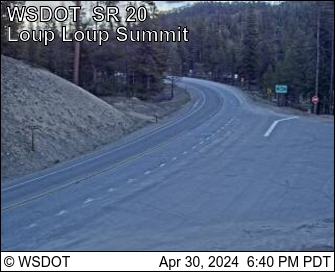
Cámaras web cerca de Old Baldy



Historia alrededor de Old Baldy
Ciudades cerca de Old Baldy
- Omaka 36 km
- Brewstera 55 km
- Bridgeporta 68 km