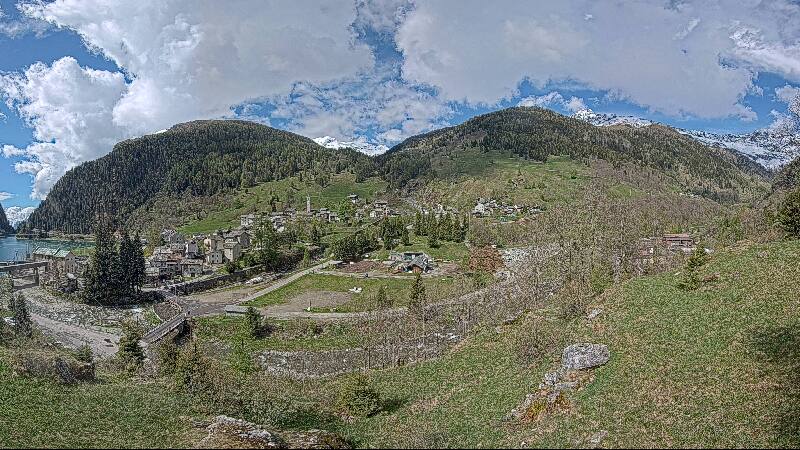
Piz Curvér
2972 m9750 ft
Montaña · Alpes de Oberhalbstein · Suiza
Piz Curvér is a mountain of the Oberhalbstein Range, between Andeer and Savognin, in the canton of Graubünden. With a height of 2,972 metres (9,751 ft) above sea level, it is the highest point of the chain north of the pass Fuorcla Cotschna.
De Wikipedia, CC BY-SA · Leer el artículo
En la cumbre · pronóstico para las 15:00
-1 °CNublado · viento de 10 km/h del N
 Verla en 3D
Clima en la cumbre de Piz Curvér, 2972 m
- 15:00-1 °CN 10 km/h–
- 18:00-3 °CN 10 km/h–
- 21:00-4 °CN 8 km/h–
- 0:00-5 °CS 4 km/h–
- 3:00-7 °CS 5 km/h–
- 6:00-8 °CS 4 km/h–
- 9:00-4 °CS 4 km/h–
- 12:001 °CN 5 km/h–
| Día | Cielo | Máx. / mín. | Lluvia | Viento hasta |
|---|---|---|---|---|
| jue, 29 oct | Despejado | 2 °C / -8 °C | – | 8 km/h |
| vie, 30 oct | Despejado | 1 °C / -8 °C | – | 7 km/h |
| sáb, 31 oct | Despejado | 1 °C / -8 °C | – | 5 km/h |
| dom, 1 nov | Despejado | -1 °C / -9 °C | – | 6 km/h |
| lun, 2 nov | Parcialmente nublado | -5 °C / -10 °C | 2,1 mm | 10 km/h |
| mar, 3 nov | Nublado | -8 °C / -10 °C | 1,9 mm | 8 km/h |
| mié, 4 nov | Mayormente despejado | -5 °C / -10 °C | 0,1 mm | 4 km/h |
Pronóstico de MET Norway (CC BY 4.0), actualizado a las 09:19 CET. Horas locales.
Ficha técnica
- Tipo
- Montaña
- Altitud sobre el nivel del mar
- 2972 m (9750 ft)
- Prominencia
- 455 m (1493 ft)
- Aislamiento
- a 8,2 km de un terreno más alto
- Cordillera
- Alpes de Oberhalbstein
- Pico padre
- Piz Grisch
- País
- Suiza
- Coordenadas
- 46.603°N 9.497°E
- Fuente
- Wikidata, CC0
Piz Curvér
Mountain in Swiss canton of Graubünden
Piz Curvér is a mountain of the Oberhalbstein Range, between Andeer and Savognin, in the canton of Graubünden. With a height of 2,972 metres (9,751 ft) above sea level, it is the highest point of the chain north of the pass Fuorcla Cotschna. On its eastern flank lies the holy pilgrimage site of Ziteil, at 2,434 metres (7,986 ft) above sea level.
De Wikipedia, CC BY-SA · Leer el artículo
Picos cerca de Piz Curvér
- Piz Platta3392 m · a 14 kmEn el mapa
- Alperschällihorn3036 m · a 15 kmEn el mapa
- Piz Ela3339 m · a 16 kmEn el mapa
- Piz Calderas3397 m · a 17 kmEn el mapa
- Aroser Rothorn2980 m · a 17 kmEn el mapa
- Aroser Weisshorn2653 m · a 23 kmEn el mapa
- Piz Julier3380 m · a 24 kmEn el mapa
- Piz Nair3056 m · a 25 kmEn el mapa
- Piz Ot3246 m · a 25 kmEn el mapa
- Piz Duan3131 m · a 26 kmEn el mapa
Pico padre
El pico más alto más cercano respecto al que se mide su prominencia.
- Piz Grisch3062 mEn el mapa
Picos por debajo de Piz Curvér
- Piz digl Gurschus2880 mEn el mapa
- Piz Cartas2712 mEn el mapa
- Piz Martegnas2681 mEn el mapa
Los más altos de Alpes de Oberhalbstein
- Piz Platta3392 mEn el mapa
- Piz Forbesch3262 mEn el mapa
- Piz Timun3209 mEn el mapa
- Piz Duan3131 mEn el mapa
- Gletscherhorn3107 mEn el mapa
- Pizz Gallaguin3107 mEn el mapa
- Cima da Lägh3083 mEn el mapa
- Piz Grisch3062 mEn el mapa
- Piz Curvér2972 mEn el mapa
Montañas más altas de Suiza
- Pico Dufour4634 mEn el mapa
- Dom4546 mEn el mapa
- Liskamm4532 mEn el mapa
- Weisshorn4505 mEn el mapa
- Cervino4478 mEn el mapa
- Dent Blanche4357 mEn el mapa
- Grand Combin4309 mEn el mapa
- Finsteraarhorn4274 mEn el mapa
- Zinalrothorn4221 mEn el mapa
- Alphubel4206 mEn el mapa