Preston Peak
7313 ft2229 m
Montaña · Montañas Siskiyou · Estados Unidos
Preston Peak, is a dominant feature of the Siskiyou Wilderness in the Klamath National Forest in northern California, U.S. Many peaks in the wilderness rise to over 6,000 feet (1,800 m) but none comes to within 500 feet (150 m) of approaching the height of Preston Peak.
De Wikipedia, CC BY-SA · Leer el artículo
En la cumbre · pronóstico para las 18:00
29 °FDespejado · viento de 3 mph del N
 Verla en 3D
Clima en la cumbre de Preston Peak, 7313 ft
- 18:0029 °FN 3 mph–
- 21:0021 °FNO 4 mph–
- 0:0020 °FNO 3 mph–
- 3:0021 °FNO 3 mph–
- 6:0022 °FNO 2 mph–
- 9:0028 °FN 3 mph–
- 12:0037 °FE 3 mph–
- 15:0040 °FNO 5 mph–
| Día | Cielo | Máx. / mín. | Lluvia | Viento hasta |
|---|---|---|---|---|
| mié, 28 oct | Despejado | 40 °F / 20 °F | – | 6 mph |
| jue, 29 oct | Nublado | 39 °F / 21 °F | – | 5 mph |
| vie, 30 oct | Mayormente despejado | 31 °F / 19 °F | – | 4 mph |
| sáb, 31 oct | Despejado | 32 °F / 19 °F | 0,13 pulg. | 5 mph |
| dom, 1 nov | Despejado | 36 °F / 15 °F | – | 3 mph |
| lun, 2 nov | Despejado | 46 °F / 24 °F | – | 4 mph |
| mar, 3 nov | Nublado | 49 °F / 34 °F | – | 2 mph |
Pronóstico de MET Norway (CC BY 4.0), actualizado a las 18:17 GMT-7. Horas locales.
Ficha técnica
- Tipo
- Montaña
- Altitud sobre el nivel del mar
- 7313 ft (2229 m)
- Prominencia
- 2509 ft (765 m)
- Cordillera
- Montañas Siskiyou
- País
- Estados Unidos
- Coordenadas
- 41.835°N 123.612°W
- Fuente
- Wikidata, CC0
Preston Peak
Mountain in the state of California
Preston Peak, is a dominant feature of the Siskiyou Wilderness in the Klamath National Forest in northern California, U.S. Many peaks in the wilderness rise to over 6,000 feet (1,800 m) but none comes to within 500 feet (150 m) of approaching the height of Preston Peak. From the summit on a clear day, the Pacific Ocean is visible along with peaks in the Klamath Mountains and Cascade Range.
De Wikipedia, CC BY-SA · Leer el artículo
Picos cerca de Preston Peak
- montaña Bear6415 ft · a 6,6 kmEn el mapa
- Peak Eight5188 ft · a 34 kmEn el mapa
- Kangaroo Mountain6697 ft · a 35 kmEn el mapa
- Chetco Peak4671 ft · a 43 kmEn el mapa
- Mount Emily2925 ft · a 49 kmEn el mapa
- Pearsoll Peak5098 ft · a 55 kmEn el mapa
- Negro Ben Mountain4398 ft · a 59 kmEn el mapa
- Collings MountainMontaña · a 45 kmEn el mapa
- Tallowbox MountainMontaña · a 55 kmEn el mapa
- Boaz MountainMontaña · a 57 kmEn el mapa
Los más altos de Montañas Siskiyou
- Mount Ashland7533 ftEn el mapa
- Preston Peak7313 ftEn el mapa
- montaña Bear6415 ftEn el mapa
- Peak Eight5188 ftEn el mapa
Montañas más altas de Estados Unidos
- Denali20.308 ftEn el mapa
- Monte San Elías18.009 ftEn el mapa
- Monte Foraker17.402 ftEn el mapa
- Monte Bona16.535 ftEn el mapa
- Monte Blackburn16.390 ftEn el mapa
- Monte Sanford16.237 ftEn el mapa
- Monte Vancouver15.787 ftEn el mapa
- Monte Churchill15.636 ftEn el mapa
- Monte Fairweather15.325 ftEn el mapa
- Mount Hubbard14.951 ftEn el mapa
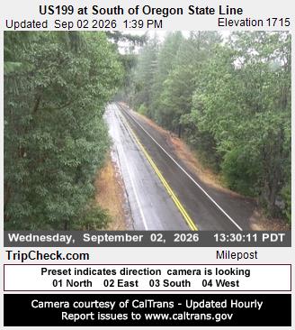
Cámaras web cerca de Preston Peak



Historia alrededor de Preston Peak
- Natchez Fire2018
- Young Fire2017
Ciudades cerca de Preston Peak
- Cave Junctiona 37 km
- Crescent Citya 49 km
- Brookingsa 63 km
- Grants Passa 71 km
- Rogue Rivera 76 km