Scenic Hill
77 m253 ft
Montaña · China
Scenic Hill is a hill on Chek Lap Kok, Hong Kong, and stands at a height of 77 metres (253 ft) above the sea level. Today, Scenic Hill is the tallest point on Chek Lap Kok Island, which houses Hong Kong International Airport.
De Wikipedia, CC BY-SA · Leer el artículo
En la cumbre · pronóstico para las 12:00
30 °CParcialmente nublado · viento de 14 km/h del NE
 Verla en 3D
Clima en la cumbre de Scenic Hill, 77 m
- 12:0030 °CNE 14 km/h–
- 15:0031 °CO 19 km/h0,1 mm
- 18:0027 °CSE 19 km/h–
- 21:0026 °CE 17 km/h–
- 0:0025 °CE 22 km/h–
- 3:0025 °CE 24 km/h–
- 6:0024 °CNE 25 km/h–
- 9:0026 °CNE 23 km/h–
| Día | Cielo | Máx. / mín. | Lluvia | Viento hasta |
|---|---|---|---|---|
| Hoy | Parcialmente nublado | 31 °C / 26 °C | 0,1 mm | 23 km/h |
| mié, 28 oct | Mayormente despejado | 29 °C / 24 °C | – | 26 km/h |
| jue, 29 oct | Parcialmente nublado | 30 °C / 24 °C | – | 26 km/h |
| vie, 30 oct | Despejado | 30 °C / 25 °C | – | 18 km/h |
| sáb, 31 oct | Mayormente despejado | 30 °C / 25 °C | – | 16 km/h |
| dom, 1 nov | Mayormente despejado | 30 °C / 25 °C | 1,5 mm | 13 km/h |
| lun, 2 nov | Mayormente despejado | 32 °C / 26 °C | 1 mm | 10 km/h |
Pronóstico de MET Norway (CC BY 4.0), actualizado a las 09:17 GMT+8. Horas locales.
Ficha técnica
- Tipo
- Montaña
- Altitud sobre el nivel del mar
- 77 m (253 ft)
- País
- China
- Coordenadas
- 22.294°N 113.936°E
- Fuente
- Wikidata, CC0
Scenic Hill (Hong Kong)
Hill in Hong Kong
Scenic Hill is a hill on Chek Lap Kok, Hong Kong, and stands at a height of 77 metres (253 ft) above the sea level. Today, Scenic Hill is the tallest point on Chek Lap Kok Island, which houses Hong Kong International Airport. In the 1990s, taller nearby mountains on Chek Lap Kok Island were bulldozed to make reclaimed-land for the airport.
De Wikipedia, CC BY-SA · Leer el artículo
Picos cerca de Scenic Hill
- Pok To Yan529 m · a 2,5 kmEn el mapa
- Por Kai Shan529 m · a 2,7 kmEn el mapa
- Nei Lak Shan751 m · a 4,3 kmEn el mapa
- Lin Fa Shan766 m · a 4,4 kmEn el mapa
- Sunset Peak869 m · a 4,5 kmEn el mapa
- Yi Tung Shan747 m · a 5 kmEn el mapa
- Lantau Peak934 m · a 5,8 kmEn el mapa
- Fu Shan75 m · a 8,8 kmEn el mapa
- Keung Shan459 m · a 8,9 kmEn el mapa
- Castle Peak583 m · a 10 kmEn el mapa
Montañas más altas de China
- Everest8849 mEn el mapa
- Lhotse8516 mEn el mapa
- Makalu8485 mEn el mapa
- Cho Oyu8188 mEn el mapa
- Gasherbrum I8080 mEn el mapa
- Broad Peak8051 mEn el mapa
- Gasherbrum II8034 mEn el mapa
- Shisha Pangma8027 mEn el mapa
- Gyachung Kang7952 mEn el mapa
- Gasherbrum III7946 mEn el mapa
Cámaras web cerca de Scenic Hill
 North Lantau Highway near Tung Chung (N) - Eastbound (1)a 0,2 km de la cumbre
 North Lantau Highway near Tung Chung (N) - Eastbound (2)a 0,5 km de la cumbre
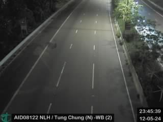 North Lantau Highway near Tung Chung (N) - Westbound (2)a 0,6 km de la cumbre
- North Lantau Highway near Tung Chung (N) - Westbound (2) [AID08122]a 0,6 km de la cumbre
Historia alrededor de Scenic Hill
- Emirates SkyCargo Flight 97882025
- China Airlines Flight 6421999
- 2019 Yuen Long attack2019
- First Battle of Tamao1521
- September 2019 Guangfu Tuen Mun Park2019
- 1 September 2019 Hong Kong anti-extradition bill protest2019
- At least 36 people are killed in a ferry collision off the coast of Hong Kong2012
- Tuen Mun Road bus plunge2003
Ciudades cerca de Scenic Hill
- Tung Chunga 1 km
- San Tung Chung Hanga 1,9 km
- Discovery Baya 8,4 km
- Butterflya 9,5 km
- Sam Shinga 11 km
- Tuen Muna 11 km