Stately Pleasure Dome
9040 ft2755 m
Colina · Sierra Nevada · Estados Unidos
Stately Pleasure Dome is the unofficial name for the prominent south-southwestern portion of Polly Dome, a granite dome on the northwest side of Tenaya Lake and Tioga Road in the Yosemite high country.
De Wikipedia, CC BY-SA · Leer el artículo
En la cumbre · pronóstico para las 18:00
33 °FParcialmente nublado · viento de 4 mph del S
 Verla en 3D
Clima en la cumbre de Stately Pleasure Dome, 9040 ft
- 18:0033 °FS 4 mph–
- 21:0028 °FSE 3 mph–
- 0:0025 °FE 4 mph–
- 3:0024 °FE 4 mph–
- 6:0024 °FE 4 mph–
- 9:0037 °FE 4 mph–
- 12:0046 °FO 7 mph–
- 15:0046 °FO 6 mph–
| Día | Cielo | Máx. / mín. | Lluvia | Viento hasta |
|---|---|---|---|---|
| mié, 28 oct | Parcialmente nublado | 47 °F / 24 °F | – | 7 mph |
| jue, 29 oct | Nublado | 45 °F / 24 °F | – | 11 mph |
| vie, 30 oct | Lluvia débil | 38 °F / 27 °F | 0,06 pulg. | 5 mph |
| sáb, 31 oct | Nieve fuerte | 35 °F / 28 °F | 0,53 pulg. | 6 mph |
| dom, 1 nov | Despejado | 35 °F / 20 °F | 0,02 pulg. | 8 mph |
| lun, 2 nov | Despejado | 51 °F / 20 °F | – | 8 mph |
| mar, 3 nov | Nublado | 56 °F / 23 °F | – | 6 mph |
Pronóstico de MET Norway (CC BY 4.0), actualizado a las 16:18 GMT-7. Horas locales.
Ficha técnica
- Tipo
- Colina
- Altitud sobre el nivel del mar
- 9040 ft (2755 m)
- Cordillera
- Sierra Nevada
- Pico padre
- Polly Dome
- País
- Estados Unidos
- Coordenadas
- 37.839°N 119.458°W
- Fuente
- Wikidata, CC0
Stately Pleasure Dome
Granite dome in Yosemite National Park, USA
Stately Pleasure Dome is the unofficial name for the prominent south-southwestern portion of Polly Dome, a granite dome on the northwest side of Tenaya Lake and Tioga Road in the Yosemite high country. Stately Pleasure Dome consists of glaciated and exfoliated granite rock that rises steeply 900 feet (270 m) from the lake shore; the very steep east side of the dome is popular with rock climbers, who gave the dome its…
De Wikipedia, CC BY-SA · Leer el artículo
Picos cerca de Stately Pleasure Dome
- Pywiack Dome8852 ft · a 1,6 kmEn el mapa
- Tenaya Peak10.306 ft · a 1,7 kmEn el mapa
- Polly Dome9806 ft · a 1,9 kmEn el mapa
- Tresidder Peak10.600 ft · a 3,3 kmEn el mapa
- Medlicott Dome9885 ft · a 3,6 kmEn el mapa
- Cathedral Peak10.912 ft · a 4,7 kmEn el mapa
- Mount Hoffmann10.855 ft · a 4,8 kmEn el mapa
- Fairview Dome9728 ft · a 6 kmEn el mapa
- Daff Dome9158 ft · a 6,1 kmEn el mapa
- Doda Dome8907 ft · a 6,1 kmEn el mapa
Pico padre
El pico más alto más cercano respecto al que se mide su prominencia.
- Polly Dome9806 ftEn el mapa
Los más altos de Sierra Nevada
- Monte Whitney14.505 ftEn el mapa
- Mount Williamson14.403 ftEn el mapa
- Mount Russell14.094 ftEn el mapa
- Monte Langley14.032 ftEn el mapa
- Mount Tyndall14.025 ftEn el mapa
- Mount Humphreys13.992 ftEn el mapa
- Mount Keith13.982 ftEn el mapa
- Mount LeConte13.936 ftEn el mapa
- Stately Pleasure Dome9040 ftEn el mapa
Montañas más altas de Estados Unidos
- Denali20.308 ftEn el mapa
- Monte San Elías18.009 ftEn el mapa
- Monte Foraker17.402 ftEn el mapa
- Monte Bona16.535 ftEn el mapa
- Monte Blackburn16.390 ftEn el mapa
- Monte Sanford16.237 ftEn el mapa
- Monte Vancouver15.787 ftEn el mapa
- Monte Churchill15.636 ftEn el mapa
- Monte Fairweather15.325 ftEn el mapa
- Mount Hubbard14.951 ftEn el mapa
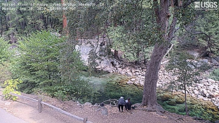
Cámaras web cerca de Stately Pleasure Dome

Historia alrededor de Stately Pleasure Dome
- Pika Fire2023
- Red Fire2022
- Meadow Fire2014
Ciudades cerca de Stately Pleasure Dome
- Mammoth Lakesa 48 km