Montañas de Estados Unidos
Warrior Peak
7320 ft2231 m
Montaña · Montañas Olímpicas · Estados Unidos
Warrior Peak is a 7,320+ ft double summit mountain located in Olympic National Park and Jefferson County of Washington state. Warrior is the 11th-highest peak in the Olympic Mountains. The southeast summit is the slightly higher of the two summits, the northwest peak is estimated at 7,285 feet elevation.
De Wikipedia, CC BY-SA · Leer el artículo
 Verla en 3D
Ficha técnica
- Tipo
- Montaña
- Altitud sobre el nivel del mar
- 7320 ft (2231 m)
- Cordillera
- Montañas Olímpicas
- País
- Estados Unidos
- Coordenadas
- 47.784°N 123.133°W
- Fuente
- Wikidata, CC0
Picos cerca de Warrior Peak
- Monte Constance7756 ft · a 1,3 kmEn el mapa
- Buckhorn Mountain6988 ft · a 4,9 kmEn el mapa
- Mount Mystery7639 ft · a 6,7 kmEn el mapa
- Mount Deception7788 ft · a 8,2 kmEn el mapa
- Welch Peaks6109 ft · a 8,6 kmEn el mapa
- Mount Clark7530 ft · a 9,3 kmEn el mapa
- Mount Jupiter5699 ft · a 10 kmEn el mapa
- Mount Townsend6280 ft · a 11 kmEn el mapa
- Mount Elk Lick6516 ft · a 14 kmEn el mapa
- The Brothers6842 ft · a 14 kmEn el mapa
Los más altos de Montañas Olímpicas
- Monte Olympus7979 ftEn el mapa
- Mount Deception7788 ftEn el mapa
- Monte Constance7756 ftEn el mapa
- Warrior Peak7320 ftEn el mapa
- Gray Wolf Ridge7218 ftEn el mapa
- Mount Cameron7192 ftEn el mapa
- Mount Mathias7146 ftEn el mapa
- Mount Carrie6995 ftEn el mapa
- Buckhorn Mountain6988 ftEn el mapa
Montañas más altas de Estados Unidos
- Denali20.308 ftEn el mapa
- Monte San Elías18.009 ftEn el mapa
- Monte Foraker17.402 ftEn el mapa
- Monte Bona16.535 ftEn el mapa
- Monte Blackburn16.390 ftEn el mapa
- Monte Sanford16.237 ftEn el mapa
- Monte Vancouver15.787 ftEn el mapa
- Monte Churchill15.636 ftEn el mapa
- Monte Fairweather15.325 ftEn el mapa
- Mount Hubbard14.951 ftEn el mapa
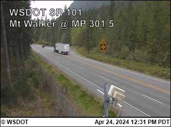
Cámaras web cerca de Warrior Peak
Ciudades cerca de Warrior Peak
- Sequima 32 km
- Silverdalea 36 km
- Poulsboa 37 km
- Port Angelesa 43 km
- Bremertona 45 km
- Port Townsenda 46 km