Whiskey Dick Mountain
3873 ft1181 m
Montaña · Wenatchee Mountains · Estados Unidos
Whiskey Dick Mountain is located 15 miles (24 km) east of Ellensburg, in Washington state. Within the 28,549-acre (115.53 km2) Whiskey Dick Unit of the L.T. Murray Wildlife Area, it is the highest point on Windy Ridge. The site of the Wild Horse Wind and Solar Facility is on its southwest flank.
De Wikipedia, CC BY-SA · Leer el artículo
En la cumbre · pronóstico para las 14:00
46 °FMayormente despejado · viento de 15 mph del O
 Verla en 3D
Clima en la cumbre de Whiskey Dick Mountain, 3873 ft
- 14:0046 °FO 15 mph–
- 17:0042 °FO 13 mph–
- 20:0037 °FO 10 mph–
- 23:0035 °FNO 12 mph–
- 2:0032 °FO 7 mph0,03 pulg.
- 5:0032 °FO 7 mph0,03 pulg.
- 8:0030 °FO 8 mph0,01 pulg.
- 11:0037 °FO 11 mph–
| Día | Cielo | Máx. / mín. | Lluvia | Viento hasta |
|---|---|---|---|---|
| mié, 28 oct | Mayormente despejado | 41 °F / 30 °F | 0,07 pulg. | 12 mph |
| jue, 29 oct | Parcialmente nublado | 39 °F / 28 °F | – | 11 mph |
| vie, 30 oct | Parcialmente nublado | 41 °F / 31 °F | 0,09 pulg. | 11 mph |
| sáb, 31 oct | Nublado | 40 °F / 29 °F | – | 7 mph |
| dom, 1 nov | Despejado | 41 °F / 27 °F | – | 8 mph |
| lun, 2 nov | Parcialmente nublado | 40 °F / 30 °F | – | 3 mph |
| mar, 3 nov | Mayormente despejado | 42 °F / 34 °F | – | 1 mph |
Pronóstico de MET Norway (CC BY 4.0), actualizado a las 12:17 GMT-7. Horas locales.
Ficha técnica
- Tipo
- Montaña
- Altitud sobre el nivel del mar
- 3873 ft (1181 m)
- Prominencia
- 423 ft (129 m)
- Cordillera
- Wenatchee Mountains
- País
- Estados Unidos
- Coordenadas
- 47.025°N 120.232°W
- Fuente
- Wikidata, CC0
Whiskey Dick Mountain
Mountain in Washington (state), United States
Whiskey Dick Mountain is located 15 miles (24 km) east of Ellensburg, in Washington state. Within the 28,549-acre (115.53 km2) Whiskey Dick Unit of the L.T. Murray Wildlife Area, it is the highest point on Windy Ridge. The site of the Wild Horse Wind and Solar Facility is on its southwest flank. The farm, with 149 wind turbines, is owned by Puget Sound Energy.
De Wikipedia, CC BY-SA · Leer el artículo
Picos cerca de Whiskey Dick Mountain
- Monument Hill2886 ft · a 46 kmEn el mapa
- Badger Mountain4262 ft · a 48 kmEn el mapa
- Yakima Ridge4195 ft · a 50 kmEn el mapa
- Mission PeakMontaña · a 33 kmEn el mapa
Los más altos de Wenatchee Mountains
- Ingalls Peak7661 ftEn el mapa
- The Cradle7467 ftEn el mapa
- Three Brothers7303 ftEn el mapa
- Navaho Peak7224 ftEn el mapa
- Harding Mountain7172 ftEn el mapa
- Hawkins Mountain7160 ftEn el mapa
- Earl Peak7037 ftEn el mapa
- Mac Peak6860 ftEn el mapa
- Whiskey Dick Mountain3873 ftEn el mapa
Montañas más altas de Estados Unidos
- Denali20.308 ftEn el mapa
- Monte San Elías18.009 ftEn el mapa
- Monte Foraker17.402 ftEn el mapa
- Monte Bona16.535 ftEn el mapa
- Monte Blackburn16.390 ftEn el mapa
- Monte Sanford16.237 ftEn el mapa
- Monte Vancouver15.787 ftEn el mapa
- Monte Churchill15.636 ftEn el mapa
- Monte Fairweather15.325 ftEn el mapa
- Mount Hubbard14.951 ftEn el mapa
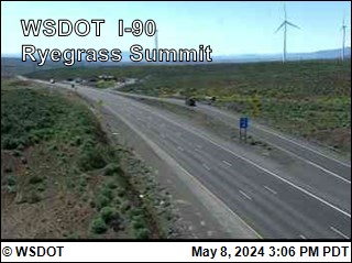
Cámaras web cerca de Whiskey Dick Mountain


Historia alrededor de Whiskey Dick Mountain
Ciudades cerca de Whiskey Dick Mountain
- Kittitasa 15 km
- Ellensburga 24 km
- Rock Islanda 39 km
- Mattawaa 41 km
- East Wenatcheea 44 km
- Wenatcheea 45 km