Montañas de China
Yuk Kwai Shan
196 m643 ft
Montaña · China
Mount Johnston, also known as Yuk Kwai Shan, is a hill located on the island of Ap Lei Chau in Hong Kong. The hill is 196m in height and is a popular site for hiking. A narrow tombolo connects the ocean facing shore of Mount Johnston to Ap Lei Pai.
De Wikipedia, CC BY-SA · Leer el artículo
En la cumbre · pronóstico para las 9:00
24 °CParcialmente nublado · viento de 39 km/h del E
 Verla en 3D
Clima en la cumbre de Yuk Kwai Shan, 196 m
- 9:0024 °CE 39 km/h–
- 12:0025 °CE 30 km/h–
- 15:0025 °CE 28 km/h–
- 18:0025 °CE 23 km/h–
- 21:0025 °CE 15 km/h–
- 0:0025 °CE 14 km/h–
- 3:0025 °CE 15 km/h–
- 6:0024 °CNE 18 km/h–
| Día | Cielo | Máx. / mín. | Lluvia | Viento hasta |
|---|---|---|---|---|
| Hoy | Parcialmente nublado | 25 °C / 24 °C | – | 39 km/h |
| vie, 30 oct | Despejado | 25 °C / 24 °C | – | 21 km/h |
| sáb, 31 oct | Mayormente despejado | 25 °C / 25 °C | 0,1 mm | 33 km/h |
| dom, 1 nov | Mayormente despejado | 26 °C / 24 °C | 4,5 mm | 26 km/h |
| lun, 2 nov | Nublado | 26 °C / 25 °C | 0,2 mm | 18 km/h |
| mar, 3 nov | Parcialmente nublado | 25 °C / 25 °C | 0,4 mm | 28 km/h |
| mié, 4 nov | Nublado | 25 °C / 24 °C | 0,1 mm | 33 km/h |
Pronóstico de MET Norway (CC BY 4.0), actualizado a las 03:19 GMT+8. Horas locales.
Ficha técnica
- Tipo
- Montaña
- Altitud sobre el nivel del mar
- 196 m (643 ft)
- País
- China
- Coordenadas
- 22.238°N 114.157°E
- Fuente
- Wikidata, CC0
Picos cerca de Yuk Kwai Shan
- Cumbre Victoria552 m · a 4,4 kmEn el mapa
- Violet Hill433 m · a 4,6 kmEn el mapa
- The Twins386 m · a 5,1 kmEn el mapa
- Lung Fu Shan253 m · a 5,2 kmEn el mapa
- Siu Ma Shan424 m · a 6,3 kmEn el mapa
- Braemar Hill200 m · a 6,8 kmEn el mapa
- Mount Parker532 m · a 7 kmEn el mapa
- Red Hill113 m · a 7,1 kmEn el mapa
- Sai Wan Shan, Chai Wan197 m · a 9 kmEn el mapa
- Pottinger Peak312 m · a 9,7 kmEn el mapa
Montañas más altas de China
- Everest8849 mEn el mapa
- Lhotse8516 mEn el mapa
- Makalu8485 mEn el mapa
- Cho Oyu8188 mEn el mapa
- Gasherbrum I8080 mEn el mapa
- Broad Peak8051 mEn el mapa
- Gasherbrum II8034 mEn el mapa
- Shisha Pangma8027 mEn el mapa
- Gyachung Kang7952 mEn el mapa
- Gasherbrum III7946 mEn el mapa
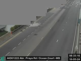
Cámaras web cerca de Yuk Kwai Shan



Historia alrededor de Yuk Kwai Shan
Ciudades cerca de Yuk Kwai Shan
- Lei Tunga 0,3 km
- Lei Tung Estatea 0,4 km
- South Horizonsa 1,1 km
- Aberdeena 1,2 km
- South Horizons (Estate)a 1,3 km
- Wong Chuk Hanga 1,4 km