Castle Peak
9 109 ft2 776 m
Montagne · sierra Nevada · États-Unis
Castle Peak is a mountain in California's Sierra Nevada near I-80, Donner Pass, and the Nevada border. It is in the Tahoe National Forest not far off the Pacific Crest Trail, and adjacent to Castle Pass. It was originally named Mount Stanford, after Leland Stanford, by the Whitney Survey of 1860–1874.
Source : Wikipedia, CC BY-SA · Lire l’article
Au sommet · prévision pour 21:00
29 °FDégagé · vent 2 mph du SO
 Voir en 3D
Météo au sommet : Castle Peak, 9 109 ft
- 21:0029 °FSO 2 mph–
- 0:0030 °FS 2 mph–
- 3:0029 °FSO 2 mph–
- 6:0031 °FSO 2 mph–
- 9:0035 °FS 3 mph–
- 12:0042 °FS 8 mph–
- 15:0041 °FSO 8 mph–
- 18:0032 °FSO 7 mph–
| Jour | Ciel | Max. / min. | Pluie | Vent jusqu’à |
|---|---|---|---|---|
| jeu. 29 oct. | Nuageux | 42 °F / 29 °F | – | 10 mph |
| ven. 30 oct. | Pluie et neige mêlées | 34 °F / 24 °F | 0,14 po | 13 mph |
| sam. 31 oct. | Neige forte | 30 °F / 24 °F | 0,91 po | 8 mph |
| dim. 1 nov. | Dégagé | 27 °F / 20 °F | – | 13 mph |
| lun. 2 nov. | Partiellement nuageux | 35 °F / 17 °F | – | 7 mph |
| mar. 3 nov. | Partiellement nuageux | 48 °F / 26 °F | – | 3 mph |
| mer. 4 nov. | Nuageux | 49 °F / 31 °F | – | 7 mph |
Prévisions de MET Norway (CC BY 4.0), mises à jour à 12:19 UTC−7. Heures locales.
Fiche technique
- Type
- Montagne
- Altitude
- 9 109 ft (2 776 m)
- Proéminence
- 1 343 ft (409 m)
- Massif
- sierra Nevada
- Pays
- États-Unis
- Coordonnées
- 39.365°N 120.349°W
- Source
- Wikidata, CC0
Castle Peak (California)
Mountain in California's Sierra Nevada
Castle Peak is a mountain in California's Sierra Nevada near I-80, Donner Pass, and the Nevada border. It is in the Tahoe National Forest not far off the Pacific Crest Trail, and adjacent to Castle Pass. It was originally named Mount Stanford, after Leland Stanford, by the Whitney Survey of 1860–1874. The peak takes its name from its conical shape.
Source : Wikipedia, CC BY-SA · Lire l’article
Sommets près de Castle Peak
- Donner Peak8 019 ft · à 7 kmSur la carte
- Mount Lola9 148 ft · à 7,6 kmSur la carte
- Tinker Knob8 950 ft · à 14 kmSur la carte
- Granite Chief9 006 ft · à 19 kmSur la carte
- Mount Pluto, California8 617 ft · à 23 kmSur la carte
- Crystal Peak8 107 ft · à 31 kmSur la carte
- Mount Baldy9 275 ft · à 32 kmSur la carte
- Schroeder Mountain6 942 ft · à 33 kmSur la carte
- Sierra Buttes8 589 ft · à 36 kmSur la carte
- Mount Rose10 785 ft · à 37 kmSur la carte
Les plus hauts : sierra Nevada
- mont Whitney14 505 ftSur la carte
- mont Williamson14 403 ftSur la carte
- mont Russell14 094 ftSur la carte
- mont Langley14 032 ftSur la carte
- mont Tyndall14 025 ftSur la carte
- Mount Humphreys13 992 ftSur la carte
- Mount Keith13 982 ftSur la carte
- Mount LeConte13 936 ftSur la carte
- Castle Peak9 109 ftSur la carte
Plus hautes montagnes : États-Unis
- Denali20 308 ftSur la carte
- mont Saint-Élie18 009 ftSur la carte
- mont Foraker17 402 ftSur la carte
- mont Bona16 535 ftSur la carte
- mont Blackburn16 390 ftSur la carte
- mont Sanford16 237 ftSur la carte
- mont Vancouver15 787 ftSur la carte
- mont Churchill15 636 ftSur la carte
- mont Fairweather15 325 ftSur la carte
- mont Hubbard14 951 ftSur la carte
Webcams près de Castle Peak
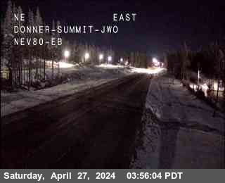
Villes près de Castle Peak
- Truckeeà 15 km
- Renoà 49 km
- Sparksà 55 km
- Carson Cityà 55 km
- Sun Valleyà 55 km
- South Lake Tahoeà 57 km