Montagnes de Allemagne
Geißkopf (Central Black Forest)
359 m1 178 ft
Montagne · Forêt-Noire · Allemagne
The Geißkopf is a foothill, 359 m above sea level (NHN), near Berghaupten in the south German state of Baden-Württemberg. During the Migration Period there was evidently a Roman or Germanic military camp on the strategically placed heights.
Source : Wikipedia, CC BY-SA · Lire l’article
Au sommet · prévision pour 0:00
3 °CPlutôt dégagé · vent 7 km/h du SE
 Voir en 3D
Météo au sommet : Geißkopf (Central Black Forest), 359 m
- 0:003 °CSE 7 km/h–
- 3:003 °CE 10 km/h–
- 6:004 °CE 9 km/h–
- 9:008 °CNE 9 km/h–
- 12:0013 °CN 12 km/h–
- 15:0013 °CN 14 km/h–
- 18:008 °CNE 10 km/h–
- 21:006 °CE 12 km/h–
| Jour | Ciel | Max. / min. | Pluie | Vent jusqu’à |
|---|---|---|---|---|
| Aujourd’hui | Partiellement nuageux | 13 °C / 3 °C | – | 14 km/h |
| ven. 30 oct. | Dégagé | 13 °C / 3 °C | – | 15 km/h |
| sam. 31 oct. | Dégagé | 11 °C / 2 °C | – | 12 km/h |
| dim. 1 nov. | Partiellement nuageux | 11 °C / 3 °C | 0,1 mm | 10 km/h |
| lun. 2 nov. | Plutôt dégagé | 9 °C / 1 °C | – | 10 km/h |
| mar. 3 nov. | Plutôt dégagé | 8 °C / -0 °C | – | 10 km/h |
| mer. 4 nov. | Dégagé | 10 °C / 5 °C | 0,1 mm | 10 km/h |
Prévisions de MET Norway (CC BY 4.0), mises à jour à 20:20 UTC+1. Heures locales.
Fiche technique
- Type
- Montagne
- Altitude
- 359 m (1 178 ft)
- Massif
- Forêt-Noire
- Pays
- Allemagne
- Coordonnées
- 48.417°N 7.974°E
- Source
- Wikidata, CC0
Sommets près de Geißkopf (Central Black Forest)
- Brandeckkopf686 m · à 6,8 kmSur la carte
- Moos878 m · à 9,5 kmSur la carte
- Brandenkopf945 m · à 16 kmSur la carte
- Schliffkopf1 056 m · à 22 kmSur la carte
- Karlsruher Grat750 m · à 23 kmSur la carte
- Hünersedel745 m · à 24 kmSur la carte
- Kniebis960 m · à 24 kmSur la carte
- Seekopf1 055 m · à 26 kmSur la carte
- Hornisgrinde1 164 m · à 27 kmSur la carte
- Rinkenkopf760 m · à 31 kmSur la carte
Les plus hauts : Forêt-Noire
- Feldberg1 494 mSur la carte
- Belchen1 414 mSur la carte
- Stübenwasen1 389 mSur la carte
- Schauinsland1 284 mSur la carte
- Hochkopf1 263 mSur la carte
- Brenntkopf1 246 mSur la carte
- Kandel1 241 mSur la carte
- Hinterwaldkopf1 199 mSur la carte
- Geißkopf (Central Black Forest)359 mSur la carte
Plus hautes montagnes : Allemagne
- Zugspitze2 962 mSur la carte
- Hochwanner2 744 mSur la carte
- Dreitorspitze2 682 mSur la carte
- Hochkalter2 607 mSur la carte
- Biberkopf2 599 mSur la carte
- Grosser Hundstod2 594 mSur la carte
- Hochvogel2 592 mSur la carte
- Östliche Karwendelspitze2 538 mSur la carte
- Hocheisspitze2 523 mSur la carte
- Hoher Göll2 522 mSur la carte
Webcams près de Geißkopf (Central Black Forest)
 Webcam SER Günter-Bimmerle-Halleà 16 km du sommet
 Eddy Covariance Tower (above Canopy), Ettenheim Forest, Ettenheim, Baden-Württemberg, Germanyà 18 km du sommet
 Eddy Covariance Tower (below Canopy), Ettenheim Forest, Ettenheim, Baden-Württemberg, Germanyà 18 km du sommet
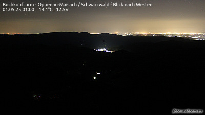 Buchkopfturm - Oppenau-Maisach / Schwarzwald - Blick nach Westenà 20 km du sommet