Kleiner Arber
1 384 m4 539 ft
Montagne · forêt de Bavière · Allemagne
The Kleiner Arber, sometimes also the Little Arber, in the Bavarian Forest is a mountain, 1,383.6 m above sea level (NHN), and the highest peak in the Bavarian province of Upper Palatinate. The border with Lower Bavaria runs over its summit and that of the Großer or Great Arber to the east.
Source : Wikipedia, CC BY-SA · Lire l’article
Au sommet · prévision pour 19:00
2 °CDégagé · vent 11 km/h du SE
 Voir en 3D
Météo au sommet : Kleiner Arber, 1 384 m
- 19:002 °CSE 11 km/h–
- 22:002 °CSE 9 km/h–
- 1:002 °CSE 5 km/h–
- 4:001 °CSE 5 km/h–
- 7:000 °CSE 5 km/h–
- 10:006 °CS 8 km/h1 mm
- 13:004 °CO 6 km/h1,9 mm
- 16:003 °CNO 9 km/h–
| Jour | Ciel | Max. / min. | Pluie | Vent jusqu’à |
|---|---|---|---|---|
| mer. 28 oct. | Pluie | 6 °C / 0 °C | 3 mm | 11 km/h |
| jeu. 29 oct. | Dégagé | 7 °C / -3 °C | – | 10 km/h |
| ven. 30 oct. | Dégagé | 7 °C / -4 °C | – | 9 km/h |
| sam. 31 oct. | Plutôt dégagé | 6 °C / 0 °C | 0,1 mm | 8 km/h |
| dim. 1 nov. | Nuageux | 2 °C / -2 °C | 0,1 mm | 8 km/h |
| lun. 2 nov. | Neige | 1 °C / -4 °C | 2,7 mm | 10 km/h |
| mar. 3 nov. | Neige | -0 °C / -1 °C | 5,6 mm | 13 km/h |
Prévisions de MET Norway (CC BY 4.0), mises à jour à 14:17 UTC+1. Heures locales.
Fiche technique
- Type
- Montagne
- Altitude
- 1 384 m (4 539 ft)
- Massif
- forêt de Bavière
- Pays
- Allemagne
- Coordonnées
- 49.113°N 13.110°E
- Source
- Wikidata, CC0
Kleiner Arber
Mountain in Germany
The Kleiner Arber, sometimes also the Little Arber, in the Bavarian Forest is a mountain, 1,383.6 m above sea level (NHN), and the highest peak in the Bavarian province of Upper Palatinate. The border with Lower Bavaria runs over its summit and that of the Großer or Great Arber to the east. An elongated rock outcrop west of the summit cross is the actual highest point in the Upper Palatinate.
Source : Wikipedia, CC BY-SA · Lire l’article
Sommets près de Kleiner Arber
- Großer Arber1 456 m · à 1,9 kmSur la carte
- Enzian1 285 m · à 2,2 kmSur la carte
- Mittagsplatzl1 340 m · à 3,3 kmSur la carte
- Heugstatt1 262 m · à 3,5 kmSur la carte
- Hochstein1 134 m · à 3,5 kmSur la carte
- Schwarzeck1 236 m · à 5 kmSur la carte
- Hindenburgkanzel1 062 m · à 5,1 kmSur la carte
- Silberberg bei Bodenmais955 m · à 6,3 kmSur la carte
- Hochberg943 m · à 7,1 kmSur la carte
- Ödriegel1 156 m · à 7,9 kmSur la carte
Les plus hauts : forêt de Bavière
- Großer Rachel1 453 mSur la carte
- Kleiner Arber1 384 mSur la carte
- Bayerischer Plöckenstein1 362 mSur la carte
- Grand Falkenstein1 315 mSur la carte
- Enzian1 285 mSur la carte
- Kiesruck1 265 mSur la carte
- Hahnenbogen1 257 mSur la carte
- Waldhäuserriegel1 151 mSur la carte
Plus hautes montagnes : Allemagne
- Zugspitze2 962 mSur la carte
- Hochwanner2 744 mSur la carte
- Dreitorspitze2 682 mSur la carte
- Hochkalter2 607 mSur la carte
- Biberkopf2 599 mSur la carte
- Grosser Hundstod2 594 mSur la carte
- Hochvogel2 592 mSur la carte
- Östliche Karwendelspitze2 538 mSur la carte
- Hocheisspitze2 523 mSur la carte
- Hoher Göll2 522 mSur la carte
Webcams près de Kleiner Arber


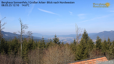
Villes près de Kleiner Arber
- Deggendorfà 32 km
- Klatovyà 34 km
- Chamà 35 km
- Straubingà 47 km
- Vilshofenà 54 km
- Strakoniceà 60 km