Montagnes de États-Unis
Mica Peak
5 209 ft1 588 m
Montagne · chaîne Selkirk · États-Unis
Mica Peak is the name of two separate mountain summits in the United States located approximately 5.49 miles (9 km) apart; one in Spokane County, Washington and the other in Kootenai County, Idaho. The two peaks are located along the same ridge, which separates the Spokane Valley and Rathdrum Prairie from the Palouse.
Source : Wikipedia, CC BY-SA · Lire l’article
Au sommet · prévision pour 23:00
30 °FNeige forte · vent 10 mph du S
 Voir en 3D
Météo au sommet : Mica Peak, 5 209 ft
- 23:0030 °FS 10 mph0,05 po
- 2:0031 °FS 13 mph–
- 5:0030 °FS 12 mph0,1 po
- 8:0028 °FS 12 mph0,08 po
- 11:0030 °FS 11 mph0,13 po
- 14:0032 °FS 11 mph0,1 po
- 17:0032 °FSO 9 mph0,04 po
- 20:0027 °FS 7 mph–
| Jour | Ciel | Max. / min. | Pluie | Vent jusqu’à |
|---|---|---|---|---|
| mer. 28 oct. | Neige forte | 32 °F / 26 °F | 0,45 po | 13 mph |
| jeu. 29 oct. | Partiellement nuageux | 38 °F / 23 °F | – | 7 mph |
| ven. 30 oct. | Nuageux | 39 °F / 25 °F | 0,01 po | 8 mph |
| sam. 31 oct. | Partiellement nuageux | 36 °F / 25 °F | 0,04 po | 3 mph |
| dim. 1 nov. | Plutôt dégagé | 35 °F / 25 °F | – | 5 mph |
| lun. 2 nov. | Nuageux | 36 °F / 22 °F | – | 3 mph |
| mar. 3 nov. | Partiellement nuageux | 39 °F / 26 °F | – | 4 mph |
Prévisions de MET Norway (CC BY 4.0), mises à jour à 18:17 UTC−7. Heures locales.
Fiche technique
- Type
- Montagne
- Altitude
- 5 209 ft (1 588 m)
- Proéminence
- 1 525 ft (465 m)
- Massif
- chaîne Selkirk
- Pays
- États-Unis
- Coordonnées
- 47.573°N 117.081°W
- Source
- Wikidata, CC0
Sommets près de Mica Peak
- Mica Peak (Idaho)5 241 ft · à 8,8 kmSur la carte
- Carlson Hill2 664 ft · à 9 kmSur la carte
- Krell Hill3 658 ft · à 26 kmSur la carte
- Mount Kit Carson5 286 ft · à 39 kmSur la carte
- mont Spokane5 886 ft · à 39 kmSur la carte
- Tekoa MountainMontagne · à 33 kmSur la carte
- Kings PeakMontagne · à 47 kmSur la carte
Les plus hauts : chaîne Selkirk
- mont Sir Sandford11 545 ftSur la carte
- mont Dawson11 079 ftSur la carte
- Mount Fox10 486 ftSur la carte
- Mount Bonney10 171 ftSur la carte
- Uto Peak9 603 ftSur la carte
- Mount Onderdonk8 809 ftSur la carte
- Mount McNicoll8 563 ftSur la carte
- Cheops Mountain8 468 ftSur la carte
- Mica Peak5 209 ftSur la carte
Plus hautes montagnes : États-Unis
- Denali20 308 ftSur la carte
- mont Saint-Élie18 009 ftSur la carte
- mont Foraker17 402 ftSur la carte
- mont Bona16 535 ftSur la carte
- mont Blackburn16 390 ftSur la carte
- mont Sanford16 237 ftSur la carte
- mont Vancouver15 787 ftSur la carte
- mont Churchill15 636 ftSur la carte
- mont Fairweather15 325 ftSur la carte
- mont Hubbard14 951 ftSur la carte
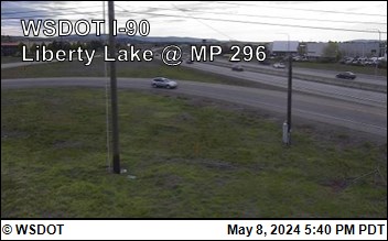
Webcams près de Mica Peak


Histoire autour de Mica Peak
Villes près de Mica Peak
- Liberty Lakeà 11 km
- Rockfordà 14 km
- Spokane Valleyà 16 km
- Post Fallsà 19 km
- Coeur d’Aleneà 25 km
- Spokaneà 28 km