Mount Carter
10 590 ft3 228 m
Montagne · chaînon Sawtooth · États-Unis
Mount Carter, standing at 10,590 feet (3,230 m) above sea level, is the seventh-highest peak in the Sawtooth Range of Idaho. Located in the Sawtooth Wilderness within the Sawtooth National Recreation Area, it lies on the border of Boise and Custer counties.
Source : Wikipedia, CC BY-SA · Lire l’article
Au sommet · prévision pour 3:00
15 °FNuageux · vent 4 mph du SO
 Voir en 3D
Météo au sommet : Mount Carter, 10 590 ft
- 3:0015 °FSO 4 mph–
- 6:0016 °FSO 4 mph–
- 9:0017 °FS 4 mph–
- 12:0020 °FSO 7 mph–
- 15:0022 °FSO 8 mph0 po
- 18:0019 °FSO 4 mph0,01 po
- 21:0013 °FSO 2 mph–
- 0:0012 °FS 3 mph–
| Jour | Ciel | Max. / min. | Pluie | Vent jusqu’à |
|---|---|---|---|---|
| Aujourd’hui | Nuageux | 23 °F / 11 °F | 0,01 po | 8 mph |
| mer. 28 oct. | Partiellement nuageux | 24 °F / 10 °F | – | 10 mph |
| jeu. 29 oct. | Partiellement nuageux | 27 °F / 7 °F | 0,04 po | 6 mph |
| ven. 30 oct. | Neige | 26 °F / 20 °F | 0,17 po | 5 mph |
| sam. 31 oct. | Neige faible | 25 °F / 8 °F | 0,06 po | 5 mph |
| dim. 1 nov. | Neige faible | 15 °F / -2 °F | 0,09 po | 6 mph |
| lun. 2 nov. | Dégagé | 20 °F / -2 °F | – | 3 mph |
Prévisions de MET Norway (CC BY 4.0), mises à jour à 19:17 UTC−6. Heures locales.
Fiche technique
- Type
- Montagne
- Altitude
- 10 590 ft (3 228 m)
- Proéminence
- 270 ft (82 m)
- Massif
- chaînon Sawtooth
- Sommet parent
- Mickey's Spire
- Pays
- États-Unis
- Coordonnées
- 44.140°N 115.018°W
- Source
- Wikidata, CC0
Mount Carter (Idaho)
Mountain in the state of Idaho
Mount Carter, standing at 10,590 feet (3,230 m) above sea level, is the seventh-highest peak in the Sawtooth Range of Idaho. Located in the Sawtooth Wilderness within the Sawtooth National Recreation Area, it lies on the border of Boise and Custer counties. The peak is located 0.32 mi (0.51 km) northwest of Mickey's Spire, its line parent, and 0.43 mi (0.69 km) west of Thompson Peak, the highest point in the range.
Source : Wikipedia, CC BY-SA · Lire l’article
Sommets près de Mount Carter
- Mickey's Spire10 680 ft · à 0,5 kmSur la carte
- pic Thompson10 751 ft · à 0,7 kmSur la carte
- Mount Limbert10 385 ft · à 0,9 kmSur la carte
- Williams Peak10 635 ft · à 1,7 kmSur la carte
- Merritt Peak10 312 ft · à 2,4 kmSur la carte
- Moolack Mountain10 330 ft · à 2,8 kmSur la carte
- Baron Peak10 297 ft · à 2,8 kmSur la carte
- Horstmann Peak10 475 ft · à 3,3 kmSur la carte
- Mount Regan10 190 ft · à 4,1 kmSur la carte
- Mount Iowa10 327 ft · à 4,3 kmSur la carte
Sommet parent
Le sommet plus haut le plus proche, auquel se mesure sa proéminence.
- Mickey's Spire10 680 ftSur la carte
Sommets sous Mount Carter
- Mount Limbert10 385 ftSur la carte
Les plus hauts : chaînon Sawtooth
- pic Thompson10 751 ftSur la carte
- Mount Cramer10 716 ftSur la carte
- Snowyside Peak10 651 ftSur la carte
- Mount Carter10 590 ftSur la carte
- Elk Peak10 582 ftSur la carte
- Horstmann Peak10 475 ftSur la carte
- Mount Regan10 190 ftSur la carte
Plus hautes montagnes : États-Unis
- Denali20 308 ftSur la carte
- mont Saint-Élie18 009 ftSur la carte
- mont Foraker17 402 ftSur la carte
- mont Bona16 535 ftSur la carte
- mont Blackburn16 390 ftSur la carte
- mont Sanford16 237 ftSur la carte
- mont Vancouver15 787 ftSur la carte
- mont Churchill15 636 ftSur la carte
- mont Fairweather15 325 ftSur la carte
- mont Hubbard14 951 ftSur la carte
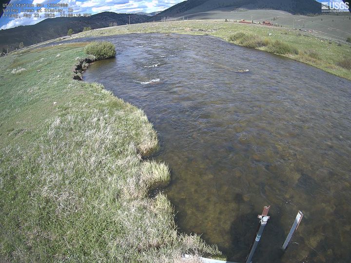
Webcams près de Mount Carter
Villes près de Mount Carter
- Sun Valleyà 75 km