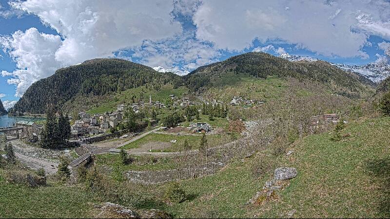
Montagnes de Suisse
Piz Pian Grand
2 689 m8 822 ft
Montagne · Adula Group · Suisse
Piz Pian Grand is a mountain of the Lepontine Alps, situated between the Val Calanca and the Mesolcina in the Swiss canton of Graubünden.
Source : Wikipedia, CC BY-SA · Lire l’article
Au sommet · prévision pour 2:00
-5 °CBrouillard · vent 9 km/h du N
 Voir en 3D
Météo au sommet : Piz Pian Grand, 2 689 m
- 2:00-5 °CN 9 km/h–
- 5:00-6 °CN 6 km/h–
- 8:00-3 °CN 6 km/h–
- 11:003 °CS 5 km/h–
- 14:004 °CS 7 km/h–
- 17:000 °CS 3 km/h–
- 20:00-3 °CN 2 km/h0,2 mm
- 23:00-5 °CN 1 km/h0,2 mm
| Jour | Ciel | Max. / min. | Pluie | Vent jusqu’à |
|---|---|---|---|---|
| Aujourd’hui | Dégagé | 4 °C / -6 °C | 0,4 mm | 9 km/h |
| ven. 30 oct. | Plutôt dégagé | 3 °C / -7 °C | – | 6 km/h |
| sam. 31 oct. | Dégagé | 3 °C / -7 °C | – | 10 km/h |
| dim. 1 nov. | Partiellement nuageux | -3 °C / -7 °C | 0,1 mm | 12 km/h |
| lun. 2 nov. | Dégagé | -0 °C / -10 °C | – | 9 km/h |
| mar. 3 nov. | Dégagé | 0 °C / -7 °C | – | 9 km/h |
| mer. 4 nov. | Dégagé | -0 °C / -8 °C | – | 5 km/h |
Prévisions de MET Norway (CC BY 4.0), mises à jour à 00:19 UTC+1. Heures locales.
Fiche technique
- Type
- Montagne
- Altitude
- 2 689 m (8 822 ft)
- Proéminence
- 528 m (1 732 ft)
- Massif
- Adula Group
- Sommet parent
- Cima de Gagela
- Pays
- Suisse
- Coordonnées
- 46.418°N 9.156°E
- Source
- Wikidata, CC0
Sommets près de Piz Pian Grand
- Rheinwaldhorn3 402 m · à 12 kmSur la carte
- Alperschällihorn3 036 m · à 22 kmSur la carte
- Bruschghorn3 056 m · à 26 kmSur la carte
- Piz Medel3 210 m · à 29 kmSur la carte
- Scopi3 190 m · à 30 kmSur la carte
- Piz Beverin2 998 m · à 30 kmSur la carte
- Piz Platta3 392 m · à 32 kmSur la carte
- Camoghè2 226 m · à 32 kmSur la carte
- Campo Tencia3 072 m · à 33 kmSur la carte
- Piz Duan3 131 m · à 33 kmSur la carte
Sommet parent
Le sommet plus haut le plus proche, auquel se mesure sa proéminence.
- Cima de Gagela2 805 mSur la carte
Sommets sous Piz Pian Grand
- Piz d'Arbeola2 600 mSur la carte
- Piz de Trescolmen2 582 mSur la carte
Les plus hauts : Adula Group
- Rheinwaldhorn3 402 mSur la carte
- Güferhorn3 379 mSur la carte
- Vogelberg3 218 mSur la carte
- Fanellhorn3 124 mSur la carte
- Torent Alto2 952 mSur la carte
- Pizzo del Ramulazz2 939 mSur la carte
- Cima di Gana Bianca2 842 mSur la carte
- Cima de Gagela2 805 mSur la carte
- Piz Pian Grand2 689 mSur la carte
Plus hautes montagnes : Suisse
- pointe Dufour4 634 mSur la carte
- Dom4 546 mSur la carte
- Liskamm4 532 mSur la carte
- Weisshorn4 505 mSur la carte
- Cervin4 478 mSur la carte
- dent Blanche4 357 mSur la carte
- Grand Combin4 309 mSur la carte
- Finsteraarhorn4 274 mSur la carte
- Zinalrothorn4 221 mSur la carte
- Alphubel4 206 mSur la carte