Puntone dei Fraciòn
3 202 m10 505 ft
Montagne · Adula Group · Suisse
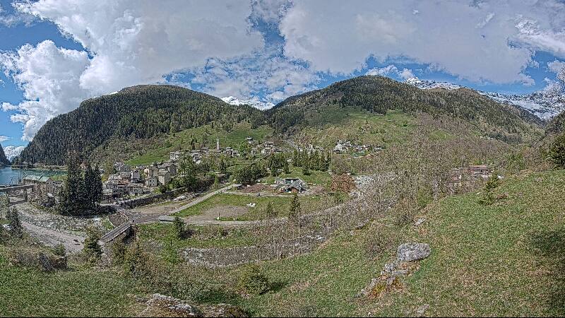
Puntone dei Fraciòn is a 3,202-metre-high mountain in the Lepontine Alps, located on the border between the Swiss cantons of Ticino and Graubünden. It is the highest peak of the Calanca valley (Graubünden). On its west side (Ticino) it overlooks the valley of Malvaglia.
Source : Wikipedia, CC BY-SA · Lire l’article
Au sommet · prévision pour 5:00
-8 °CDégagé · vent 4 km/h du NE
Météo au sommet : Puntone dei Fraciòn, 3 202 m
- 5:00-8 °CNE 4 km/h–
- 8:00-6 °CNE 5 km/h–
- 11:00-0 °CSO 5 km/h–
- 14:000 °CN 8 km/h–
- 17:00-3 °CNE 4 km/h–
- 20:00-6 °CNE 2 km/h–
- 23:00-7 °CNE 1 km/h–
- 2:00-7 °CE 1 km/h–
| Jour | Ciel | Max. / min. | Pluie | Vent jusqu’à |
|---|---|---|---|---|
| Aujourd’hui | Dégagé | 0 °C / -8 °C | – | 8 km/h |
| ven. 30 oct. | Dégagé | -1 °C / -8 °C | – | 8 km/h |
| sam. 31 oct. | Dégagé | -2 °C / -9 °C | – | 8 km/h |
| dim. 1 nov. | Plutôt dégagé | -7 °C / -12 °C | 0,1 mm | 15 km/h |
| lun. 2 nov. | Dégagé | -6 °C / -14 °C | – | 9 km/h |
| mar. 3 nov. | Plutôt dégagé | -5 °C / -11 °C | – | 12 km/h |
| mer. 4 nov. | Dégagé | -4 °C / -9 °C | – | 4 km/h |
Prévisions de MET Norway (CC BY 4.0), mises à jour à 00:19 UTC+1. Heures locales.
Fiche technique
- Type
- Montagne
- Altitude
- 3 202 m (10 505 ft)
- Proéminence
- 157 m (515 ft)
- Massif
- Adula Group
- Sommet parent
- Vogelberg
- Pays
- Suisse
- Coordonnées
- 46.471°N 9.085°E
- Source
- Wikidata, CC0
Puntone dei Fraciòn
Mountain in Switzerland
Puntone dei Fraciòn is a 3,202-metre-high mountain in the Lepontine Alps, located on the border between the Swiss cantons of Ticino and Graubünden. It is the highest peak of the Calanca valley (Graubünden). On its west side (Ticino) it overlooks the valley of Malvaglia. It lies approximately halfway between the Vogelberg and the Zapporthorn.
Source : Wikipedia, CC BY-SA · Lire l’article
Sommets près de Puntone dei Fraciòn
- Rheinwaldhorn3 402 m · à 4,3 kmSur la carte
- Güferhorn3 379 m · à 4,9 kmSur la carte
- Pizzo di Claro2 727 m · à 20 kmSur la carte
- Piz Medel3 210 m · à 21 kmSur la carte
- Alperschällihorn3 036 m · à 21 kmSur la carte
- Scopi3 190 m · à 23 kmSur la carte
- Bruschghorn3 056 m · à 25 kmSur la carte
- Campo Tencia3 072 m · à 28 kmSur la carte
- Piz Beverin2 998 m · à 29 kmSur la carte
- Piz Platta3 392 m · à 37 kmSur la carte
Sommet parent
Le sommet plus haut le plus proche, auquel se mesure sa proéminence.
- Vogelberg3 218 mSur la carte
Les plus hauts : Adula Group
- Rheinwaldhorn3 402 mSur la carte
- Güferhorn3 379 mSur la carte
- Vogelberg3 218 mSur la carte
- Puntone dei Fraciòn3 202 mSur la carte
- Fanellhorn3 124 mSur la carte
- Torent Alto2 952 mSur la carte
- Pizzo del Ramulazz2 939 mSur la carte
- Cima di Gana Bianca2 842 mSur la carte
- Cima de Gagela2 805 mSur la carte
Plus hautes montagnes : Suisse
- pointe Dufour4 634 mSur la carte
- Dom4 546 mSur la carte
- Liskamm4 532 mSur la carte
- Weisshorn4 505 mSur la carte
- Cervin4 478 mSur la carte
- dent Blanche4 357 mSur la carte
- Grand Combin4 309 mSur la carte
- Finsteraarhorn4 274 mSur la carte
- Zinalrothorn4 221 mSur la carte
- Alphubel4 206 mSur la carte