Montagnes de Autriche
Rohnenspitze
1 990 m6 529 ft
Montagne · Alpes d'Allgäu · Autriche
Au sommet · prévision pour 12:00
3 °CPluie · vent 10 km/h du NO
 Voir en 3D
Météo au sommet : Rohnenspitze, 1 990 m
- 12:003 °CNO 10 km/h1,1 mm
- 15:002 °CN 7 km/h0,4 mm
- 18:001 °CN 6 km/h0,9 mm
- 21:000 °CN 5 km/h0,4 mm
- 0:00-0 °CNE 6 km/h–
- 3:00-1 °CE 5 km/h–
- 6:00-1 °CE 5 km/h–
- 9:000 °CSE 5 km/h–
| Jour | Ciel | Max. / min. | Pluie | Vent jusqu’à |
|---|---|---|---|---|
| jeu. 29 oct. | Partiellement nuageux | 4 °C / -4 °C | – | 15 km/h |
| ven. 30 oct. | Dégagé | 3 °C / -6 °C | – | 16 km/h |
| sam. 31 oct. | Dégagé | 4 °C / -6 °C | – | 8 km/h |
| dim. 1 nov. | Plutôt dégagé | 1 °C / -5 °C | – | 8 km/h |
| lun. 2 nov. | Neige | -3 °C / -6 °C | 11,1 mm | 6 km/h |
| mar. 3 nov. | Neige faible | -3 °C / -5 °C | 2,4 mm | 6 km/h |
| mer. 4 nov. | Dégagé | -1 °C / -7 °C | – | 6 km/h |
Prévisions de MET Norway (CC BY 4.0), mises à jour à 02:17 UTC+1. Heures locales.
Fiche technique
- Type
- Montagne
- Altitude
- 1 990 m (6 529 ft)
- Proéminence
- 132 m (433 ft)
- Isolement
- à 1,2 km d’un terrain plus haut
- Massif
- Alpes d'Allgäu
- Sommet parent
- Ponten
- Pays
- Autriche
- Coordonnées
- 47.488°N 10.468°E
- Source
- Wikidata, CC0
Sommets près de Rohnenspitze
- Ponten2 044 m · à 1,3 kmSur la carte
- Bschießer1 998 m · à 2,1 kmSur la carte
- Gaishorn2 247 m · à 2,1 kmSur la carte
- Kühgundkopf1 907 m · à 3,2 kmSur la carte
- Rauhhorn2 241 m · à 3,3 kmSur la carte
- Kugelhorn2 125 m · à 4,4 kmSur la carte
- Lahnerkopf2 121 m · à 6,6 kmSur la carte
- Schänzlespitze2 052 m · à 7,3 kmSur la carte
- Schänzlekopf2 070 m · à 7,9 kmSur la carte
- Leilachspitze2 274 m · à 8,1 kmSur la carte
Sommet parent
Le sommet plus haut le plus proche, auquel se mesure sa proéminence.
- Ponten2 044 mSur la carte
Les plus hauts : Alpes d'Allgäu
- Grosser Krottenkopf2 656 mSur la carte
- Hohes Licht2 651 mSur la carte
- Biberkopf2 599 mSur la carte
- Hochvogel2 592 mSur la carte
- Widderstein2 533 mSur la carte
- Rohnenspitze1 990 mSur la carte
Plus hautes montagnes : Autriche
- Grossglockner3 798 mSur la carte
- Wildspitze3 768 mSur la carte
- Weisskugel3 738 mSur la carte
- Grossvenediger3 657 mSur la carte
- Hintere Schwärze3 624 mSur la carte
- Grosses Wiesbachhorn3 564 mSur la carte
- Ramolkogel3 549 mSur la carte
- Schalfkogel3 537 mSur la carte
- Watzespitze3 532 mSur la carte
- Fineilspitze3 514 mSur la carte
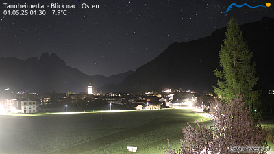
Webcams près de Rohnenspitze



Histoire autour de Rohnenspitze
- Treaty of Füssen1745
Villes près de Rohnenspitze
- Sonthofenà 14 km
- Füssenà 20 km
- Kempten (Allgäu)à 29 km
- Marktoberdorfà 34 km
- Kaufbeurenà 45 km
- Garmisch-Partenkirchenà 47 km