Montagnes de Chine
Sai Wan Shan, Chai Wan
197 m646 ft
Colline · Chine
Sai Wan Shan is a hill in northern Hong Kong Island. It has a height of 197 metres (646 ft) above sea level. The hill is the site of former military installations used by the British Colonial administration. Now, the installations have been turned into a leisure facility called Lei Yue Mun Park and Holiday Village.
Source : Wikipedia, CC BY-SA · Lire l’article
Au sommet · prévision pour 19:00
25 °CDégagé · vent 14 km/h du E
 Voir en 3D
Météo au sommet : Sai Wan Shan, Chai Wan, 197 m
- 19:0025 °CE 14 km/h–
- 22:0024 °CE 12 km/h–
- 1:0023 °CE 9 km/h–
- 4:0023 °CNE 15 km/h–
- 7:0023 °CNE 15 km/h–
- 10:0027 °CE 18 km/h–
- 13:0028 °CE 18 km/h–
- 16:0027 °CSE 19 km/h–
| Jour | Ciel | Max. / min. | Pluie | Vent jusqu’à |
|---|---|---|---|---|
| ven. 30 oct. | Dégagé | 28 °C / 22 °C | – | 20 km/h |
| sam. 31 oct. | Plutôt dégagé | 26 °C / 24 °C | – | 30 km/h |
| dim. 1 nov. | Nuageux | 26 °C / 23 °C | 4 mm | 28 km/h |
| lun. 2 nov. | Dégagé | 28 °C / 24 °C | 0,9 mm | 13 km/h |
| mar. 3 nov. | Plutôt dégagé | 26 °C / 24 °C | 3,3 mm | 20 km/h |
| mer. 4 nov. | Partiellement nuageux | 26 °C / 24 °C | 3,4 mm | 19 km/h |
| jeu. 5 nov. | Partiellement nuageux | 26 °C / 23 °C | 2,3 mm | 9 km/h |
Prévisions de MET Norway (CC BY 4.0), mises à jour à 16:20 UTC+8. Heures locales.
Fiche technique
- Type
- Colline
- Altitude
- 197 m (646 ft)
- Pays
- Chine
- Coordonnées
- 22.272°N 114.235°E
- Source
- Wikidata, CC0
Sommets près de Sai Wan Shan, Chai Wan
- Mount Parker532 m · à 2 kmSur la carte
- Devil's Peak222 m · à 2,5 kmSur la carte
- Pottinger Peak312 m · à 2,9 kmSur la carte
- Siu Ma Shan424 m · à 2,9 kmSur la carte
- Colline Braemar200 m · à 3,9 kmSur la carte
- Black Hill304 m · à 4,2 kmSur la carte
- Red Hill113 m · à 4,2 kmSur la carte
- Violet Hill433 m · à 4,5 kmSur la carte
- The Twins386 m · à 5,6 kmSur la carte
- Miu Tsai Tun333 m · à 5,7 kmSur la carte
Plus hautes montagnes : Chine
- Everest8 849 mSur la carte
- Lhotse8 516 mSur la carte
- Makalu8 485 mSur la carte
- Cho Oyu8 188 mSur la carte
- Gasherbrum I8 080 mSur la carte
- Broad Peak8 051 mSur la carte
- Gasherbrum II8 034 mSur la carte
- Shishapangma8 027 mSur la carte
- Gyachung Kang7 952 mSur la carte
- Gasherbrum III7 946 mSur la carte
Webcams près de Sai Wan Shan, Chai Wan
 Island Eastern Corridor near HKIVE (Chai Wan) - Northboundà 0,4 km du sommet
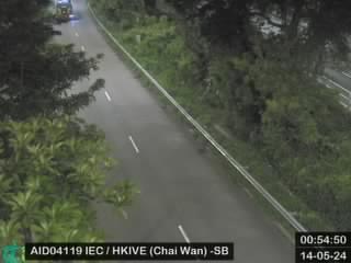 Island Eastern Corridor near HKIVE (Chai Wan) - Southboundà 0,4 km du sommet
 Island Eastern Corridor near Heng Fa Chuen - Southbound (3)à 0,5 km du sommet
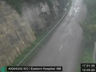 Island Eastern Corridor near Eastern Hospital - Northboundà 0,5 km du sommet
Histoire autour de Sai Wan Shan, Chai Wan
Villes près de Sai Wan Shan, Chai Wan
- Heng Fa Chuenà 0,7 km
- Yiu Tung Estateà 1,4 km
- Aldrich Bayà 1,5 km
- Siu Sai Wan Estateà 1,8 km
- Sai Wan Hoà 1,8 km
- Taikoo Shingà 2,3 km