Montagnes de États-Unis
The Sentinel
7 136 ft2 175 m
Montagne · États-Unis
The Sentinel is a 7,120+ ft elevation Navajo Sandstone summit located near the Court of the Patriarchs in Zion National Park, in Washington County of southwest Utah, United States, that is part of the Towers of the Virgin. The national park map lists the elevation as 7,157-feet.
Source : Wikipedia, CC BY-SA · Lire l’article
Au sommet · prévision pour 13:00
55 °FDégagé · vent 7 mph du S
 Voir en 3D
Météo au sommet : The Sentinel, 7 136 ft
- 13:0055 °FS 7 mph–
- 16:0056 °FSO 7 mph–
- 19:0046 °FN 2 mph–
- 22:0037 °FE 5 mph–
- 1:0037 °FE 5 mph–
- 4:0033 °FE 6 mph–
- 7:0030 °FE 7 mph–
- 10:0045 °FE 6 mph–
| Jour | Ciel | Max. / min. | Pluie | Vent jusqu’à |
|---|---|---|---|---|
| mer. 28 oct. | Dégagé | 56 °F / 30 °F | – | 8 mph |
| jeu. 29 oct. | Partiellement nuageux | 57 °F / 31 °F | – | 8 mph |
| ven. 30 oct. | Pluie forte | 45 °F / 38 °F | 1,21 po | 8 mph |
| sam. 31 oct. | Pluie | 49 °F / 38 °F | 0,31 po | 6 mph |
| dim. 1 nov. | Pluie forte | 42 °F / 35 °F | 1,12 po | 6 mph |
| lun. 2 nov. | Dégagé | 42 °F / 28 °F | – | 8 mph |
| mar. 3 nov. | Plutôt dégagé | 45 °F / 23 °F | – | 4 mph |
Prévisions de MET Norway (CC BY 4.0), mises à jour à 11:17 UTC−6. Heures locales.
Fiche technique
- Type
- Montagne
- Altitude
- 7 136 ft (2 175 m)
- Pays
- États-Unis
- Coordonnées
- 37.231°N 112.981°W
- Source
- Wikidata, CC0
Sommets près de The Sentinel
- Bee Hive6 886 ft · à 0,9 kmSur la carte
- Three Patriarchs7 014 ft · à 1,6 kmSur la carte
- Abraham Peak7 014 ft · à 1,6 kmSur la carte
- Meridian Tower7 336 ft · à 1,7 kmSur la carte
- Isaac Peak6 726 ft · à 1,7 kmSur la carte
- Mount Spry5 758 ft · à 1,9 kmSur la carte
- Mount Moroni5 650 ft · à 2,1 kmSur la carte
- Twin Brothers6 860 ft · à 2,5 kmSur la carte
- Mountain of the Sun6 716 ft · à 2,5 kmSur la carte
- Lady Mountain6 903 ft · à 2,9 kmSur la carte
Plus hautes montagnes : États-Unis
- Denali20 308 ftSur la carte
- mont Saint-Élie18 009 ftSur la carte
- mont Foraker17 402 ftSur la carte
- mont Bona16 535 ftSur la carte
- mont Blackburn16 390 ftSur la carte
- mont Sanford16 237 ftSur la carte
- mont Vancouver15 787 ftSur la carte
- mont Churchill15 636 ftSur la carte
- mont Fairweather15 325 ftSur la carte
- mont Hubbard14 951 ftSur la carte
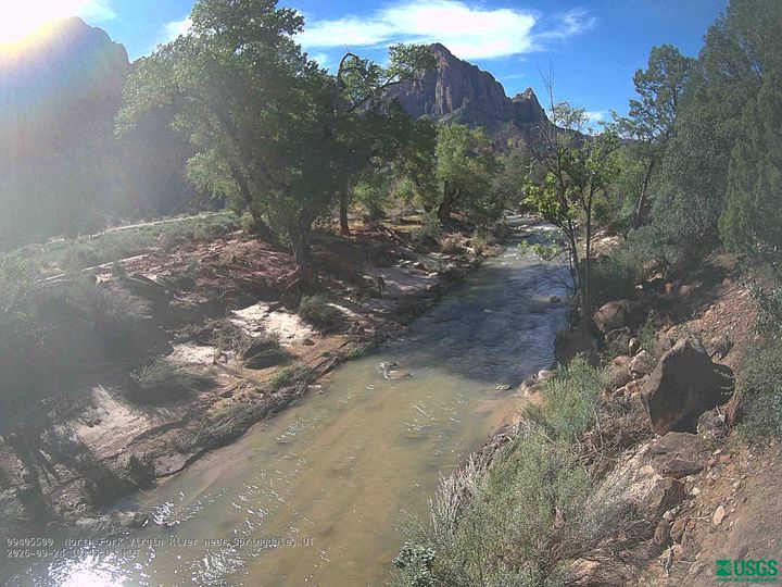
Webcams près de The Sentinel
Villes près de The Sentinel
- Springdaleà 5,8 km
- Hurricaneà 28 km
- Washingtonà 48 km
- Cedar Cityà 50 km
- Fredoniaà 51 km
- Saint Georgeà 55 km