グラン・ソム
2,026 m6,647 ft
山 · シャルトルーズ山地 · フランス
The Grand Som is a mountain of the Chartreuse Mountains in the French Prealps, in Isère, France. It has a long ridge, unevenly sharp, overlooking the Petit Som (1,772m), the Col de la Ruchère northwest and the Grande Chartreuse monastery below the cliffs. The summit has a cross and two relief tables.
出典: Wikipedia、CC BY-SA · 記事を読む
山頂 · 23:00 の予報
3 °C晴れ時々曇り · 北の風 4 km/h
 3D で見る
グラン・ソム 山頂の天気(2,026 m)
- 23:003 °C北 4 km/h–
- 2:003 °C北西 5 km/h0.3 mm
- 5:002 °C北西 4 km/h1 mm
- 8:002 °C北西 5 km/h0.1 mm
- 11:002 °C北西 7 km/h0.6 mm
- 14:002 °C北 9 km/h0.1 mm
- 17:002 °C北 6 km/h–
- 20:00-1 °C北 3 km/h–
| 日付 | 天気 | 最高 / 最低 | 雨 | 最大風速 |
|---|---|---|---|---|
| 10月28日(水) | 小雨 | 3 °C / -2 °C | 2.1 mm | 10 km/h |
| 10月29日(木) | 晴れ | 5 °C / -2 °C | – | 6 km/h |
| 10月30日(金) | 晴れ時々曇り | 7 °C / -3 °C | – | 5 km/h |
| 10月31日(土) | 快晴 | 6 °C / -2 °C | – | 4 km/h |
| 11月1日(日) | 晴れ | 4 °C / -3 °C | – | 6 km/h |
| 11月2日(月) | 曇り | -0 °C / -5 °C | – | 7 km/h |
| 11月3日(火) | 晴れ | 1 °C / -6 °C | – | 5 km/h |
MET Norway(CC BY 4.0)による予報。14:17 GMT+1 更新。時刻は現地時間です。
基本データ
- 種類
- 山
- 標高
- 2,026 m (6,647 ft)
- プロミネンス
- 887 m (2,910 ft)
- 山脈
- シャルトルーズ山地
- 国
- フランス
- 座標
- 45.371°N 5.812°E
Grand Som
The Grand Som is a mountain of the Chartreuse Mountains in the French Prealps, in Isère, France. It has a long ridge, unevenly sharp, overlooking the Petit Som (1,772m), the Col de la Ruchère northwest and the Grande Chartreuse monastery below the cliffs. The summit has a cross and two relief tables. It lies in the Parc Naturel Régional de la Chartreuse.
出典: Wikipedia、CC BY-SA · 記事を読む
グラン・ソム周辺の山
- Lances de Malissard2,045 m · 5.5 km先地図上
- Charmant Som1,867 m · 6.3 km先地図上
- Dent de Crolles2,062 m · 7.7 km先地図上
- Chamechaude2,082 m · 9.4 km先地図上
- Sommet du Pinet1,867 m · 9.9 km先地図上
- Mont Granier1,933 m · 14 km先地図上
- Grand Pic de Belledonne2,977 m · 26 km先地図上
- Moucherotte1,901 m · 28 km先地図上
- Nivolet1,558 m · 31 km先地図上
- Le Taillefer2,857 m · 38 km先地図上
シャルトルーズ山地の最高峰
- Chamechaude2,082 m地図上
- Dent de Crolles2,062 m地図上
- Lances de Malissard2,045 m地図上
- グラン・ソム2,026 m地図上
- Mont Granier1,933 m地図上
- La Grande Sure1,920 m地図上
- Sommet du Pinet1,867 m地図上
- Charmant Som1,867 m地図上
- Rocher de Lorzier1,838 m地図上
フランスの高い山
- モンブラン4,806 m地図上
- Pointe Walker4,208 m地図上
- グランド・ジョラス4,208 m地図上
- エギーユ・ヴェルト4,122 m地図上
- バール・デゼクラン山4,102 m地図上
- ラ・メイジュ3,983 m地図上
- エールフロアド3,954 m地図上
- Mont Pelvoux3,946 m地図上
- Pic Sans Nom3,913 m地図上
- Aiguille de Tré la Tête3,911 m地図上
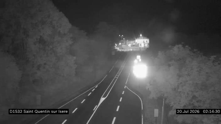
グラン・ソム周辺のライブカメラ

グラン・ソム周辺の歴史
グラン・ソム周辺の町
- ヴォワロン18 km先
- Meylan18 km先
- Saint-Égrève18 km先
- Saint-Martin-d'Hères22 km先
- Fontaine22 km先
- グルノーブル23 km先