Henline Mountain
山 · カスケード山脈 · アメリカ合衆国
Henline Mountain is a mountain located in the Opal Creek Wilderness in the Willamette National Forest. The mountain lies about 10 miles northeast of the town of Mill City. Henline Mountain stands 4,644 ft above sea level. The name of the mountain comes from a 19th-century settler.
出典: Wikipedia、CC BY-SA · 記事を読む
山頂 · 16:00 の予報
39 °F強い雨 · 南西の風 9 mph
Henline Mountainの天気予報
- 16:0039 °F南西 9 mph0.08 インチ
- 19:0038 °F南西 9 mph0.02 インチ
- 22:0037 °F南西 11 mph0.01 インチ
- 1:0037 °F南西 13 mph0.14 インチ
- 4:0037 °F南西 11 mph0.15 インチ
- 7:0037 °F南西 10 mph0.04 インチ
- 10:0037 °F南西 9 mph0.08 インチ
- 13:0040 °F南西 9 mph0.08 インチ
| 日付 | 天気 | 最高 / 最低 | 雨 | 最大風速 |
|---|---|---|---|---|
| 10月28日(水) | 雨 | 40 °F / 35 °F | 0.55 インチ | 13 mph |
| 10月29日(木) | 曇り | 46 °F / 32 °F | – | 6 mph |
| 10月30日(金) | 雨 | 40 °F / 30 °F | 0.22 インチ | 7 mph |
| 10月31日(土) | 曇り | 43 °F / 29 °F | 0.01 インチ | 4 mph |
| 11月1日(日) | 晴れ時々曇り | 42 °F / 32 °F | – | 5 mph |
| 11月2日(月) | 曇り | 48 °F / 32 °F | – | 7 mph |
| 11月3日(火) | 快晴 | 59 °F / 38 °F | – | 5 mph |
MET Norway(CC BY 4.0)による予報。12:17 GMT-7 更新。時刻は現地時間です。
基本データ
- 種類
- 山
- 山脈
- カスケード山脈
- 座標
- 44.864°N 122.321°W
Henline Mountain
Mountain peak in Oregon, United States
Henline Mountain is a mountain located in the Opal Creek Wilderness in the Willamette National Forest. The mountain lies about 10 miles northeast of the town of Mill City. Henline Mountain stands 4,644 ft above sea level. The name of the mountain comes from a 19th-century settler. The mountain is most well known for the hike up the mountain which has views of Mt. Jefferson.
出典: Wikipedia、CC BY-SA · 記事を読む
Henline Mountain周辺の山
- Battle Ax5,566 ft · 15 km先地図上
- Keel Mountain2,833 ft · 44 km先地図上
- Tumala Mountain4,773 ft · 46 km先地図上
- ジェファーソン山10,495 ft · 46 km先地図上
- スリー・フィンガード・ジャック7,844 ft · 57 km先地図上
- Dome Rock山 · 15 km先地図上
- Stahlman Point山 · 23 km先地図上
- Snow Peak山 · 33 km先地図上
- Coffin Mountain山 · 35 km先地図上
- Bachelor Mountain山 · 36 km先地図上
カスケード山脈の最高峰
- レーニア山14,400 ft地図上
- アダムズ山12,280 ft地図上
- Mount McLoughlin9,495 ft地図上
- Mount Thielsen9,183 ft地図上
- ブロークン・トップ9,177 ft地図上
- Black Peak8,976 ft地図上
- Dome Peak8,921 ft地図上
- Silver Star Mountain8,875 ft地図上
アメリカ合衆国の高い山
Henline Mountain周辺のライブカメラ

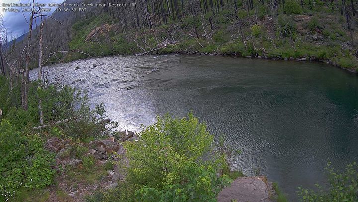


Henline Mountain周辺の歴史
- Santiam Fire2020
Henline Mountain周辺の町
- ウッドバーン52 km先
- Four Corners53 km先
- キャンビー53 km先
- Hayesville54 km先
- セイラム57 km先
- カイザー57 km先