Humbug Mountain
1,765 ft538 m
山 · クラマス山脈 · アメリカ合衆国
Humbug Mountain is one of the highest mountains in the U.S. state of Oregon to rise directly from the Pacific Ocean. It lies on the state's southern coast, about 6 miles (10 km) south of Port Orford and 21 miles (34 km) north of Gold Beach.
出典: Wikipedia、CC BY-SA · 記事を読む
山頂 · 17:00 の予報
49 °F快晴 · 北西の風 10 mph
 3D で見る
Humbug Mountain 山頂の天気(1,765 ft)
- 17:0049 °F北西 10 mph–
- 20:0040 °F東 4 mph–
- 23:0036 °F東 6 mph–
- 2:0037 °F東 7 mph0 インチ
- 5:0042 °F東 6 mph–
- 8:0040 °F東 6 mph–
- 11:0050 °F南 5 mph0.02 インチ
- 14:0051 °F南西 6 mph0.01 インチ
| 日付 | 天気 | 最高 / 最低 | 雨 | 最大風速 |
|---|---|---|---|---|
| 10月28日(水) | 小雨 | 51 °F / 36 °F | 0.03 インチ | 7 mph |
| 10月29日(木) | 曇り | 50 °F / 37 °F | – | 9 mph |
| 10月30日(金) | 晴れ | 47 °F / 35 °F | 0.02 インチ | 9 mph |
| 10月31日(土) | 雨 | 48 °F / 32 °F | 0.15 インチ | 4 mph |
| 11月1日(日) | 快晴 | 52 °F / 33 °F | – | 6 mph |
| 11月2日(月) | 曇り | 55 °F / 35 °F | – | 4 mph |
| 11月3日(火) | 曇り | 57 °F / 41 °F | – | 2 mph |
MET Norway(CC BY 4.0)による予報。12:17 GMT-7 更新。時刻は現地時間です。
基本データ
- 種類
- 山
- 標高
- 1,765 ft (538 m)
- プロミネンス
- 1,561 ft (476 m)
- 山脈
- クラマス山脈
- 座標
- 42.679°N 124.437°W
Humbug Mountain
Mountain in the U.S. state of Oregon
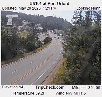
Humbug Mountain is one of the highest mountains in the U.S. state of Oregon to rise directly from the Pacific Ocean. It lies on the state's southern coast, about 6 miles (10 km) south of Port Orford and 21 miles (34 km) north of Gold Beach. The mountain is completely within Humbug Mountain State Park, and U.S. Route 101 passes by its northern base.
出典: Wikipedia、CC BY-SA · 記事を読む
Humbug Mountain周辺の山
- Brandy Peak5,302 ft · 46 km先地図上
- Bosley Butte3,423 ft · 55 km先地図上
- Purple Mountain山 · 7.3 km先地図上
クラマス山脈の最高峰
- Thompson Peak9,001 ft地図上
- Russian Peak8,199 ft地図上
- Salmon Mountain6,962 ft地図上
- Pearsoll Peak5,098 ft地図上
- Chetco Peak4,671 ft地図上
- Bosley Butte3,423 ft地図上
- Mount Emily2,925 ft地図上
- Humbug Mountain1,765 ft地図上