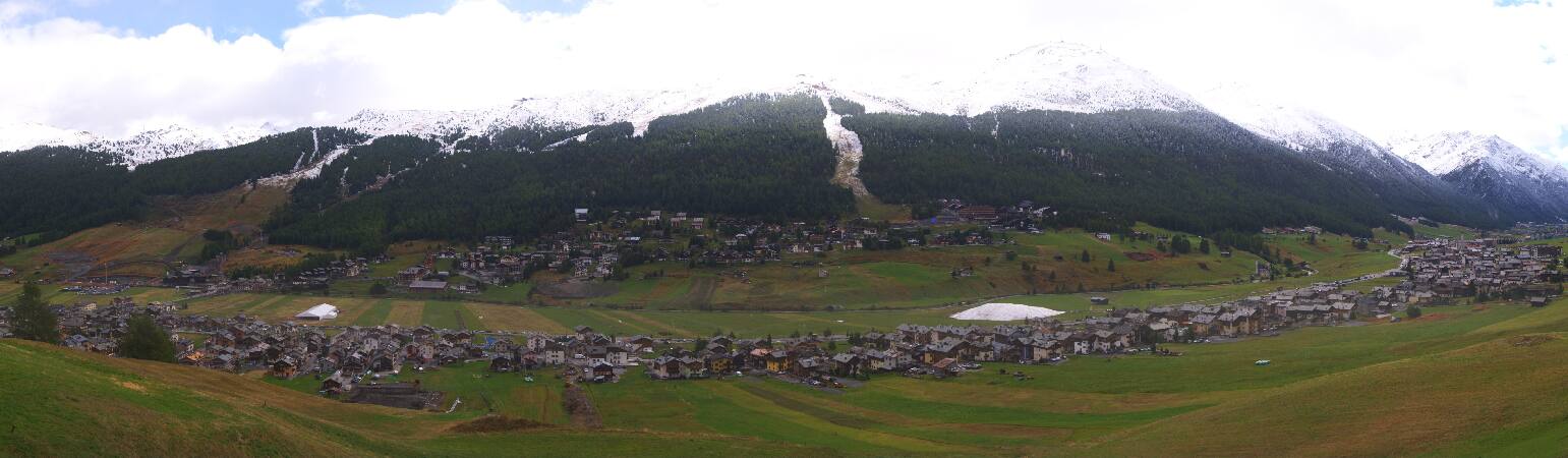
イタリアの山
Piz Chaschauna
3,071 m10,075 ft
山 · Livigno Alps · イタリア · スイス
Piz Chaschauna is a mountain of the Livigno Alps, located on the border between Italy and Switzerland. The northern side of the mountain (Graubünden) is part of the Swiss National Park. The eastern side of the mountain (Lombardy) is part of the Stelvio National Park.
出典: Wikipedia、CC BY-SA · 記事を読む
山頂 · 8:00 の予報
-4 °C曇り · 西の風 5 km/h
 3D で見る
Piz Chaschauna 山頂の天気(3,071 m)
- 8:00-4 °C西 5 km/h–
- 11:002 °C北西 6 km/h–
- 14:002 °C北西 12 km/h–
- 17:00-2 °C北西 6 km/h–
- 20:00-4 °C北西 6 km/h–
- 23:00-4 °C北西 5 km/h–
- 2:00-6 °C西 4 km/h–
- 5:00-8 °C西 3 km/h–
| 日付 | 天気 | 最高 / 最低 | 雨 | 最大風速 |
|---|---|---|---|---|
| 今日 | 晴れ | 2 °C / -4 °C | – | 12 km/h |
| 10月29日(木) | 快晴 | 3 °C / -8 °C | – | 9 km/h |
| 10月30日(金) | 快晴 | 1 °C / -8 °C | – | 8 km/h |
| 10月31日(土) | 快晴 | 2 °C / -8 °C | – | 4 km/h |
| 11月1日(日) | 快晴 | 3 °C / -9 °C | – | 7 km/h |
| 11月2日(月) | 快晴 | -1 °C / -8 °C | – | 13 km/h |
| 11月3日(火) | 晴れ時々曇り | -1 °C / -11 °C | 0.1 mm | 13 km/h |
MET Norway(CC BY 4.0)による予報。20:17 GMT+1 更新。時刻は現地時間です。
基本データ
- 種類
- 山
- 標高
- 3,071 m (10,075 ft)
- プロミネンス
- 289 m (948 ft)
- 山脈
- Livigno Alps
- 親ピーク
- Piz Quattervals
- 座標
- 46.575°N 10.079°E
Piz Chaschauna周辺の山
- Piz Languard3,262 m · 13 km先地図上
- ムオタス・ムライユ2,453 m · 15 km先地図上
- Piz Kesch3,418 m · 17 km先地図上
- Piz Ot3,246 m · 21 km先地図上
- Scima da Saoseo3,264 m · 22 km先地図上
- Piz Morteratsch3,751 m · 23 km先地図上
- ピッツ・ネイル3,056 m · 24 km先地図上
- Piz Palü3,899 m · 24 km先地図上
- Piz Linard3,411 m · 25 km先地図上
- Piz Bianco3,993 m · 25 km先地図上
親ピーク
プロミネンスの基準となる、最も近いより高い山。
- Piz Quattervals3,165 m地図上
Livigno Alpsの最高峰
- Cima Viola3,374 m地図上
- Pizzo Dosdè3,280 m地図上
- Scima da Saoseo3,264 m地図上
- Piz Languard3,262 m地図上
- Corno di Dosdè3,232 m地図上
- Piz Vadret3,199 m地図上
- Piz Albris3,166 m地図上
- Piz Quattervals3,165 m地図上
- Piz Chaschauna3,071 m地図上