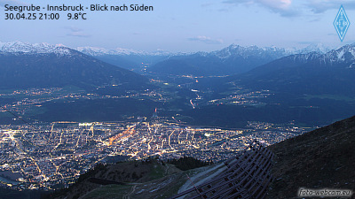
Kleiner Solstein
2.637 m8.652 pés
Montanha · Áustria
The Kleiner Solstein is a mountain, 2,637 m (AA) high, in the Nordkette in the Karwendel Alps in the Austrian state of Tyrol. Despite its name it towers above its western neighbour, the Großer Solstein by almost 100 m (330 ft) and is thus the highest summit in the Nordkette.
Da Wikipedia, CC BY-SA · Ler o artigo
No cume · previsão para 12:00
2 °CChuva com neve · vento de 5 km/h de NO
 Ver em 3D
Clima no cume de Kleiner Solstein, 2.637 m
- 12:002 °CNO 5 km/h2 mm
- 15:00-0 °CN 6 km/h0,3 mm
- 18:00-2 °CN 8 km/h0,9 mm
- 21:00-2 °CNO 6 km/h0,4 mm
- 0:00-3 °CN 5 km/h–
- 3:00-3 °CNO 4 km/h–
- 6:00-5 °CNO 3 km/h–
- 9:00-4 °CSE 4 km/h–
| Dia | Céu | Máx. / mín. | Chuva | Vento até |
|---|---|---|---|---|
| qui., 29 de out. | Poucas nuvens | 2 °C / -9 °C | – | 7 km/h |
| sex., 30 de out. | Céu limpo | 2 °C / -11 °C | – | 8 km/h |
| sáb., 31 de out. | Céu limpo | 3 °C / -10 °C | – | 4 km/h |
| dom., 1 de nov. | Poucas nuvens | -1 °C / -8 °C | – | 5 km/h |
| seg., 2 de nov. | Neve | -6 °C / -8 °C | 6,5 mm | 6 km/h |
| ter., 3 de nov. | Neve | -6 °C / -9 °C | 6,7 mm | 4 km/h |
| qua., 4 de nov. | Céu limpo | -2 °C / -9 °C | 0,7 mm | 2 km/h |
Previsão: MET Norway (CC BY 4.0), atualizada às 10:22 GMT+1. Horários locais.
Ficha técnica
- Tipo
- Montanha
- Altitude acima do nível do mar
- 2.637 m (8.652 pés)
- Isolamento
- a 8 km de um terreno mais alto
- País
- Áustria
- Primeira ascensão
- 1867
- Coordenadas
- 47.302°N 11.324°E
- Fonte
- Wikidata, CC0
Kleiner Solstein
The Kleiner Solstein is a mountain, 2,637 m (AA) high, in the Nordkette in the Karwendel Alps in the Austrian state of Tyrol. Despite its name it towers above its western neighbour, the Großer Solstein by almost 100 m (330 ft) and is thus the highest summit in the Nordkette. The southern side of the Kleiner Solstein facing the Inn valley is characterised by schrofen and steep-sided cirques.
Da Wikipedia, CC BY-SA · Ler o artigo
Picos perto de Kleiner Solstein
- Nordkette2.637 m · a 2 kmNo mapa
- Bergisel746 m · a 8,4 kmNo mapa
- Patscherkofel2.246 m · a 15 kmNo mapa
- Birkkarspitze2.749 m · a 15 kmNo mapa
- Dreitorspitze2.682 m · a 19 kmNo mapa
- Serles2.717 m · a 20 kmNo mapa
- Hochwanner2.744 m · a 23 kmNo mapa
- Alpspitze2.628 m · a 25 kmNo mapa
- Höllentalspitzen2.743 m · a 26 kmNo mapa
- Wank1.780 m · a 27 kmNo mapa
Montanhas mais altas de Áustria
- Grossglockner3.798 mNo mapa
- Wildspitze3.768 mNo mapa
- Weißkugel3.738 mNo mapa
- Großvenediger3.657 mNo mapa
- Hintere Schwärze3.624 mNo mapa
- Großes Wiesbachhorn3.564 mNo mapa
- Ramolkogel3.549 mNo mapa
- Schalfkogel3.537 mNo mapa
- Watzespitze3.532 mNo mapa
- Fineilspitze3.514 mNo mapa