Moucherotte
1.901 m6.237 pés
Montanha · Maciço do Vercors · França
Le Moucherotte is the easternmost peak of the Vercors Massif, and also the northern culmination of the long ridge that runs along the eastern edge of the Vercors high plateau, and overlooks the city of Grenoble.
Da Wikipedia, CC BY-SA · Ler o artigo
No cume · previsão para 13:00
12 °CParcialmente nublado · vento de 4 km/h de N
 Ver em 3D
Clima no cume de Moucherotte, 1.901 m
- 13:0012 °CN 4 km/h–
- 16:0011 °CNO 5 km/h–
- 19:004 °CO 4 km/h–
- 22:003 °CSO 3 km/h–
- 1:003 °CO 4 km/h–
- 4:002 °CNO 5 km/h–
- 7:003 °CNO 8 km/h0,4 mm
- 10:003 °CNO 8 km/h0,4 mm
| Dia | Céu | Máx. / mín. | Chuva | Vento até |
|---|---|---|---|---|
| qua., 28 de out. | Chuva fraca | 3 °C / -1 °C | 0,9 mm | 12 km/h |
| qui., 29 de out. | Poucas nuvens | 6 °C / -1 °C | – | 6 km/h |
| sex., 30 de out. | Céu limpo | 8 °C / -1 °C | – | 5 km/h |
| sáb., 31 de out. | Poucas nuvens | 8 °C / -2 °C | – | 4 km/h |
| dom., 1 de nov. | Poucas nuvens | 7 °C / -2 °C | – | 4 km/h |
| seg., 2 de nov. | Parcialmente nublado | 1 °C / -2 °C | 0,1 mm | 3 km/h |
| ter., 3 de nov. | Céu limpo | 6 °C / -3 °C | – | 5 km/h |
Previsão: MET Norway (CC BY 4.0), atualizada às 02:17 GMT+1. Horários locais.
Ficha técnica
- Tipo
- Montanha
- Altitude acima do nível do mar
- 1.901 m (6.237 pés)
- Cordilheira
- Maciço do Vercors
- País
- França
- Coordenadas
- 45.148°N 5.639°E
- Fonte
- Wikidata, CC0
Moucherotte
Mountain in France
Le Moucherotte is the easternmost peak of the Vercors Massif, and also the northern culmination of the long ridge that runs along the eastern edge of the Vercors high plateau, and overlooks the city of Grenoble. The mountain is divided between the communes of Saint-Nizier-du-Moucherotte, Lans-en-Vercors, Seyssins and Claix.
Da Wikipedia, CC BY-SA · Ler o artigo
Picos perto de Moucherotte
- Chamechaude2.082 m · a 19 kmNo mapa
- La Grande Sure1.920 m · a 21 kmNo mapa
- Charmant Som1.867 m · a 22 kmNo mapa
- Dent de Crolles2.062 m · a 25 kmNo mapa
- Le Taillefer2.857 m · a 25 kmNo mapa
- Le Tabor2.389 m · a 25 kmNo mapa
- Grand Pic de Belledonne2.977 m · a 28 kmNo mapa
- Grand Som2.026 m · a 28 kmNo mapa
- Lances de Malissard2.045 m · a 29 kmNo mapa
- Grand Veymont2.341 m · a 32 kmNo mapa
Os mais altos de Maciço do Vercors
- Grand Veymont2.341 mNo mapa
- La Grande Moucherolle2.284 mNo mapa
- Arêtes du Gerbier2.109 mNo mapa
- Sommet de Malaval2.097 mNo mapa
- Monte Agulha2.087 mNo mapa
- Rochers de la Balme2.063 mNo mapa
- Roc Cornafion2.049 mNo mapa
- Pié Ferré2.041 mNo mapa
- Moucherotte1.901 mNo mapa
Montanhas mais altas de França
- Monte Branco4.806 mNo mapa
- Pointe Walker4.208 mNo mapa
- Grandes Jorasses4.208 mNo mapa
- Agulha Verde4.122 mNo mapa
- Barre des Écrins4.102 mNo mapa
- Meije3.983 mNo mapa
- Ailefroide3.954 mNo mapa
- Mont Pelvoux3.946 mNo mapa
- Pico Sem Nome3.913 mNo mapa
- Agulha de Tré la Tête3.911 mNo mapa
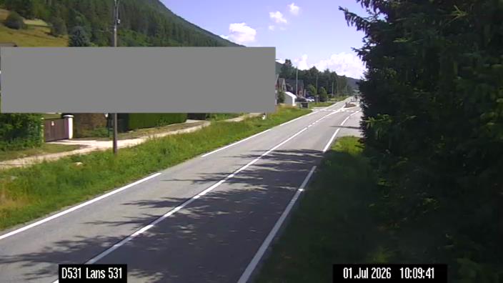
Webcams perto de Moucherotte

História ao redor de Moucherotte
- Day of the Tiles1788
- The 1968 Winter Olympics are held in Grenoble, France1968
- 2019 Grenoble riots2019
- 25 October International Exhibition of Hydropower and Tourism in Grenoble1925
- Battle of Jarrie1587
- 2025 Grenoble attack – Twelve people are injured in a grenade attack on a bar in Grenoble2025
- Adrien Perez case2018
- murder of Kévin Noubissi et Sofiane Tadbirt2012
Cidades perto de Moucherotte
- Échirollesa 5,9 km
- Fontainea 6,3 km
- Grenoblea 6,9 km
- Saint-Égrèvea 10 km
- Saint-Martin-d'Hèresa 10 km
- Meylana 13 km