Ruderhofspitze
3.474 m11.398 pés
Montanha · Alpes de Stubai · Áustria
At 3,474 m (AA) the Ruderhofspitze is the fourth highest mountain in the Stubai Alps in Austria. It is part of the Alpein Mountains and lies in the Austrian state of Tyrol. As a result of its topographic isolation and good all-round views it is one of the most visited mountains in the Stubai.
Da Wikipedia, CC BY-SA · Ler o artigo
No cume · previsão para 10:00
-4 °CNublado · vento de 5 km/h de NO
 Ver em 3D
Clima no cume de Ruderhofspitze, 3.474 m
- 10:00-4 °CNO 5 km/h–
- 13:00-4 °CNO 8 km/h0,9 mm
- 16:00-6 °CNO 8 km/h0,4 mm
- 19:00-7 °CNO 6 km/h–
- 22:00-8 °CNO 5 km/h–
- 1:00-11 °CNO 5 km/h–
- 4:00-14 °CNO 6 km/h–
- 7:00-17 °CNO 5 km/h–
| Dia | Céu | Máx. / mín. | Chuva | Vento até |
|---|---|---|---|---|
| Hoje | Neve fraca | -4 °C / -9 °C | 1,3 mm | 8 km/h |
| qui., 29 de out. | Céu limpo | -5 °C / -17 °C | – | 6 km/h |
| sex., 30 de out. | Céu limpo | -5 °C / -14 °C | – | 4 km/h |
| sáb., 31 de out. | Céu limpo | -5 °C / -14 °C | – | 4 km/h |
| dom., 1 de nov. | Céu limpo | -7 °C / -15 °C | – | 9 km/h |
| seg., 2 de nov. | Neve | -12 °C / -16 °C | 5,4 mm | 13 km/h |
| ter., 3 de nov. | Nublado | -12 °C / -15 °C | 0,6 mm | 10 km/h |
Previsão: MET Norway (CC BY 4.0), atualizada às 09:19 GMT+1. Horários locais.
Ficha técnica
- Tipo
- Montanha
- Altitude acima do nível do mar
- 3.474 m (11.398 pés)
- Proeminência
- 368 m (1.207 pés)
- Isolamento
- a 3,4 km de um terreno mais alto
- Cordilheira
- Alpes de Stubai
- País
- Áustria
- Primeira ascensão
- 30 de agosto de 1864
- Coordenadas
- 47.040°N 11.144°E
- Fonte
- Wikidata, CC0
Ruderhofspitze
Mountain in Austria
At 3,474 m (AA) the Ruderhofspitze is the fourth highest mountain in the Stubai Alps in Austria. It is part of the Alpein Mountains and lies in the Austrian state of Tyrol. As a result of its topographic isolation and good all-round views it is one of the most visited mountains in the Stubai. An almost two-kilometre-long arête, the Grawawand, runs away from the summit to the east.
Da Wikipedia, CC BY-SA · Ler o artigo
Picos perto de Ruderhofspitze
- Zuckerhütl3.507 m · a 8,5 kmNo mapa
- Wildspitze3.768 m · a 27 kmNo mapa
- Bergisel746 m · a 30 kmNo mapa
- Patscherkofel2.246 m · a 30 kmNo mapa
- Nordkette2.637 m · a 33 kmNo mapa
- Hintere Schwärze3.624 m · a 34 kmNo mapa
- Similaun3.597 m · a 37 kmNo mapa
- Hochwanner2.744 m · a 40 kmNo mapa
- Weißkugel3.738 m · a 42 kmNo mapa
- Schwemser Spitze3.459 m · a 43 kmNo mapa
Os mais altos de Alpes de Stubai
- Zuckerhütl3.507 mNo mapa
- Schrankogel3.497 mNo mapa
- Ruderhofspitze3.474 mNo mapa
- Wilde Leck3.359 mNo mapa
- Strahlkogel3.288 mNo mapa
- Habicht3.277 mNo mapa
- Östlicher Feuerstein3.268 mNo mapa
- Botzer3.250 mNo mapa
- Hoher Seeblaskogel3.235 mNo mapa
Montanhas mais altas de Áustria
- Grossglockner3.798 mNo mapa
- Wildspitze3.768 mNo mapa
- Weißkugel3.738 mNo mapa
- Großvenediger3.657 mNo mapa
- Hintere Schwärze3.624 mNo mapa
- Großes Wiesbachhorn3.564 mNo mapa
- Ramolkogel3.549 mNo mapa
- Schalfkogel3.537 mNo mapa
- Watzespitze3.532 mNo mapa
- Fineilspitze3.514 mNo mapa
Webcams perto de Ruderhofspitze
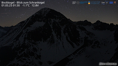

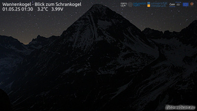

História ao redor de Ruderhofspitze
Cidades perto de Ruderhofspitze
- Telfsa 30 km
- Innsbrucka 31 km
- Meranoa 41 km
- Garmisch-Partenkirchena 50 km
- Bressanonea 53 km
- Bolzanoa 63 km