Trugberg
3.932 m12.900 pés
Montanha · Jungfrau-Fiescherhorn Group · Suíça
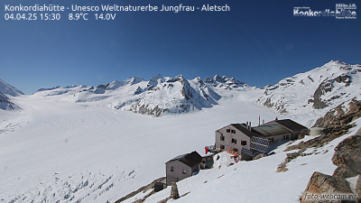
The Trugberg is a mountain in the Bernese Alps, located south of the Mönch in the canton of Valais, Switzerland. It is located above the Konkordiaplatz where the névé of the Jungfraufirn on the west side and the Ewigschneefeld on the east side converge to form the Aletsch Glacier.
Da Wikipedia, CC BY-SA · Ler o artigo
No cume · previsão para 19:00
-6 °CNevoeiro · vento de 4 km/h de SO
 Ver em 3D
Clima no cume de Trugberg, 3.932 m
- 19:00-6 °CSO 4 km/h–
- 22:00-11 °CS 5 km/h–
- 1:00-11 °CS 5 km/h0,3 mm
- 4:00-7 °CS 5 km/h–
- 7:00-9 °CSO 4 km/h–
- 10:00-7 °CNO 3 km/h–
- 13:00-7 °CNO 4 km/h–
- 16:00-8 °CNO 4 km/h–
| Dia | Céu | Máx. / mín. | Chuva | Vento até |
|---|---|---|---|---|
| qua., 28 de out. | Parcialmente nublado | -7 °C / -12 °C | 0,3 mm | 5 km/h |
| qui., 29 de out. | Céu limpo | -4 °C / -12 °C | – | 5 km/h |
| sex., 30 de out. | Céu limpo | -5 °C / -11 °C | – | 4 km/h |
| sáb., 31 de out. | Céu limpo | -5 °C / -12 °C | – | 3 km/h |
| dom., 1 de nov. | Céu limpo | -5 °C / -10 °C | – | 3 km/h |
| seg., 2 de nov. | Céu limpo | -7 °C / -14 °C | – | 4 km/h |
| ter., 3 de nov. | Poucas nuvens | -7 °C / -14 °C | – | 4 km/h |
Previsão: MET Norway (CC BY 4.0), atualizada às 14:17 GMT+1. Horários locais.
Ficha técnica
- Tipo
- Montanha
- Altitude acima do nível do mar
- 3.932 m (12.900 pés)
- Proeminência
- 308 m (1.010 pés)
- Isolamento
- a 1,7 km de um terreno mais alto
- Cordilheira
- Jungfrau-Fiescherhorn Group
- Pico pai
- Mönch
- País
- Suíça
- Coordenadas
- 46.547°N 8.015°E
- Fonte
- Wikidata, CC0
Trugberg
Mountain in Switzerland
The Trugberg is a mountain in the Bernese Alps, located south of the Mönch in the canton of Valais, Switzerland. It is located above the Konkordiaplatz where the névé of the Jungfraufirn on the west side and the Ewigschneefeld on the east side converge to form the Aletsch Glacier. Debris accumulating on both sides of the mountain form one of the two important supraglacial moraines of the Aletsch Glacier.
Da Wikipedia, CC BY-SA · Ler o artigo
Picos perto de Trugberg
- Mönch4.110 m · a 1,9 kmNo mapa
- Eiger3.967 m · a 3,5 kmNo mapa
- Gross Fiescherhorn4.049 m · a 3,5 kmNo mapa
- Fiescherhorn4.025 m · a 4 kmNo mapa
- Jungfrau4.158 m · a 4,2 kmNo mapa
- Grünhorn4.043 m · a 5 kmNo mapa
- Gletscherhorn3.982 m · a 5,2 kmNo mapa
- Ebnefluh3.961 m · a 6,4 kmNo mapa
- Agassizhorn3.947 m · a 7,6 kmNo mapa
- Mittaghorn3.893 m · a 8,3 kmNo mapa
Pico pai
Os mais altos de Jungfrau-Fiescherhorn Group
Montanhas mais altas de Suíça
- Pico Dufour4.634 mNo mapa
- Dom de Mischabel4.546 mNo mapa
- Liskamm4.532 mNo mapa
- Weisshorn4.505 mNo mapa
- Matterhorn4.478 mNo mapa
- Dente Branco4.357 mNo mapa
- Grand Combin4.309 mNo mapa
- Finsteraarhorn4.274 mNo mapa
- Zinalrothorn4.221 mNo mapa
- Alphubel4.206 mNo mapa
Webcams perto de Trugberg



História ao redor de Trugberg
Cidades perto de Trugberg
- Thuna 38 km
- Steffisburga 39 km
- Sierrea 46 km
- Domodossolaa 52 km
- Kriensa 58 km
- Littaua 59 km