Ameisnockenkopf
1.925 m6.316 ft
Dağ · Reiter Alpe · Almanya · Avusturya
Ameisnockenkopf is a 1,925 m (6,316 ft) high mountain on the border of Austria (Salzburg) and Germany (Bavaria). It is part of the Reiter Alpe. It is separated from the Stadelhorn, which lies to the north-east, by the Hochgscheidsattel.
Kaynak: Wikipedia, CC BY-SA · Makaleyi oku
Zirvede · 22:00 tahmini
0 °CKar · rüzgâr KB yönünden 7 km/sa
 3D olarak gör
Ameisnockenkopf zirvesinde hava durumu, 1.925 m
- 22:000 °CKB 7 km/sa0,4 mm
- 1:00-0 °CB 5 km/sa–
- 4:00-1 °CGB 5 km/sa–
- 7:00-1 °CG 3 km/sa–
- 10:000 °CKD 4 km/sa–
- 13:003 °CKD 6 km/sa–
- 16:001 °CKD 5 km/sa–
- 19:00-1 °CD 3 km/sa–
| Gün | Gökyüzü | En yüksek / en düşük | Yağmur | Maks. rüzgâr |
|---|---|---|---|---|
| 29 Eki Per | Bulutlu | 3 °C / -2 °C | – | 7 km/sa |
| 30 Eki Cum | Az bulutlu | 3 °C / -6 °C | – | 10 km/sa |
| 31 Eki Cmt | Açık | 3 °C / -6 °C | 0,2 mm | 8 km/sa |
| 1 Kas Paz | Hafif kar | -4 °C / -5 °C | 7,8 mm | 5 km/sa |
| 2 Kas Pzt | Bulutlu | -4 °C / -5 °C | 0,8 mm | 5 km/sa |
| 3 Kas Sal | Bulutlu | -4 °C / -6 °C | 1,5 mm | 8 km/sa |
| 4 Kas Çar | Açık | 0 °C / -9 °C | – | 3 km/sa |
Tahmin: MET Norway (CC BY 4.0), güncelleme 20:18 GMT+1. Saatler yerel saattir.
Temel bilgiler
- Türü
- Dağ
- Deniz seviyesinden yükseklik
- 1.925 m (6.316 ft)
- İzolasyon
- daha yüksek bir zemine 0,8 km
- Sıradağ
- Reiter Alpe
- Koordinatlar
- 47.586°N 12.785°E
- Kaynak
- Wikidata, CC0
Ameisnockenkopf
Mountain in Austria and Germany
Ameisnockenkopf is a 1,925 m (6,316 ft) high mountain on the border of Austria (Salzburg) and Germany (Bavaria). It is part of the Reiter Alpe. It is separated from the Stadelhorn, which lies to the north-east, by the Hochgscheidsattel. A ridge runs south-west via the Ameisnockenkopf, over the Gernhorn and the Leimbichlhorn, to the Sülzenstein.
Kaynak: Wikipedia, CC BY-SA · Makaleyi oku
Ameisnockenkopf yakınındaki zirveler
- Stadelhorn2.286 m · 1,1 km uzaktaHaritada
- Schottmalhorn1.982 m · 4,5 km uzaktaHaritada
- Hochkalter2.607 m · 6,3 km uzaktaHaritada
- Großes Ochsenhorn2.511 m · 11 km uzaktaHaritada
- Großer Hundstod2.594 m · 11 km uzaktaHaritada
- Sonntagshorn1.961 m · 13 km uzaktaHaritada
- Birnhorn2.634 m · 13 km uzaktaHaritada
- Karkopf1.738 m · 14 km uzaktaHaritada
- Persailhorn2.347 m · 16 km uzaktaHaritada
- Breithorn2.504 m · 17 km uzaktaHaritada
Reiter Alpe içinde en yüksekler
- Stadelhorn2.286 mHaritada
- Großer Weitschartenkopf1.979 mHaritada
- Ameisnockenkopf1.925 mHaritada
Almanya en yüksek dağları
- Zugspitze Dağı2.962 mHaritada
- Hochwanner2.744 mHaritada
- Dreitorspitze2.682 mHaritada
- Hochkalter2.607 mHaritada
- Biberkopf2.599 mHaritada
- Großer Hundstod2.594 mHaritada
- Hochvogel2.592 mHaritada
- Östliche Karwendelspitze2.538 mHaritada
- Hocheisspitze2.523 mHaritada
- Hoher Göll2.522 mHaritada
Ameisnockenkopf yakınındaki web kameraları
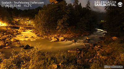


Ameisnockenkopf çevresinde tarih
Ameisnockenkopf yakınındaki şehirler
- Bad Reichenhall17 km uzakta
- Saalfelden am Steinernen Meer18 km uzakta
- Salzburg31 km uzakta
- Freilassing32 km uzakta
- Traunstein33 km uzakta
- Traunreut44 km uzakta