Mount Doongal
231 m758 ft
Dağ · Avustralya
Mount Doongul is a mountain in Queensland state forest north of Maryborough, Australia. The mountain, although not particularly high, is said to offer views to Fraser Island off the southern Queensland coast and north to the town of Childers.
Kaynak: Wikipedia, CC BY-SA · Makaleyi oku
Zirvede · 9:00 tahmini
26 °CBulutlu · rüzgâr B yönünden 6 km/sa
 3D olarak gör
Mount Doongal zirvesinde hava durumu, 231 m
- 9:0026 °CB 6 km/sa–
- 12:0032 °CB 8 km/sa5,1 mm
- 15:0023 °CKB 14 km/sa6,1 mm
- 18:0022 °CB 11 km/sa0,4 mm
- 21:0020 °CGD 7 km/sa–
- 0:0020 °CG 6 km/sa–
- 3:0018 °CGB 6 km/sa–
- 6:0016 °CG 10 km/sa–
| Gün | Gökyüzü | En yüksek / en düşük | Yağmur | Maks. rüzgâr |
|---|---|---|---|---|
| Bugün | Kuvvetli yağmur | 32 °C / 19 °C | 11,6 mm | 21 km/sa |
| 29 Eki Per | Açık | 30 °C / 16 °C | – | 20 km/sa |
| 30 Eki Cum | Bulutlu | 26 °C / 15 °C | 0,1 mm | 15 km/sa |
| 31 Eki Cmt | Yağmur | 23 °C / 17 °C | 4,8 mm | 13 km/sa |
| 1 Kas Paz | Bulutlu | 28 °C / 17 °C | 7,3 mm | 13 km/sa |
| 2 Kas Pzt | Açık | 31 °C / 19 °C | 0,1 mm | 11 km/sa |
| 3 Kas Sal | Açık | 29 °C / 19 °C | – | 13 km/sa |
Tahmin: MET Norway (CC BY 4.0), güncelleme 05:17 GMT+10. Saatler yerel saattir.
Temel bilgiler
- Türü
- Dağ
- Deniz seviyesinden yükseklik
- 231 m (758 ft)
- Ülke
- Avustralya
- Koordinatlar
- 25.487°S 152.345°E
- Kaynak
- Wikidata, CC0
Mount Doongul
Mountain in Queensland, Australia
Mount Doongul is a mountain in Queensland state forest north of Maryborough, Australia. The mountain, although not particularly high, is said to offer views to Fraser Island off the southern Queensland coast and north to the town of Childers. Mount Doongul can be reached via the Maryborough-Biggenden Road and then by taking the North Aramara turn-off and following unsealed roads.
Kaynak: Wikipedia, CC BY-SA · Makaleyi oku
Avustralya en yüksek dağları
- Mawson Peak2.745 mHaritada
- Kosciuszko Dağı2.228 mHaritada
- Rams Head2.190 mHaritada
- Bogong Dağı1.986 mHaritada
- Feathertop Dağı1.922 mHaritada
- Bimberi Peak1.912 mHaritada
- Mount Loch1.865 mHaritada
- Hotham Dağı1.861 mHaritada
- Mount Gingera1.857 mHaritada
- Mount Kelly1.829 mHaritada
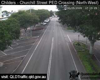
Mount Doongal yakınındaki web kameraları
Mount Doongal yakınındaki şehirler
- Maryborough37 km uzakta
- Hervey Bay48 km uzakta
- Bundaberg69 km uzakta