Schlieferspitze
3.290 m10.794 ft
Dağ · Venediger Group · Avusturya
The Schlieferspitze is a mountain, 3,290 m (AA), on the ridge known as the Krimmler Kamm in the Venediger Group of the Alps. The ridge lies in the northwest of the High Tauern, part of the Austrian Central Alps in the Austrian federal state of Salzburg.
Kaynak: Wikipedia, CC BY-SA · Makaleyi oku
Zirvede · 14:00 tahmini
-5 °CHafif kar · rüzgâr K yönünden 8 km/sa
 3D olarak gör
Schlieferspitze zirvesinde hava durumu, 3.290 m
- 14:00-5 °CK 8 km/sa2,9 mm
- 17:00-5 °CKB 8 km/sa3,4 mm
- 20:00-6 °CK 8 km/sa0,6 mm
- 23:00-7 °CK 7 km/sa0,4 mm
- 2:00-7 °CK 6 km/sa–
- 5:00-8 °CK 8 km/sa–
- 8:00-9 °CKD 8 km/sa–
- 11:00-7 °CK 6 km/sa–
| Gün | Gökyüzü | En yüksek / en düşük | Yağmur | Maks. rüzgâr |
|---|---|---|---|---|
| 29 Eki Per | Açık | -6 °C / -14 °C | 0,2 mm | 8 km/sa |
| 30 Eki Cum | Açık | -5 °C / -15 °C | – | 6 km/sa |
| 31 Eki Cmt | Açık | -6 °C / -15 °C | – | 5 km/sa |
| 1 Kas Paz | Parçalı bulutlu | -10 °C / -15 °C | – | 10 km/sa |
| 2 Kas Pzt | Yoğun kar | -12 °C / -14 °C | 17,8 mm | 9 km/sa |
| 3 Kas Sal | Kar | -12 °C / -14 °C | 5,9 mm | 10 km/sa |
| 4 Kas Çar | Açık | -11 °C / -17 °C | – | 8 km/sa |
Tahmin: MET Norway (CC BY 4.0), güncelleme 00:18 GMT+1. Saatler yerel saattir.
Temel bilgiler
- Türü
- Dağ
- Deniz seviyesinden yükseklik
- 3.290 m (10.794 ft)
- İzolasyon
- daha yüksek bir zemine 4,5 km
- Sıradağ
- Venediger Group
- Ülke
- Avusturya
- Koordinatlar
- 47.123°N 12.243°E
- Kaynak
- Wikidata, CC0
Schlieferspitze
Mountain in the Venediger Group of the Alps
The Schlieferspitze is a mountain, 3,290 m (AA), on the ridge known as the Krimmler Kamm in the Venediger Group of the Alps. The ridge lies in the northwest of the High Tauern, part of the Austrian Central Alps in the Austrian federal state of Salzburg. The summit is the highest on the Krimmler Kamm and is described in the sources as one of the most attractive peaks in the Venediger Group.
Kaynak: Wikipedia, CC BY-SA · Makaleyi oku
Schlieferspitze yakınındaki zirveler
- Dreiherrnspitze3.499 m · 6 km uzaktaHaritada
- Großvenediger3.657 m · 8 km uzaktaHaritada
- Rainerhorn3.559 m · 9,5 km uzaktaHaritada
- Rötspitze3.496 m · 11 km uzaktaHaritada
- Lenkstein3.236 m · 21 km uzaktaHaritada
- Kreuzjoch2.558 m · 24 km uzaktaHaritada
- Hochgall3.436 m · 25 km uzaktaHaritada
- Großer Löffler3.379 m · 27 km uzaktaHaritada
- Großer Muntanitz3.232 m · 27 km uzaktaHaritada
- Schneebiger Nock3.358 m · 27 km uzaktaHaritada
Venediger Group içinde en yüksekler
- Großvenediger3.657 mHaritada
- Dreiherrnspitze3.499 mHaritada
- Rötspitze3.496 mHaritada
- Hoher Eichham3.371 mHaritada
- Großer Geiger3.360 mHaritada
- Keeskogel3.291 mHaritada
- Schlieferspitze3.290 mHaritada
Avusturya en yüksek dağları
- Grossglockner3.798 mHaritada
- Wildspitze3.768 mHaritada
- Weißkugel3.738 mHaritada
- Großvenediger3.657 mHaritada
- Hintere Schwärze3.624 mHaritada
- Großes Wiesbachhorn3.564 mHaritada
- Ramolkogel3.549 mHaritada
- Schalfkogel3.537 mHaritada
- Watzespitze3.532 mHaritada
- Fineilspitze3.514 mHaritada
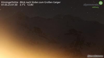
Schlieferspitze yakınındaki web kameraları



Schlieferspitze yakınındaki şehirler
- Saalfelden am Steinernen Meer57 km uzakta
- Bressanone64 km uzakta
- Innsbruck66 km uzakta