美国的山
Davis Lake volcanic field
火山 · 喀斯喀特山脉 · 美国
The Davis Lake volcanic field is a volcanic field consisting of a group of three young cinder cones and their associated andesitic lava flows. The field is located just east of the crest of the Cascade Range in Oregon, United States. The northernmost lava flow created Davis Lake by blocking Odell Creek.
来自Wikipedia,CC BY-SA · 阅读文章
山顶 · 21:00 的预报
29 °F多云 · 南风 5 英里/小时
 3D 查看
Davis Lake volcanic field天气预报
- 21:0029 °F南 5 英里/小时–
- 0:0028 °F南 4 英里/小时–
- 3:0026 °F西南 4 英里/小时–
- 6:0025 °F西南 3 英里/小时–
- 9:0026 °F南 2 英里/小时–
- 12:0036 °F东南 2 英里/小时–
- 15:0043 °F西南 7 英里/小时–
- 18:0033 °F西北 6 英里/小时–
| 日期 | 天气 | 最高 / 最低 | 雨 | 最大风速 |
|---|---|---|---|---|
| 10月29日周四 | 多云 | 43 °F / 22 °F | – | 7 英里/小时 |
| 10月30日周五 | 多云 | 39 °F / 20 °F | – | 8 英里/小时 |
| 10月31日周六 | 雨夹雪 | 33 °F / 19 °F | 0.2 英寸 | 3 英里/小时 |
| 11月1日周日 | 阴 | 37 °F / 21 °F | – | 5 英里/小时 |
| 11月2日周一 | 少云 | 40 °F / 22 °F | – | 2 英里/小时 |
| 11月3日周二 | 少云 | 49 °F / 32 °F | – | 2 英里/小时 |
| 11月4日周三 | 少云 | 47 °F / 29 °F | – | 2 英里/小时 |
预报来自 MET Norway(CC BY 4.0),更新于 GMT-7 18:17。时间均为当地时间。
基本信息
有记录的喷发 1 次
Davis Lake volcanic field附近的山峰
- Maiden Peak7,823 英尺 · 14 公里外地图上
- Diamond Peak8,748 英尺 · 28 公里外地图上
- Waldo Mountain6,361 英尺 · 32 公里外地图上
- Williamson Mountain6,304 英尺 · 41 公里外地图上
- Cinnamon Butte6,427 英尺 · 43 公里外地图上
- Howlock Mountain8,401 英尺 · 45 公里外地图上
- 纽贝里火山7,986 英尺 · 47 公里外地图上
- 巴奇勒山9,068 英尺 · 48 公里外地图上
- Mount Thielsen9,183 英尺 · 50 公里外地图上
- Tumalo Mountain7,776 英尺 · 51 公里外地图上
喀斯喀特山脉最高峰
- 雷尼爾山14,400 英尺地图上
- 亞當斯山12,280 英尺地图上
- 麥勞夫林山9,495 英尺地图上
- Mount Thielsen9,183 英尺地图上
- Broken Top9,177 英尺地图上
- Black Peak8,976 英尺地图上
- Dome Peak8,921 英尺地图上
- Silver Star Mountain8,875 英尺地图上
美国最高的山
Davis Lake volcanic field附近的网络摄像头

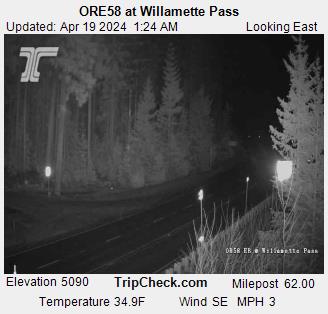


Davis Lake volcanic field附近的城镇
- 本德68 公里外