Mount Bogart
3,144 米10,315 英尺
山 · Kananaskis Range · 加拿大
Mount Bogart is a 3,144-metre (10,315-foot) summit located in Kananaskis Country in the Canadian Rockies of Alberta, Canada. Mount Bogart's nearest higher peak is Wind Mountain, 4.7 km (2.9 mi) to the north.
来自Wikipedia,CC BY-SA · 阅读文章
山顶 · 22:00 的预报
-10 °C阴 · 西南风 5 km/h
 3D 查看
Mount Bogart山顶天气,3,144 米
- 22:00-10 °C西南 5 km/h–
- 1:00-10 °C南 4 km/h–
- 4:00-11 °C东 4 km/h0.6 mm
- 7:00-11 °C东北 6 km/h1.4 mm
- 10:00-12 °C东北 7 km/h1.2 mm
- 13:00-12 °C东北 8 km/h0.8 mm
- 16:00-13 °C东北 8 km/h0.3 mm
- 19:00-14 °C东北 8 km/h0.6 mm
| 日期 | 天气 | 最高 / 最低 | 雨 | 最大风速 |
|---|---|---|---|---|
| 10月28日周三 | 中雪 | -10 °C / -15 °C | 5 mm | 8 km/h |
| 10月29日周四 | 阴 | -13 °C / -16 °C | 0.4 mm | 6 km/h |
| 10月30日周五 | 少云 | -9 °C / -23 °C | 0.2 mm | 7 km/h |
| 10月31日周六 | 少云 | -10 °C / -17 °C | – | 7 km/h |
| 11月1日周日 | 阴 | -9 °C / -21 °C | 3.3 mm | 6 km/h |
| 11月2日周一 | 晴 | -9 °C / -21 °C | – | 11 km/h |
| 11月3日周二 | 阴 | -3 °C / -11 °C | – | 11 km/h |
预报来自 MET Norway(CC BY 4.0),更新于 GMT-6 19:17。时间均为当地时间。
基本信息
Mount Bogart
Mountain in the country of Canada
Mount Bogart is a 3,144-metre (10,315-foot) summit located in Kananaskis Country in the Canadian Rockies of Alberta, Canada. Mount Bogart's nearest higher peak is Wind Mountain, 4.7 km (2.9 mi) to the north. Mount Bogart is situated northwest of Mount Kidd, and both can be seen from Highway 40 near the Kananaskis Village junction.
来自Wikipedia,CC BY-SA · 阅读文章
Mount Bogart附近的山峰
- Mount Buller2,805 米 · 5.5 公里外地图上
- Mount Galatea3,185 米 · 8.3 公里外地图上
- Mount Nestor2,970 米 · 8.7 公里外地图上
- The Fortress3,000 米 · 9.3 公里外地图上
- Skogan Peak2,662 米 · 12 公里外地图上
- Pigeon Mountain2,394 米 · 13 公里外地图上
- 三姐妹峰2,936 米 · 14 公里外地图上
- Mount McGillivray2,451 米 · 14 公里外地图上
- Heart Mountain2,135 米 · 16 公里外地图上
- Mount Allenby2,995 米 · 21 公里外地图上
Kananaskis Range最高峰
- Mount Galatea3,185 米地图上
- Wind Mountain3,153 米地图上
- Mount Bogart3,144 米地图上
- The Tower3,117 米地图上
- Mount Chester3,054 米地图上
- Mount James Walker3,035 米地图上
- Mount Inflexible3,000 米地图上
- Mount Engadine2,972 米地图上
- Mount Kidd2,958 米地图上
加拿大最高的山
Mount Bogart附近的网络摄像头
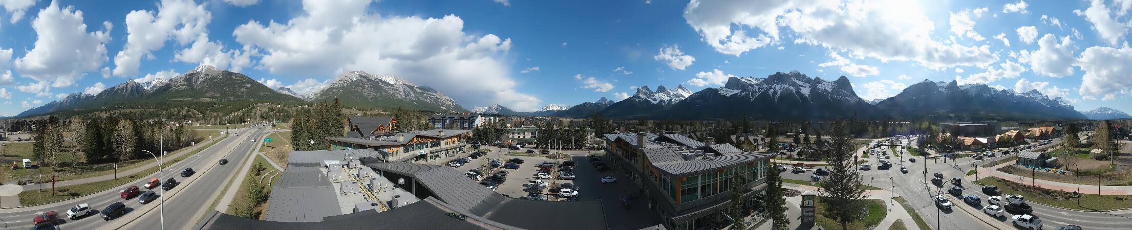
Mount Bogart附近的城镇
- Cochrane62 公里外