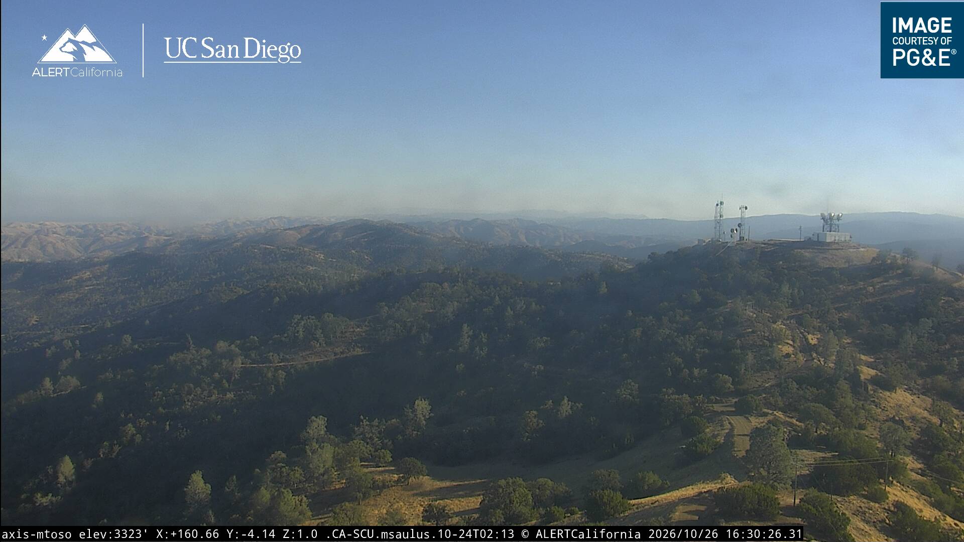
Mount Oso
3,352 英尺1,022 米
山 · 代阿布洛岭 · 美国
Mount Oso is a mountain in Western Stanislaus County, California, and is located on the Diablo Range. At 3,352 feet (1,022 m) feet in elevation, it is the third highest point in Stanislaus County. There are many radio stations and an unused forest fire lookout tower on the mountain.
来自Wikipedia,CC BY-SA · 阅读文章
山顶 · 20:00 的预报
49 °F晴 · 西风 7 英里/小时
 3D 查看
Mount Oso山顶天气,3,352 英尺
- 20:0049 °F西 7 英里/小时–
- 23:0044 °F西南 6 英里/小时–
- 2:0040 °F西南 6 英里/小时–
- 5:0037 °F西南 6 英里/小时–
- 8:0037 °F西南 6 英里/小时–
- 11:0055 °F东北 4 英里/小时–
- 14:0059 °F东北 6 英里/小时–
- 17:0057 °F东北 9 英里/小时–
| 日期 | 天气 | 最高 / 最低 | 雨 | 最大风速 |
|---|---|---|---|---|
| 10月27日周二 | 多云 | 59 °F / 36 °F | – | 9 英里/小时 |
| 10月28日周三 | 多云 | 59 °F / 43 °F | – | 10 英里/小时 |
| 10月29日周四 | 多云 | 60 °F / 47 °F | – | 6 英里/小时 |
| 10月30日周五 | 晴 | 58 °F / 42 °F | – | 4 英里/小时 |
| 10月31日周六 | 阴 | 53 °F / 37 °F | – | 8 英里/小时 |
| 11月1日周日 | 晴 | 56 °F / 42 °F | – | 11 英里/小时 |
| 11月2日周一 | 晴 | 64 °F / 46 °F | – | 5 英里/小时 |
预报来自 MET Norway(CC BY 4.0),更新于 GMT-7 16:20。时间均为当地时间。
基本信息
Mount Oso
Mountain in California, United States
Mount Oso is a mountain in Western Stanislaus County, California, and is located on the Diablo Range. At 3,352 feet (1,022 m) feet in elevation, it is the third highest point in Stanislaus County. There are many radio stations and an unused forest fire lookout tower on the mountain. It appears in the City of Modesto's logo due to its predominance in the area's skyline.
来自Wikipedia,CC BY-SA · 阅读文章
Mount Oso附近的山峰
- Mount Boardman3,621 英尺 · 9 公里外地图上
- Rooster Comb1,836 英尺 · 29 公里外地图上
- Black Mountain3,955 英尺 · 30 公里外地图上
- 汉密尔顿山 (加利福尼亚州)4,354 英尺 · 30 公里外地图上
- Mount Sizer3,219 英尺 · 35 公里外地图上
- Monument Peak2,598 英尺 · 43 公里外地图上
- Mount Allison2,664 英尺 · 44 公里外地图上
- Tulare Hill620 英尺 · 46 公里外地图上
- El Toro1,427 英尺 · 50 公里外地图上
- Lions Peak1,117 英尺 · 55 公里外地图上
代阿布洛岭最高峰
- San Benito Mountain5,267 英尺地图上
- Santa Rita peak5,165 英尺地图上
- 汉密尔顿山 (加利福尼亚州)4,354 英尺地图上
- Black Mountain4,345 英尺地图上
- Black Mountain3,955 英尺地图上
- 代阿布洛山3,806 英尺地图上
- Laveaga Peak3,804 英尺地图上
- Black Mountain3,758 英尺地图上
- Mount Oso3,352 英尺地图上