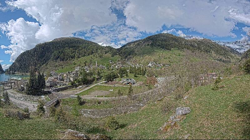
瑞士的山
3D 查看Piz d'Arbeola
2,600 米8,530 英尺
山 · Adula Group · 瑞士
Piz d'Arbeola is a mountain of the Lepontine Alps, south of San Bernardino in the canton of Graubünden. It lies between the Val Calanca and the Val Mesolcina, north of Piz Pian Grand.
来自Wikipedia,CC BY-SA · 阅读文章
山顶 · 22:00 的预报
-2 °C雾 · 北风 9 km/h
Piz d'Arbeola山顶天气,2,600 米
- 22:00-2 °C北 9 km/h–
- 1:00-4 °C北 9 km/h–
- 4:00-6 °C北 9 km/h–
- 7:00-5 °C北 5 km/h–
- 10:003 °C南 4 km/h–
- 13:005 °C南 7 km/h–
- 16:003 °C南 7 km/h–
- 19:00-2 °C北 3 km/h–
| 日期 | 天气 | 最高 / 最低 | 雨 | 最大风速 |
|---|---|---|---|---|
| 10月29日周四 | 晴 | 5 °C / -6 °C | – | 10 km/h |
| 10月30日周五 | 少云 | 3 °C / -5 °C | 0.4 mm | 7 km/h |
| 10月31日周六 | 晴 | 4 °C / -7 °C | – | 5 km/h |
| 11月1日周日 | 晴 | 0 °C / -6 °C | – | 9 km/h |
| 11月2日周一 | 少云 | 0 °C / -9 °C | – | 7 km/h |
| 11月3日周二 | 晴 | 2 °C / -7 °C | – | 6 km/h |
| 11月4日周三 | 少云 | -1 °C / -8 °C | 0.8 mm | 3 km/h |
预报来自 MET Norway(CC BY 4.0),更新于 GMT+1 12:19。时间均为当地时间。