德国的山
Roß- und Buchstein
1,701 米5,581 英尺
山 · 泰根塞山 · 德国
The Roß- und Buchstein are two mountain peaks within the Tegernsee Mountains range, in the Bavarian Prealps, Bavaria, Germany. The Tegernsee cabin is lodged between the Roßstein and the Buchstein.
来自Wikipedia,CC BY-SA · 阅读文章
山顶 · 23:00 的预报
6 °C多云 · 西风 6 km/h
 3D 查看
Roß- und Buchstein山顶天气,1,701 米
- 23:006 °C西 6 km/h–
- 2:005 °C西北 8 km/h–
- 5:004 °C西北 11 km/h–
- 8:005 °C西北 8 km/h0.6 mm
- 11:005 °C西北 13 km/h2.3 mm
- 14:003 °C西北 13 km/h1.7 mm
- 17:002 °C西北 9 km/h0.6 mm
- 20:002 °C西北 7 km/h0.8 mm
| 日期 | 天气 | 最高 / 最低 | 雨 | 最大风速 |
|---|---|---|---|---|
| 10月28日周三 | 大雨 | 6 °C / 1 °C | 6 mm | 13 km/h |
| 10月29日周四 | 晴 | 7 °C / -1 °C | – | 13 km/h |
| 10月30日周五 | 晴 | 7 °C / -2 °C | – | 7 km/h |
| 10月31日周六 | 晴 | 7 °C / -3 °C | – | 8 km/h |
| 11月1日周日 | 少云 | 5 °C / -5 °C | – | 5 km/h |
| 11月2日周一 | 多云 | 1 °C / -2 °C | 2.9 mm | 9 km/h |
| 11月3日周二 | 中雪 | -1 °C / -3 °C | 4.3 mm | 12 km/h |
预报来自 MET Norway(CC BY 4.0),更新于 GMT+1 18:17。时间均为当地时间。
基本信息
Roß- und Buchstein附近的山峰
泰根塞山最高峰
德国最高的山
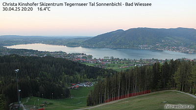
Roß- und Buchstein附近的网络摄像头



Roß- und Buchstein附近的城镇
- Bad Tölz17 公里外
- Penzberg26 公里外
- Holzkirchen27 公里外
- Geretsried29 公里外
- Bruckmühl32 公里外
- Bad Aibling35 公里外