美国的山
Spiral Butte
5,929 英尺1,807 米
火山 · 喀斯喀特山脉 · 美国
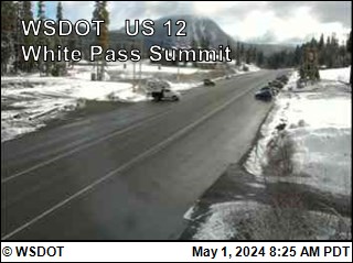
Spiral Butte is a cinder cone in Yakima County, Washington in the United States. The summit and most of the slopes are located within the William O. Douglas Wilderness of the Okanogan–Wenatchee National Forest between White Pass and Rimrock Lake. Historically the mountain has also been referred to as Big Peak.
来自Wikipedia,CC BY-SA · 阅读文章
山顶 · 1:00 的预报
27 °F大雪 · 西风 11 英里/小时
 3D 查看
Spiral Butte山顶天气,5,929 英尺
- 1:0027 °F西 11 英里/小时0.24 英寸
- 4:0027 °F西南 10 英里/小时0.18 英寸
- 7:0025 °F西南 8 英里/小时0.11 英寸
- 10:0027 °F西 9 英里/小时0.04 英寸
- 13:0029 °F西 12 英里/小时0.04 英寸
- 16:0028 °F西 9 英里/小时0.01 英寸
- 19:0023 °F西南 5 英里/小时0.01 英寸
- 22:0024 °F西南 6 英里/小时–
| 日期 | 天气 | 最高 / 最低 | 雨 | 最大风速 |
|---|---|---|---|---|
| 今天 | 中雪 | 29 °F / 23 °F | 0.63 英寸 | 13 英里/小时 |
| 10月29日周四 | 雨夹雪 | 33 °F / 16 °F | 0.15 英寸 | 6 英里/小时 |
| 10月30日周五 | 多云 | 35 °F / 11 °F | – | 6 英里/小时 |
| 10月31日周六 | 晴 | 33 °F / 13 °F | – | 2 英里/小时 |
| 11月1日周日 | 少云 | 32 °F / 18 °F | – | 3 英里/小时 |
| 11月2日周一 | 多云 | 43 °F / 24 °F | – | 3 英里/小时 |
| 11月3日周二 | 晴 | 43 °F / 31 °F | – | 2 英里/小时 |
预报来自 MET Norway(CC BY 4.0),更新于 GMT-7 00:18。时间均为当地时间。
基本信息
Spiral Butte附近的山峰
- Mount Aix7,766 英尺 · 16 公里外地图上
- Big Horn7,999 英尺 · 20 公里外地图上
- Gilbert Peak8,184 英尺 · 20 公里外地图上
- Shriner Peak5,834 英尺 · 21 公里外地图上
- Dewey Peak6,710 英尺 · 22 公里外地图上
- Seymour Peak6,337 英尺 · 23 公里外地图上
- Tahtlum Peak6,567 英尺 · 24 公里外地图上
- Tatoosh Peak6,310 英尺 · 24 公里外地图上
- Double Peak6,199 英尺 · 25 公里外地图上
- Naches Peak6,452 英尺 · 25 公里外地图上
喀斯喀特山脉最高峰
- 雷尼爾山14,400 英尺地图上
- 亞當斯山12,280 英尺地图上
- 麥勞夫林山9,495 英尺地图上
- Mount Thielsen9,183 英尺地图上
- Broken Top9,177 英尺地图上
- Black Peak8,976 英尺地图上
- Dome Peak8,921 英尺地图上
- Silver Star Mountain8,875 英尺地图上
- Spiral Butte5,929 英尺地图上