A week in Mainz, Germany
Seven days in Mainz, each a walk through best-known places that lie close together, the best known first: day one starts at St. Stephen's Church. 36 stops in all.
Day 1
- St. Stephen's ChurchTemple or shrine · On the map

- Mainz CathedralCathedral · 0.5 km on from St. Stephen's Church · On the map

- MogontiacumArchaeological site · 0.2 km on from Mainz Cathedral · On the map
- Gutenberg MuseumMuseum · 0.4 km on from Mogontiacum · On the map

- St. Peter's ChurchTemple or shrine · 0.1 km on from Gutenberg Museum · On the map

- Protestant Christ Church, MainzTemple or shrine · 0.4 km on from St. Peter's Church · On the map

6 stops, about 1.7 km between them in straight lines.
Day 2
- DrusussteinArchaeological site · On the map

- Roman theater at MainzTheatre or opera house · 0.3 km on from Drususstein · On the map

- St. Augustine's church (Mainz)Temple or shrine · 0.5 km on from Roman theater at Mainz · On the map

- St. John' Church, MainzTemple or shrine · 0.2 km on from St. Augustine's church (Mainz) · On the map

- Deutschhaus MainzPalace · 0.8 km on from St. John' Church, Mainz · On the map

- New synagogue MainzSynagogue · 1 km on from Deutschhaus Mainz · On the map

6 stops, about 2.7 km between them in straight lines.
Day 3
- Theodor Heuss BridgeBridge · On the map

- Electoral PalacePalace · 0.5 km on from Theodor Heuss Bridge · On the map

- Arch of Dativius VictorMonument · 0.1 km on from Electoral Palace · On the map

- Catholic St. Quentin's Church, MainzTemple or shrine · 0.6 km on from Arch of Dativius Victor · On the map

- Osteiner HofPalace · 0.5 km on from Catholic St. Quentin's Church, Mainz · On the map

- Catholic St. Ignaz' Church, MainzTemple or shrine · 0.7 km on from Osteiner Hof · On the map

6 stops, about 2.3 km between them in straight lines.
Day 4
- Castle LandskronCastle · On the map

- St. Catherine's Church, OppenheimTemple or shrine · 0.2 km on from Castle Landskron · On the map

- Deutsches WeinbaumuseumMuseum · 0.5 km on from St. Catherine's Church, Oppenheim · On the map

3 stops, about 0.7 km between them in straight lines.
Day 5
- Kunsthalle MainzMuseum · On the map

- The Big Jupiter columnMonument · 0.9 km on from Kunsthalle Mainz · On the map
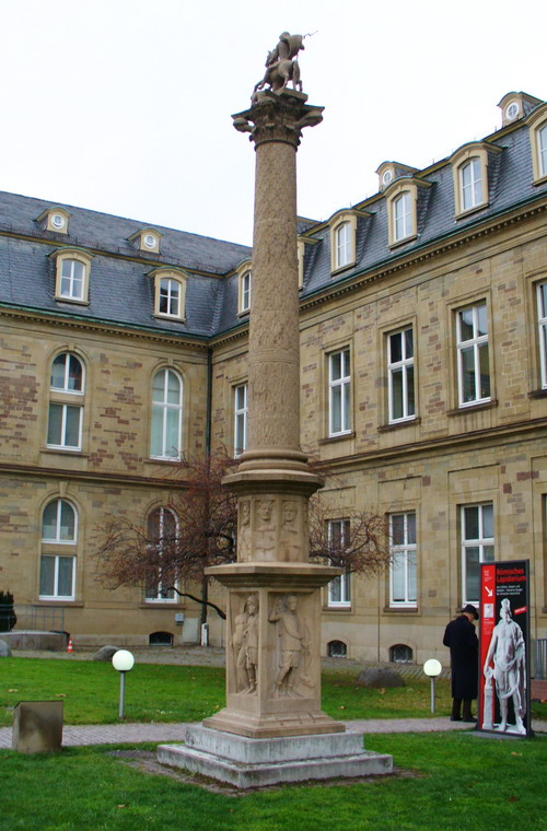
- Landesmuseum MainzMuseum · 0.3 km on from The Big Jupiter column · On the map

- Sanctuary of Isis and Magna MaterArchaeological site · 0.3 km on from Landesmuseum Mainz · On the map

- St. Christoph's Church, MainzTemple or shrine · 0.3 km on from Sanctuary of Isis and Magna Mater · On the map

- Museum of Ancient SeafaringMuseum · 1 km on from St. Christoph's Church, Mainz · On the map

6 stops, about 2.8 km between them in straight lines.
Day 6
- Bassenheimer HofPalace · On the map

- St. Emmeran, MainzTemple or shrine · 0.3 km on from Bassenheimer Hof · On the map

- Natural History Museum MainzMuseum · 0.4 km on from St. Emmeran, Mainz · On the map

- KarmeliterkircheTemple or shrine · 0.2 km on from Natural History Museum Mainz · On the map

- St. Maria ad GradusTemple or shrine · 0.4 km on from Karmeliterkirche · On the map

- Dom- und Diözesanmuseum (Mainz)Museum · 0.1 km on from St. Maria ad Gradus · On the map

6 stops, about 1.4 km between them in straight lines.
Day 7
- Römisch-Germanisches ZentralmuseumMuseum · On the map

- Walk of Fame of CabaretMonument · 1.2 km on from Römisch-Germanisches Zentralmuseum · On the map
- Golden-Ross-KaserneMuseum · 0.6 km on from Walk of Fame of Cabaret · On the map

3 stops, about 1.8 km between them in straight lines.
More for Mainz
- Things to do in Mainz, Germany · 40 places to see, led by Mainz Cathedral and St. Stephen's Church
- One day in Mainz, Germany · 6 stops in a day, starting at St. Stephen's Church
Day trips from Mainz
- Trier120 km awayTrier6 stops in a day, starting at Roman amphitheatre of Trier
- Köln142 km awayCologne Cathedral6 stops in a day, starting at Hohenzollern Bridge
- Würzburg122 km awayWürzburg Residence6 stops in a day, starting at Würzburg Residence
- Frankfurt am Main32 km awayCommerzbank Tower6 stops in a day, starting at Städel Museum
Photo credits
- St. Stephen's Church: Unknown author, CC BY-SA 3.0
- Mainz Cathedral: Michiel1972, CC BY-SA 3.0
- Gutenberg Museum: Pedelecs, CC BY-SA 3.0
- St. Peter's Church: Berthold Werner, CC BY-SA 3.0
- Protestant Christ Church, Mainz: Wolfgang Pehlemann Wiesbaden Germany, CC BY-SA 3.0 de
- Drususstein: Martin Bahmann, CC BY-SA 3.0
- Roman theater at Mainz: User:Kandschwar, CC BY-SA 2.0 de
- St. Augustine's church (Mainz): Berthold Werner, CC BY-SA 3.0
- St. John' Church, Mainz: Lorbas40, CC BY-SA 3.0
- Deutschhaus Mainz: Photo: Andreas Praefcke, CC BY 4.0
- New synagogue Mainz: Linus Wolf, CC BY-SA 3.0
- Theodor Heuss Bridge: Unknown author, CC BY-SA 3.0
- Electoral Palace: Wolfgang Pehlemann Wiesbaden Germany, CC BY-SA 3.0 de
- Arch of Dativius Victor: Kamée, CC BY 3.0
- Catholic St. Quentin's Church, Mainz: Berthold Werner, CC BY-SA 3.0
- Osteiner Hof: Unknown author, CC BY-SA 3.0
- Catholic St. Ignaz' Church, Mainz: Falense, CC BY-SA 3.0
- Castle Landskron: Kumbalam, CC0
- St. Catherine's Church, Oppenheim: Valgard, CC BY-SA 3.0
- Deutsches Weinbaumuseum: paddy, CC BY-SA 3.0
- Kunsthalle Mainz: Martin Bahmann, CC BY-SA 3.0
- The Big Jupiter column: Enslin, CC BY 2.5
- Landesmuseum Mainz: User:Kandschwar, CC BY-SA 3.0
- Sanctuary of Isis and Magna Mater: Martin Bahmann, CC BY-SA 3.0
- St. Christoph's Church, Mainz: RomkeHoekstra, CC BY-SA 3.0
- Museum of Ancient Seafaring: User:Matthias Süßen, CC BY-SA 3.0
- Bassenheimer Hof: Photo: Andreas Praefcke, CC BY 4.0
- St. Emmeran, Mainz: Symposiarch, CC BY-SA 3.0
- Natural History Museum Mainz: Martin Bahmann, CC BY-SA 3.0
- Karmeliterkirche: Immanuel Giel, CC BY-SA 3.0
- St. Maria ad Gradus: Symposiarch, Public domain
- Dom- und Diözesanmuseum (Mainz): Unknown author, CC BY-SA 3.0
- Römisch-Germanisches Zentralmuseum: Unknown author, CC BY-SA 3.0
- Golden-Ross-Kaserne: Benjamin Dahlhoff, CC BY-SA 3.0
Pictures from Wikimedia Commons, through each place’s Wikidata entry.
Good to know
- Each day starts at the best-known place not yet seen and adds the best known within a short walk of it, then puts them in the shortest order. The places come from Wikidata (CC0), ranked by how many Wikipedias have an article about them.
- The map draws each day’s walk along the streets, routed by Valhalla on OpenStreetMap; the distances beside the stops are straight lines.
- Opening hours, tickets and closures are not checked: each place’s Wikipedia article has them.
Other places nearby
- Wiesbaden12 km away · Things to do, Plans, Flights, Weather, ISS passes, Sunrise and sunset and Hiking routes
- Darmstadt29 km away · Right now, Things to do, Plans, Cameras, Flights, Weather, ISS passes, Sunrise and sunset and Hiking routes
- Frankfurt am Main32 km away · Right now, Things to do, Plans, Transit, Cameras, Flights, Weather, ISS passes, Sunrise and sunset and Hiking routes
- Mannheim56 km away · Right now, Things to do, Plans, Flights, Weather, ISS passes, Sunrise and sunset and Hiking routes
- Koblenz65 km away · Things to do, Plans, Cameras, Weather, ISS passes, Sunrise and sunset and Hiking routes
- Heidelberg70 km away · Things to do, Plans, Flights, Weather and Hiking routes
- Bonn119 km away · Right now, Things to do, Plans, Cameras, Flights, Weather and Hiking routes
- Trier120 km away · Things to do, Plans, Flights, Weather, ISS passes, Sunrise and sunset and Hiking routes