One day in Saintes, France
A day through Saintes’s best-known sights that lie close together: Arch of Germanicus, Musée archéologique de Saintes, Saintes cathedral, Mediolanum Santonum, Basilique Saint-Eutrope de Saintes and Roman amphitheatre of Saintes. 6 stops, about 1.7 km between them in straight lines; the streets make it longer.
The route
- Arch of GermanicusMonument · On the map

- Musée archéologique de SaintesMuseum · 0.1 km on from Arch of Germanicus · On the map

- Saintes cathedralCathedral · 0.2 km on from Musée archéologique de Saintes · On the map

- Mediolanum SantonumArchaeological site · 0.2 km on from Saintes cathedral · On the map

- Basilique Saint-Eutrope de SaintesTemple or shrine · 0.7 km on from Mediolanum Santonum · On the map
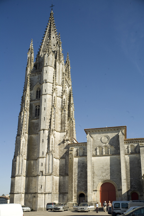
- Roman amphitheatre of SaintesArchaeological site · 0.3 km on from Basilique Saint-Eutrope de Saintes · On the map

6 stops, 2.6 km on foot along the streets: about 33 min of walking.
More for Saintes
- Things to do in Saintes, France · 10 places to see, led by Arch of Germanicus and Saintes cathedral
Day trips from Saintes
- Bordeaux101 km awayBordeaux Cathedral6 stops in a day, starting at Basilica of St. Michael, Bordeaux
- Limoges146 km awayLimoges Cathedral6 stops in a day, starting at Pont Saint-Martial
- Périgueux122 km awayPérigueux Cathedral5 stops in a day, starting at musée Vesunna
- Poitiers120 km awayFuturoscope6 stops in a day, starting at église Sainte-Radegonde de Poitiers
Photo credits
- Arch of Germanicus: Propre travail, CC BY-SA 2.5
- Musée archéologique de Saintes: Cobber17, CC BY-SA 3.0
- Saintes cathedral: GO69, CC BY-SA 4.0
- Mediolanum Santonum: Johan Allard, CC BY-SA 4.0
- Basilique Saint-Eutrope de Saintes: PMRMaeyaert, CC BY-SA 3.0
- Roman amphitheatre of Saintes: Myrabella, CC BY-SA 3.0
Pictures from Wikimedia Commons, through each place’s Wikidata entry.
Good to know
- Each day starts at the best-known place not yet seen and adds the best known within a short walk of it, then puts them in the shortest order. The places come from Wikidata (CC0), ranked by how many Wikipedias have an article about them.
- The map draws each day’s walk along the streets, routed by Valhalla on OpenStreetMap; the distances beside the stops are straight lines.
- Opening hours, tickets and closures are not checked: each place’s Wikipedia article has them.
Other places nearby
- Bordeaux101 km away · Right now, Things to do, Plans, Transit, Flights, Weather, Port and ships, ISS passes, Sunrise and sunset and Hiking routes
- Poitiers120 km away · Things to do, Plans, Weather, Sunrise and sunset and Hiking routes
- Périgueux122 km away · Things to do and Plans
- Limoges146 km away · Things to do, Plans, Flights, Weather, ISS passes, Sunrise and sunset and Hiking routes
- Nantes178 km away · Right now, Things to do, Plans, Transit, Cameras, Flights, Weather, ISS passes, Sunrise and sunset and Hiking routes
- Angers192 km away · Things to do, Plans, Transit, Weather, ISS passes, Sunrise and sunset and Hiking routes
- Tours210 km away · Right now, Things to do, Plans, Transit, Flights, Weather, ISS passes, Sunrise and sunset and Hiking routes
- Blois254 km away · Things to do, Plans, Transit, Sunrise and sunset and Hiking routes