A week in Siem Reap, Cambodia
Seven days in Siem Reap, each a walk through best-known places that lie close together, the best known first: day one starts at Angkor Wat. 25 stops in all.
Day 1
- Angkor WatTemple or shrine · On the map
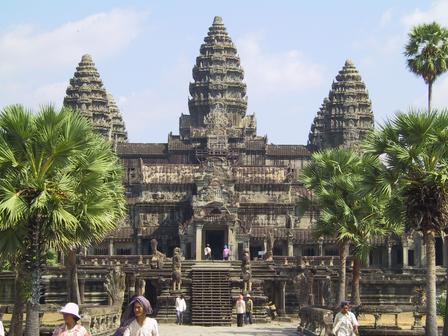
- YasodharapuraArchaeological site · Next to Angkor Wat · On the map

2 stops, about 0.1 km between them in straight lines.
Day 2
- AngkorArchaeological site · On the map

1 stop, about 0.1 km between them in straight lines.
Day 3
- BayonTemple or shrine · On the map

- Angkor ThomArchaeological site · 0.2 km on from Bayon · On the map

- BaphuonTemple or shrine · 0.4 km on from Angkor Thom · On the map

- PhimeanakasArchaeological site · 0.2 km on from Baphuon · On the map

- Terrace of the ElephantsArchaeological site · 0.3 km on from Phimeanakas · On the map

- Terrace of the Leper KingArchaeological site · 0.2 km on from Terrace of the Elephants · On the map

6 stops, about 1.3 km between them in straight lines.
Day 4
- ThommanonArchaeological site · On the map

- Chau Say TevodaTemple or shrine · 0.2 km on from Thommanon · On the map

- Ta KeoArchaeological site · 0.5 km on from Chau Say Tevoda · On the map

- Ta ProhmArchaeological site · 1.3 km on from Ta Keo · On the map

- Banteay KdeiTemple or shrine · 1.1 km on from Ta Prohm · On the map

- Prasat KravanArchaeological site · 1.1 km on from Banteay Kdei · On the map

6 stops, about 4.3 km between them in straight lines.
Day 5
- LoleiArchaeological site · On the map

- Preah KoArchaeological site · 1 km on from Lolei · On the map

- BakongArchaeological site · 0.9 km on from Preah Ko · On the map

- HariharalayaArchaeological site · 0.9 km on from Bakong · On the map

4 stops, about 2.7 km between them in straight lines.
Day 6
- Pre RupArchaeological site · On the map

- East MebonArchaeological site · 1.2 km on from Pre Rup · On the map

- East BarayArchaeological site · 0.2 km on from East Mebon · On the map
3 stops, about 1.5 km between them in straight lines.
Day 7
- West MebonTemple or shrine · On the map

- BarayArchaeological site · Next to West Mebon · On the map

- West BarayArchaeological site · Next to Baray · On the map

3 stops, about 0.1 km between them in straight lines.
More for Siem Reap
- Things to do in Siem Reap, Cambodia · 40 places to see, led by Angkor Wat and Angkor
- One day in Siem Reap, Cambodia · 2 stops in a day, starting at Angkor Wat
Photo credits
- Angkor Wat: Fuzheado, CC BY-SA 2.0
- Yasodharapura: Ziegler175, CC BY-SA 3.0
- Angkor: Manfred Werner, CC BY-SA 3.0
- Bayon: Trusty Tuk Tuk, CC BY-SA 4.0
- Angkor Thom: Charles J Sharp, CC BY 2.5
- Baphuon: Jean-Pierre Dalbéra, CC BY 2.0
- Phimeanakas: Diego Delso, CC BY-SA 3.0
- Terrace of the Elephants: Diego Delso, CC BY-SA 3.0
- Terrace of the Leper King: Olaf Tausch, CC BY 3.0
- Thommanon: Chris, CC BY-SA 2.0
- Chau Say Tevoda: Diego Delso, CC BY-SA 3.0
- Ta Keo: Liftold, Public domain
- Ta Prohm: Dmitry A. Mottl, CC BY-SA 4.0
- Banteay Kdei: Diego Delso, CC BY-SA 3.0
- Prasat Kravan: Diego Delso, CC BY-SA 3.0
- Lolei: Alcyon, CC BY-SA 3.0
- Preah Ko: en:User:Markh, Public domain
- Bakong: Culexx, CC BY-SA 3.0
- Hariharalaya: Vassil, Public domain
- Pre Rup: Diego Delso, CC BY-SA 3.0
- East Mebon: Writer128, CC BY-SA 3.0
- West Mebon: Writer128, CC BY-SA 3.0
- Baray: DARIO SEVERI, CC BY-SA 3.0
- West Baray: Gcmarino, CC BY-SA 3.0
Pictures from Wikimedia Commons, through each place’s Wikidata entry.
Good to know
- Each day starts at the best-known place not yet seen and adds the best known within a short walk of it, then puts them in the shortest order. The places come from Wikidata (CC0), ranked by how many Wikipedias have an article about them.
- The map draws each day’s walk along the streets, routed by Valhalla on OpenStreetMap; the distances beside the stops are straight lines.
- Opening hours, tickets and closures are not checked: each place’s Wikipedia article has them.