Hager Mountain
7.189 ft2.191 m
Berg · Vereinigte Staaten
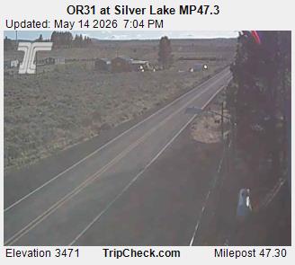
Hager Mountain is a volcanic peak in Oregon in the northwest corner of the Basin and Range Province in the United States. The mountain is located south of the small unincorporated community of Silver Lake in south-central Oregon, and it is in the Fremont–Winema National Forest.
Aus Wikipedia, CC BY-SA · Artikel lesen
Am Gipfel · Vorhersage für 21:00
22 °FKlar · Wind 9 mph aus SW
 In 3D ansehen
Wetter auf dem Gipfel: Hager Mountain, 7.189 ft
- 21:0022 °FSW 9 mph–
- 0:0021 °FS 8 mph–
- 3:0021 °FS 8 mph–
- 6:0020 °FS 8 mph–
- 9:0026 °FS 7 mph–
- 12:0035 °FSW 8 mph–
- 15:0038 °FSW 9 mph–
- 18:0028 °FS 6 mph–
| Tag | Himmel | Max. / Min. | Regen | Wind bis |
|---|---|---|---|---|
| Mi., 28. Okt. | Überwiegend klar | 38 °F / 20 °F | – | 9 mph |
| Do., 29. Okt. | Bewölkt | 42 °F / 23 °F | – | 11 mph |
| Fr., 30. Okt. | Teilweise bewölkt | 37 °F / 25 °F | – | 10 mph |
| Sa., 31. Okt. | Schneeregen | 35 °F / 24 °F | 0,19 in | 5 mph |
| So., 1. Nov. | Bewölkt | 30 °F / 20 °F | – | 4 mph |
| Mo., 2. Nov. | Überwiegend klar | 39 °F / 21 °F | – | 4 mph |
| Di., 3. Nov. | Klar | 49 °F / 27 °F | – | 4 mph |
Vorhersage von MET Norway (CC BY 4.0), aktualisiert um 16:17 GMT-7. Zeiten in Ortszeit.
Fakten
- Art
- Berg
- Höhe über dem Meer
- 7.189 ft (2.191 m)
- Schartenhöhe
- 1.455 ft (444 m)
- Koordinaten
- 43.009°N 121.032°W
- Quelle
- Wikidata, CC0
Hager Mountain
Volcanic peak in Oregon
Hager Mountain is a volcanic peak in Oregon in the northwest corner of the Basin and Range Province in the United States. The mountain is located south of the small unincorporated community of Silver Lake in south-central Oregon, and it is in the Fremont–Winema National Forest. On the summit, there is a fire lookout operated during the summer and fall by the United States Forest Service.
Aus Wikipedia, CC BY-SA · Artikel lesen
Gipfel nahe Hager Mountain
- Yamsay Mountain8.196 ft · 28 km entferntAuf der Karte
- Fort Rock4.699 ft · 40 km entferntAuf der Karte
- Four Craters Lava Field4.924 ft · 49 km entferntAuf der Karte
- East Lava Field5.614 ft · 56 km entferntAuf der Karte
- Gearhart Mountain8.041 ft · 58 km entferntAuf der Karte
- Crack in the GroundVulkan · 46 km entferntAuf der Karte
- Christmas Valley Sand DunesHügel · 59 km entferntAuf der Karte
Höchste Berge in Vereinigte Staaten
- Denali20.308 ftAuf der Karte
- Mount Saint Elias18.009 ftAuf der Karte
- Mount Foraker17.402 ftAuf der Karte
- Mount Bona16.535 ftAuf der Karte
- Mount Blackburn16.390 ftAuf der Karte
- Mount Sanford16.237 ftAuf der Karte
- Mount Vancouver15.787 ftAuf der Karte
- Mount Churchill15.636 ftAuf der Karte
- Mount Fairweather15.325 ftAuf der Karte
- Mount Hubbard14.951 ftAuf der Karte