Hager Mountain
7,189 ft2,191 m
山 · アメリカ合衆国
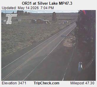
Hager Mountain is a volcanic peak in Oregon in the northwest corner of the Basin and Range Province in the United States. The mountain is located south of the small unincorporated community of Silver Lake in south-central Oregon, and it is in the Fremont–Winema National Forest.
出典: Wikipedia、CC BY-SA · 記事を読む
山頂 · 0:00 の予報
26 °F曇り · 南の風 7 mph
 3D で見る
Hager Mountain 山頂の天気(7,189 ft)
- 0:0026 °F南 7 mph–
- 3:0026 °F南 6 mph–
- 6:0025 °F南 6 mph–
- 9:0030 °F南 9 mph0.02 インチ
- 12:0031 °F南西 10 mph0.02 インチ
- 15:0035 °F北西 11 mph–
- 18:0029 °F西 7 mph–
- 21:0023 °F西 9 mph–
| 日付 | 天気 | 最高 / 最低 | 雨 | 最大風速 |
|---|---|---|---|---|
| 10月27日(火) | みぞれ | 35 °F / 20 °F | 0.04 インチ | 12 mph |
| 10月28日(水) | 晴れ時々曇り | 39 °F / 20 °F | – | 9 mph |
| 10月29日(木) | 曇り | 38 °F / 23 °F | – | 5 mph |
| 10月30日(金) | 晴れ | 37 °F / 21 °F | – | 4 mph |
| 10月31日(土) | 雪 | 33 °F / 19 °F | 0.06 インチ | 8 mph |
| 11月1日(日) | 快晴 | 33 °F / 18 °F | – | 5 mph |
| 11月2日(月) | 晴れ時々曇り | 39 °F / 23 °F | – | 2 mph |
MET Norway(CC BY 4.0)による予報。16:19 GMT-7 更新。時刻は現地時間です。
基本データ
- 種類
- 山
- 標高
- 7,189 ft (2,191 m)
- プロミネンス
- 1,455 ft (444 m)
- 座標
- 43.009°N 121.032°W
Hager Mountain
Volcanic peak in Oregon
Hager Mountain is a volcanic peak in Oregon in the northwest corner of the Basin and Range Province in the United States. The mountain is located south of the small unincorporated community of Silver Lake in south-central Oregon, and it is in the Fremont–Winema National Forest. On the summit, there is a fire lookout operated during the summer and fall by the United States Forest Service.
出典: Wikipedia、CC BY-SA · 記事を読む
Hager Mountain周辺の山
- Yamsay Mountain8,196 ft · 28 km先地図上
- フォートロック4,699 ft · 40 km先地図上
- Four Craters Lava Field4,924 ft · 49 km先地図上
- East Lava Field5,614 ft · 56 km先地図上
- Gearhart Mountain8,041 ft · 58 km先地図上
- Crack in the Ground火山 · 46 km先地図上
- Christmas Valley Sand Dunes丘 · 59 km先地図上